


Where to stay on the Heysen Trail
Learn more about Heysen Trail accommodation, including huts and campsites.
Accommodation along the Heysen Trail
Whether you’re through-hiking the entire length of the Trail or hiking along the Trail for just a few days, you’ll need somewhere to sleep. There are a number of campsites, huts and shelters to be found on the Trail. Many are on private land, where the landowners have allowed the Friends to build or restore facilities.
The Trail also passes through and near towns where walkers may choose to set up a base and arrange transfers for section or day walks as well as resupply; options include caravan parks, hotels, motels, B&Bs and self-contained holiday homes.
Search accommodation options below or by using our interactive map.
Camping on the Trail
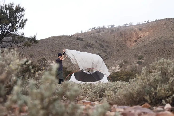
When camping along the Trail please use the designated huts and hike-in sites to help preserve access to the Trail, as large parts of the Trail traverse private, farming and conservation properties. Campsites vary from very basic with few facilities to new sites with timber platforms and camp kitchens. The Friends volunteers maintain many huts and campsites; others are managed by SA National Parks and Wildlife Service or ForestrySA.
Huts and shelters
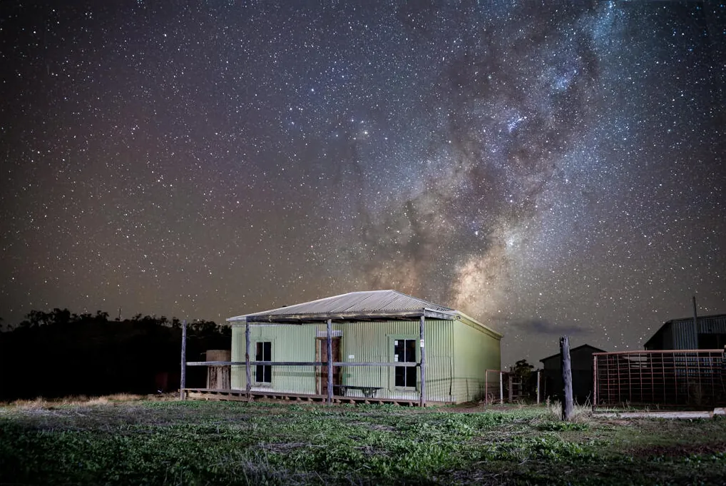
Huts are generally old stone or timber cottages and public buildings. Most are very basic, with a sleeping platform, fireplace, table and seats, a rainwater tank and an outdoor toilet.
You can also stay at one of the shelters along the Trail. These have been built mainly to catch rainwater, rather than to provide space to sleep so some are just a roof while some of our bigger shelters have three walls with one open side, giving you some protection from wet and windy weather.
Bookings and fees
There are no fees for using the huts, campsites and shelters maintained by the Friends. You can’t book or reserve these so you should always carry a tent in case other hikers have arrived before you and they are full.
Huts and campsites in national parks and forests incur a fee and need to be booked in advance on the relevant websites.
Water tanks
Most huts, campsites and shelters have a rainwater tank. The Friends keep information about water levels, however you should always carry enough water in case the tank is empty. Tank water may need to be treated.
Caravan parks, hotels, motels, B&Bs and self-contained cottages
There are many commercial accommodation options available in towns near the Trail. You can camp or book a cabin in caravan parks, or you may prefer a hotel, motel, B&B or self-contained cottage. Generally, these are not included in the accommodation directory. You can find them by searching the internet.
Search accommodation
You can learn more about accommodation options along the Heysen Trail by using our Interactive Map of the Trail and selecting the Accommodation checkbox, or from the list of towns and accommodation below. Other than huts, shelters and campsites, the commercial accommodation providers listed below are those who advertise with us and support hikers and the Friends of the Heysen Trail in other ways.