


John Babister – Honorary Member 2025
Honorary Membership of the Friends is a fitting recognition of his years of generous service, warm leadership, and deep commitment to our community and the Trail.
Honorary Membership of the Friends is a fitting recognition of his years of generous service, warm leadership, and deep commitment to our community and the Trail.
There is not much science when it comes to walking poles. Just opinion and plenty of it. I have seen…
James Wenzel advises us to slow down on the trail and add orchid-spotting to the pleasures of bushwalking.

Amelia Veale writes of her family’s tradition of walking the Heysen Trail as a child and now as a parent with her children.
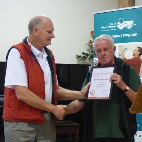
To many of the Friends of the Heysen Trail, David is considered a quiet achiever. However he is clearly a deserving recipient of honorary membership of the Friends.

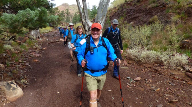
A family of five, including Eli, 12, Emily, 10, and Noah, 9, skipped school in favour of hiking the Heysen Trail. Along with their parents Luke and Erina, the were a world away from the classroom routine as they undertook a mission to cover 1,151km on foot over 56 days.

To start our final year on the trail we had an easy one-day walk – a catch-up for the postponed last walk in 2014. Our numbers had reduced due to a couple of our walkers suffering injuries in the ‘off’ season. So it was down to The Woods of Mount Crawford with a random assortment of teddy bears and a screaming baboon called Super Morris Major!!!

The Wandergruppe Bushwalkers of the South-Australian German Association (SAADV) are celebrating 15 years of membership in the ‘Friends of The Heysen Trail’, and with it, 15 years during which the Bushwalkers have been helping to develop and expand the Trail and boost its recreational potential.
… and on that understanding I became part of a 4-man crew that met at Cobblers Creek at 8:30am on…

Ten walking companions walk the Heysen Trail in 1986 as a South Australian Jubilee 150 project, prior to the trail even being finished.

The WEA Ramblers celebrated it’s 90th birthday earlier this year, remembering the occasion in 1925 when WEA students – then attached to the S.A. University – united to form a club to organise hikes, to enjoy the environment and to participate in conservation issues. The Club is now smaller in number but continues to organise fortnightly daywalks and the occasional long weekend ‘camp’ further afield. Individual members have always participated in trail issues, including the making of the Heysen Trail and continue this particular involvement by maintaining responsibility for Section 8 of the trail between Piccadilly and Norton Summit.

“The establishment of a new brewery in Burra at this time (1873) was a little surprising, as the population of…
Call us
+61 (08) 8212 6299
Email us
Visit us
Suite 203, Epworth Building
33 Pirie Street, Adelaide SA 5000
Opening hours
We’re open Mon-Fri, 10.30am–2.30pm. As we’re staffed by volunteers, the office may occasionally be closed, so it’s best to call before you visit.
The Heysen Trail is developed and maintained as a partnership between the Government of South Australia – Department for Environment & Water (DEW) and the Friends of the Heysen Trail.
The Friends of Heysen Trail acknowledge and respect the Traditional Custodians of the ancestral lands we traverse along the Heysen Trail, embracing the Ngarrindjeri, Kaurna, Peramangk, Ngadjuri, Nukunu and Adnyamathanha peoples.