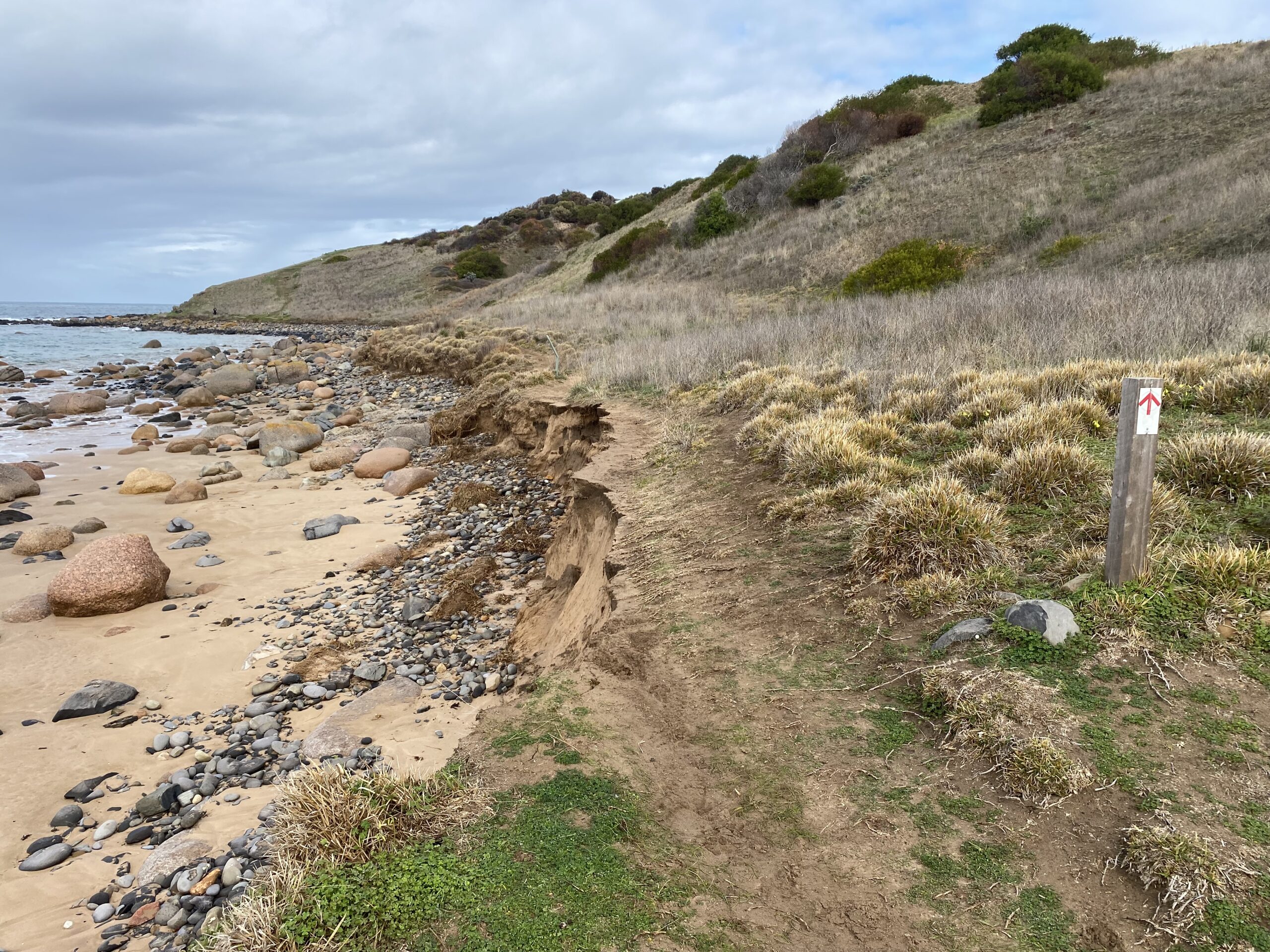
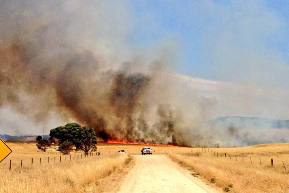
Heysen Trail GPX files update for GPS: version 4.9 issued 15/5/2025

Latest update to the Heysen Trail gpx and Interactive Map

With the opening of the walk season upon us, we have updated the Heysen Trail gpx file to include all re-routes since the last version of the consolidated gpx file was released in February 2024.

The trail changes include five re-routes and a new spur trail:

  • Mapsheet 1D: Willowburn reroute of 1.1km which takes the trail along a series of fencelines on the Willowburn property.
  • Mapsheet 1D/2A: permanent re-route at Chookarloo Campsite, Kuitpo Forest.
  • Mapsheet 2B: a minor re-route of the trail through Mt Lofty Botanic Gardens.
  • Mapsheet 3B: a new spur trail trail north of Kapunda to a campsite and pub at Allendale North.
  • Mapsheet 4C: a re-route on Olive Road, Spalding East to get some of the Heysen Trail off of the main highway.
  • Mapsheet 5B: in August 2024 a re-route was created to get some of the Heysen Trail back on land it was previously on prior to May 2021.

The reroutes have been added to the downloadable GPX file (version 4.9 released 15/5/2025) and the Interactive Map as displayed on Friends of the Heysen Trail website.

You can find instructions for downloading the updated file onto your GPS unit on the Maps & GPS page.

The reroutes have had a very minor impact on the Heysen Trail Distances.

Please note the the revised gpx file does not include temporary reroutes such as :

  • Those frequently established around Forestry SA logging operations in the Kuitpo and Mt Crawford Forest reserves (Mapsheets 1D, 2A & 2D)
  • The Maryvale reroute, south of Hamilton (Mapsheet 3B)
  • The Goyder Windfarm reroute, east of Huppatz Hut (Mapsheet 3D

Improvements to the Walk Selector pages

Walkers are reminded that following recent improvements to our website,  the Heysen Trail Walk Selector pages now include:

  • Re-routes – all current re-routes (permanent and temporary) are listed for each of the 61 ‘day walk’ sections from Cape Jervis to Parachilna.
    Before before setting out on any walk, you should check the relevant Walk Selector page to make sure you are aware of any recent trail changes.
  • Vehicle access to End to End points – there are a limited number of ‘End to End’ start and finishing points that do not have close access to a public road.
    In those cases, the Walk Selector pages now include an advisory note to independent/through walkers wishing to get vehicle access to End to End points.

Heysen Trail closure – Advance Notice – May & June 2025

Heysen Trail Closures for Feral Animal Control

Advance Notice for 2025

The Friends is pleased that we have received early notice of closures for the 2025 season following consultation with Parks, Landscape Boards and Feral Animal Control Project staff about communication challenges in 2024.  The closures aim to protect public safety during aerial shooting operations.

Deep Creek & Fleurieu Peninsula Parks

Sunday 18 to Friday 23 May:

The following parks/trails will be closed:

  • Deep Creek National Park
  • Talisker Conservation Park
  • Ballaparudda Creek Recreation Park
  • Eric Bonython Conservation Park
  • Waitpinga Conservation Park
  • Wild South Coast Way on the Heysen Trail (except Newland Head Conservation Park and Natunyuru Ngawanthi/Sand Dunes Campground)

Click here for further information.

Northern Adelaide Hills including ForestrySA & private land

Monday 2 June to Friday 6 June

Shooting over Pewsey Vale zone and Mt Gawler/Old Kersbrook/Para Wirra/South Para. Rossiter’s Hut Heysen Trail (Pewsey) will need to be closed for public access. Trail at Pewsey Vale / Kaiserstuhl will have closure signage.

Tuesday 10 June to Friday 13 June

Shooting over eastern side of Mt Crawford – campsites to consider: Chalks, Rocky Paddock, Cromer Shed, Fromm’s Farm, Old Schoolhouse, Ponderosa, Old Schoolhouse, Centennial Drive and Scott’s Heysen Trail hut. Closure signage will be erected at all public land gates in this area, including at points along the Heysen Trail.

Campsite & event bookings will be blocked for the dates above. Any bookings already in place will be managed through communication with option to change dates or cancel and get refund. (at time of preparing details are not yet listed on ForestrySA website).

Mid-North Rangelands: 

The feral animal control program is scheduled in April during the Fire Danger Season Closure period. The Friends welcome this decision that will have no impact on hiking for 2025.

Fire Danger Season Closures remain in place until mid-April/May 2025

The end date remains subject to confirmation by the Country Fire Service assessment of risk in each region. Click here for further information.

It’ s good practice to review the “Know Before You Go” sites before starting any hike.

  • For information regarding Parks click here.
  • For ForestrySA information click here.