Summer Twilight Walks + 2015 Walk Season Program Released

Walk-Season-2014-2015-Twilight-Walks 728px

Summer Twilight Walks program released

Wednesday evening walks, 1-2 hours, around Adelaide.

Warm summer evenings are perfect for short walks. Open to members and new people from just $6 per walk.

Trailstarter and Trailwalker 2015 Walk Season program

Trailstarter walks are good for those new bushwalking or who want a shorter walk.

Trailwalker walks are for those wanting more demanding walks.

End-to-End 2015 Walk Season program

A new End-to-End group 10 starting from Cape Jervis in May 2015.

Walk the complete length of the Heysen Trail over approx sixty walking days, spread over six years. One day or one weekend a month.

Find out more about End-to-End walks.

FREE SA National Parks Vehicle Entry

Take the kids to walk and explore nature

Nature Play - FREE SA National Parks vehicle entry 1024px - 2

Thanks to the guys at Nature Play and National Parks and Wildlife Service SA free vehicle entry passes are being offered to provide opportunities for children to explore nature.

Hike, ride, swim, climb, camp, play or take photographs at any of South Australia’s great Parks listed below with this free vehicle entry pass.

South Australian Parks are special places that provide a safe home for thousands of plants and animals that are found nowhere else in the world. Hike, ride, swim, climb, camp, play or take photographs at any of South Australia’s great Parks listed below with this free vehicle entry pass!

Nature Play SA Inc is a not-for-profit association established to increase the time South Australian children spend in unstructured play outdoors and in nature.

Need some inspiration for where to walk and explore? Check out the SA National Parks Guide.

Photos courtesy of Play & Go.

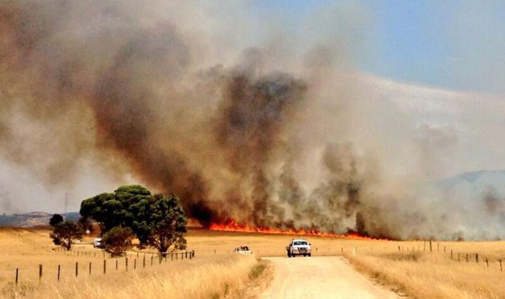
Fire Danger Season Brought Forward 2014/15

Fire Danger Season

The dates for the 2014/2015 Fire Danger Season have been brought forward. The Heysen Trail is closed during these high risk times.

Fire Ban District Start Date End Date
Mount Lofty Ranges 1 December 17 November 2014    30 April 2015
Adelaide Metropolitan    1 December 2014 30 April 2015
Mid North 15 November 1 November 2014 30 April 2015
Flinders 1 November 15 October 2014 15 April 2015

Walkers are reminded to be extra vigilant of fire weather conditions in coming months. Check the Fire Danger Rating before setting out on a hike, monitor changing weather conditions, and always have a back-up plan. Download the CFS smartphone app.

Find which Fire Ban District your planned hike is in on our Interactive Map, by turning on the Fire Ban Districts checkbox layer.

Some short sections of the Heysen Trail remain open year round, principally those sections not on private land. These sections include public roads, Conservation Parks and Reserves (closed on days of Total Fire Ban), Forests (closed on days of Total Fire Ban) and vacant land.

Pathway along Adelaide’s beaches – have your say

The Government of SA and six local councils have been working on a scheme to create a Coast Park – a 70km walking and cycling path along the metropolitan Adelaide coastline, from North Haven through to Sellicks Beach.

Planning and consultation for one of the final sections, from Grange, through Tennyson, to Semaphore Park, is underway. A working group has produced four solutions, and local residents have raised their concerns. It’s time to have your say on the plan.

The Park will include, as far as possible, a continuous two-way pathway or trail for walkers and cyclists along the coastal foreshore.

It has been progressively developed since 1992.

We at the Friends of the Heysen Trail consider that Option 1 provides the best solution and is in line with our Policy Document on Shared Use of Walking Trails: a narrower 1.5m – 2m wide path along the dune edge. As path allows for walkers and slow cyclists we consider a 2m wide path is required. Part of this option includes an upgrade of the parallel Seaview Road for faster cyclists. Whilst the ideal in the overall plan calls for a 3m wide path, we think this option provides the balance between encouraging people to walk, cycle and experience the natural environment, whilst balancing dune environment management.

More information about this Coast Park Consultation can be found on the Charles Sturt website at yoursaycharlessturt.com.au/coast-park-consultation

Have your say via the online consultation survey.

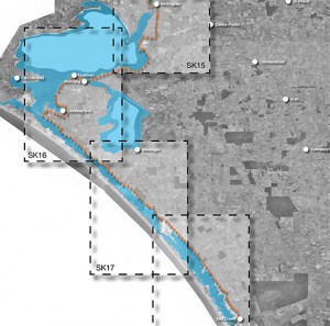
Trail along Adelaide beaches - have your say

Trail along Adelaide's beaches - have your say - map

Proposed 400km Walking Trail along River Murray

Seeking Feedback via Online Survey

Proposed 400km Walking Trail along River Murray 560pxA new walking and riding trail along the River Murray is being considered by three regional councils.

A feasibility study is underway and input is being sought.

The trail could begin in Salt Creek on the Coroong, following the Coorong to the Murray Mouth, then following the River Murray to Morgan via Tailem Bend, Murray Bridge and Mannum. The trail will provide links to a number of iconic and historic river towns, major tourism attractions and other existing trail networks along its route.

This feedback survey allows people to view the preliminary trail alignment prior to the land survey commencing. The feedback survey closes 3 November 2014.

You can review the high level alignment maps:

New Heysen Trail Maps for Sale

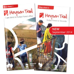
Heysen Trail new September 2014 map sheets no bgA new series of Heysen Trail maps have been released.

Over the next 12-18 months the Southern and Northern Guidebooks are being gradually replaced with fold-out map sheets.

The first two map sheets are available for purchase now via our online store, for $15 with postage from $1.45.

The maps are double sided and printed on water resistant paper. The maps include elevation profiles with kilometre markers and crossing point names. The new map style allows walkers to gain a “big picture” understanding of where they are on the trail, with a continuous trail line and a constant 3-5km of mapping around the trail.

Remember, you can sign up to receive re-route notifications for your guidebook or map sheet editions. All guidebooks and map sheets published since 2008 are available for notification.

There will be 8 maps in this series:

  • Map 1: Cape Jervis to Kuitpo Forest – available now
  • Map 2: Kuitpo Forest to Tanunda – available now
  • Map 3: Tanunda to Burra – coming soon
  • Map 4: Burra to Spalding – coming soon
  • Map 5: Spalding to Wirrabara Forest – coming soon
  • Map 6: Wirrabara Forest to Dutchmans Stern Conservation Park – coming soon
  • Map 7: Dutchmans Stern Conservation Park to Mernmerna Creek – coming soon
  • Map 8: Mernmerna Creek to Parachilna Gorge – coming soon

The Friends End-to-End group 4 complete the Heysen Trail

End-to-End 4 - final day

On Saturday 16th August the Friends End-to-End group 4 completed the Heysen Trail. Congratulations to the 38 walkers who completed the 1,200km Trail on that day. Five walkers had walked each of the 61 End-to-End 4 walking days over 6 walk seasons, a real commitment and achievement. They are Pam O’Donnell, Gary Dawes, David Weinel, Giles Walkley and David Sando.

David and Michael Weinel may be the first father and son to walk the length of the Heysen trail together?

Dean Mortimer completed the Trail for the second time, and Kevin Liddiard completed the Trail for the third time.

Heavy rain on the Thursday night and Friday prevented our bus from travelling off the bitumen. We are thankful to the 4×4 vehicles which enabled us to ferry the walkers over very slippery roads on Friday and Saturday. Surprisingly, on the Trail, the walkers had little need for raincoats. Celebrations were held at the Northern Trailhead and at the celebratory dinner on Saturday night.