


Storm Damage at Kings Beach on the WSCW
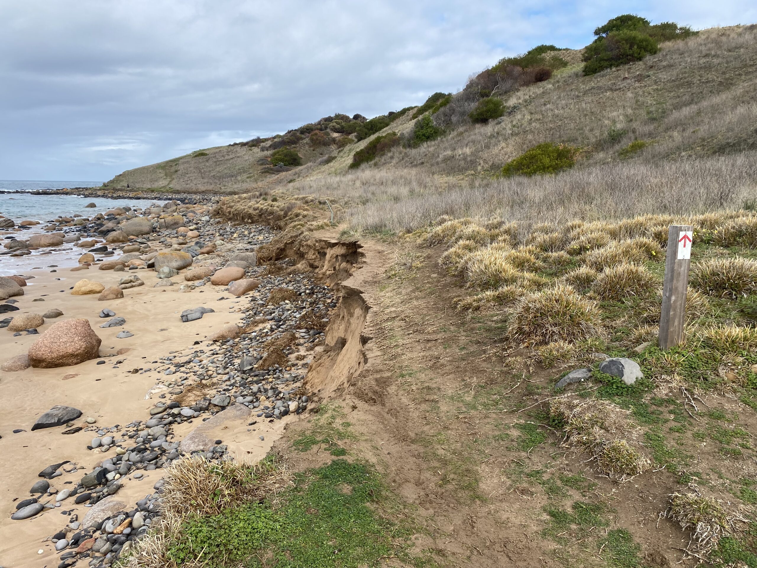
Storms have damaged the trail at Kings Beach on the WSCW. FOHT volunteers are working on organising a re-route but in the meantime do take care as you cross that section of the trail.
Storms have damaged the trail at Kings Beach on the WSCW. FOHT volunteers are working on organising a re-route but in the meantime do take care as you cross that section of the trail.
This is an update to the downloadable GPX file and Interactive Map since the last update in February 2024.
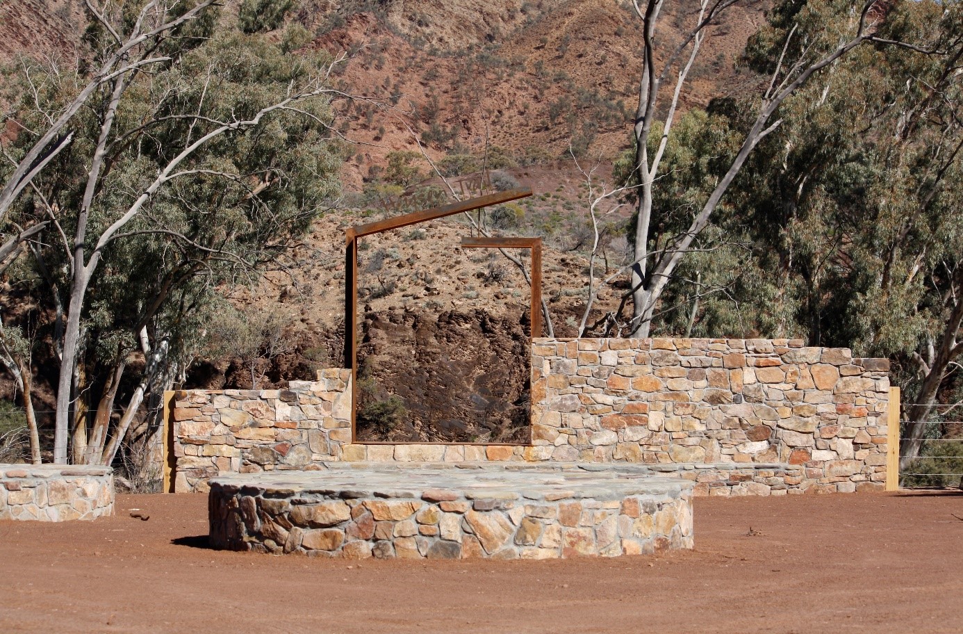
Friends of Heysen Trail members & supporters are invited to Parachilna Gorge on Monday September 2nd to help celebrate completion of the Northern Trailhead Rejuvenation Project.

The Friends are involved in a project to develop a best-practice governance model to give the Heysen Trail a continuing and successful future. Landowners and other stakeholder are invited to participate in consultation that will take place in the near future.
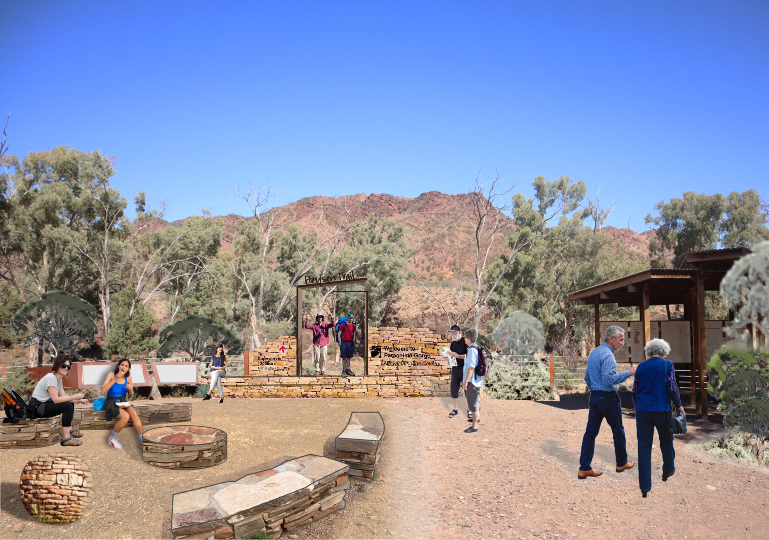
Change is coming to the Heysen Northern Trailhead! Work will commence in early May. The Friends of Heysen Trail initiated…
This is a major update to the downloadable GPX file and Interactive Map since the last update in September 2023. We have also published links to the re-routes on the Walk Selector pages.
The Friends announce an exciting proposal to enhance the Northern Trailhead at Parachilna. We also provide an update on the Friends website review.
This is a major update: the downloadable GPX file and Interactive Map have been updated to include 9 trail re-routes since the last update in May 2022.
A new version of the Heysen Trail map 1 has just been released. The map incorporates the Wild South Coast Way and is now available on our on line store. The Friends' Map and Book clearance sale is also continuing.
With the increasing risk of F&MD being introduced to Australia, it is essential that walkers take precautions to combat the potential spread of this and other soil borne diseases. Walkers are asked to clean footwear and equipment to eliminate the chance of spreading disease.
This is a major update: the downloadable GPX file and Interactive Map have been updated to include 13 trail re-routes, minor corrections and improvements since the last bundled update in February 2021.
A guided walk on the Heysen Trail from Inman Valley to Mt Lofty. Six days of consecutive walks on some of the prettiest sections of the trail. Ideal for, but not limited to, walkers from regional areas and interstate. .