

Friends of the Heysen Trail Logo
Search
Contact us
Join
Upgrade
Account
Login
Map
Interactive Map
Walks
Walk Calendar
Donate
Menu
  • Walking the Heysen Trail
        • Walk the Trail with the Friends
          • End-to-End walks
          • Walk calendar
        • Walk the Trail independently
          • Section walk selector
          • Short walks
        • Prepare to walk the Trail
          • Maps
          • Interactive map
          • What to wear and bring
          • Accessing water
          • Trail distances
          • Transport
          • Accommodation
          • Trail reroutes & closures
        • Upcoming walks

        • View the calendar
  • About the Friends
        • About The Friends
          • History of the Trail
          • Become a member
          • Our volunteers
          • Make a donation
        • Become a member

        • Join now
        • Support the Friends

        • Make a donation
  • Shop
  • News
        • News
          • News and updates
          • Trailwalker Magazine
          • Trailwalker Magazine archive
        • News and updates

        • Read all
        • Latest issue

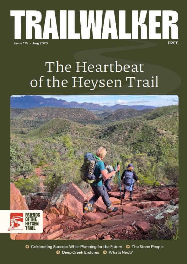
          August 2026 Trailwalker Magazine
        • Download
  • Contact us
          • Facebook
          • Instagram
Back to news

Event Category: End-to-End 11

Select CategoryFriendsAGM & other organisation meetingsMediaMerchandiseWalks & EventsGeneralHeysen TrailEventsGPS/GPX Files UpdatesHiking the TrailTrail DevelopmentTrail Status (Open/Close)HikingAustraliaInternationalSouth AustraliaWalking CommunityWalking SA
Select Year20262025202420232022202120202019201820172016201520142013201220112010200920082007
  • 28 September 2017

    Nuggett Rd to Mt Crawford

    The walk will start from where the Trail crosses Nuggett Rd,our finishing point for last year.Depending upon how close the…

    Read more about Nuggett Rd to Mt Crawford
  • 1 November 2016

    Cudlee Creek to Nugget Road

    A pretty walk through the rolling hills of the South Mt Lofty Ranges including several blocks of the Mt Crawford…

    Read more about Cudlee Creek to Nugget Road
  • 1 November 2016

    Montacute Heights to Cudlee Creek

    After an initial undulating walk along Moores Rd the trail makes a long and steep descent to Sixth Creek before…

    Read more about Montacute Heights to Cudlee Creek
  • 25 October 2016

    Cleland to Montacute Heights

    A testing and spectacular walk that passes through the native bushland of Cleland, Horsnell Gully and Morialta Cons. Parks and…

    Read more about Cleland to Montacute Heights
  • 25 October 2016

    Mylor to Cleland

    A very pretty walk over probably the most popular section of the trail. Walkers pass through the parks and bushland…

    Read more about Mylor to Cleland
  • 25 October 2016

    Dashwood Gully to Mylor

    A picturesque walk through gently undulating farmlsnd and the northern blocks of Kuitpo Forest. The trail normally passes through the…

    Read more about Dashwood Gully to Mylor
  • 25 October 2016

    Kyeema to Dashwood Gully

    The dense native bushland of Kyeema Conservation Park, the plantations of Kuitpo Forest and pretty back roads make this a…

    Read more about Kyeema to Dashwood Gully
  • 25 October 2016

    Mt Compass to Kyeema

    Starting from the Old Dairy Factory, 1.5 south of Mt Compass the trail crosses the Victor Harbor Rd before moving…

    Read more about Mt Compass to Kyeema
  • 25 October 2016

    Myponga to Mt Compass

    A lovely walk to start our second year on the trail. Starting along Yulte Rd the trail enters Yulte CP,…

    Read more about Myponga to Mt Compass
  • 20 December 2015

    Inman Valley to Myponga

    A very undulating walk starting with a climb up Sugarloaf Hill and on to Moon Hill, each offering spectactular rural…

    Read more about Inman Valley to Myponga
  • 20 December 2015

    Tugwell Road to Inman Valley

    Having left the coast the trail enters the South Mount Lofty Ranges for what is a gently undulating walk through…

    Read more about Tugwell Road to Inman Valley
  • 20 December 2015

    Waitpinga to Tugwell Road

    One of the most spectacular sections of the trail. Leaving the Waitpinga campground the trail slowly climbs its way along…

    Read more about Waitpinga to Tugwell Road
  • 20 December 2015

    Balquhidder to Waitpinga

    Starting along Callawonga Creek Road before passing Balquhidder Station, named after the birthplace of Rob Roy, the trail crosses through…

    Read more about Balquhidder to Waitpinga
  • 20 December 2015

    Tapanappa to Balquhidder

    A picturesque section highlighting the diversity of the . Heysen Trail, the walk continues through dense native bushland in Deep…

    Read more about Tapanappa to Balquhidder
  • 20 December 2015

    Cobbler Hill to Tapanappa

    A relatively short though spectacular walk through Deep Creek Conservation Park offering a mixture of dense native bushland,picturesque coastal view…

    Read more about Cobbler Hill to Tapanappa
  • 20 December 2015

    End-to-End 11, Cape Jervis – Cobbler Hill

    From the Cape Jervis trailhead, this section follows sandy coastal tracks and exposed coastal hillsides, providing spectacular views over Backstairs…

    Read more about End-to-End 11, Cape Jervis – Cobbler Hill
←
1 2

Connect with us

  • Facebook
  • Instagram

Quick links

  • Walking the Heysen Trail
  • About the Friends
  • Become a member
  • Online shop
  • Account login
  • Policies

Get in touch

Call us

+61 (08) 8212 6299

Email us

heysentrail@heysentrail.asn.au

Visit us

Suite 203, Epworth Building
33 Pirie Street, Adelaide SA 5000

Opening hours

We’re open Mon-Fri, 10.30am–2.30pm. As we’re staffed by volunteers, the office may occasionally be closed, so it’s best to call before you visit.

Friends of the Heysen Trail Logo

The Heysen Trail is developed and maintained as a partnership between the Government of South Australia – Department for Environment & Water (DEW) and the Friends of the Heysen Trail.

The Friends of Heysen Trail acknowledge and respect the Traditional Custodians of the ancestral lands we traverse along the Heysen Trail, embracing the Ngarrindjeri, Kaurna, Peramangk, Ngadjuri, Nukunu and Adnyamathanha peoples.

Heysen Trail Logo
Department of Environment & Water Logo
South Australia Logo

© Friends of the Heysen Trail and Other Walking Trails Inc.

ABN 95 539 572 296

Site credits

Search this site

Your cart (items: 0)

Products in cart

Product Details Total
Subtotal A$0.00
Shipping, taxes, and discounts calculated at checkout.
View cart
Go to checkout

Your cart is currently empty!

Go to Shop

Notifications