Horseshoe Top-End Homestead & Campsites

Accommodation Option on the Heysen Trail

Accommodation
Self contained unit/house
Guidebook
Northern Guidebook, chapter 3, map 10
Location
Horseshoe Range, 42 km east of Quorn
Coordinates
Longitude: 138.3779441
Latitude: -32.4213837
Download
Download GPX file for a GPS unit
Download KML file for Google Earth/Maps
Facilities
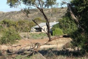
1. Self contained homestead sleeping up to 12 people
2. Campsites (1km from homestead) with modern shower block
View full featured Interative Map of the Heysen Trail - showing additional information layers such as Re-routes, Guidebook map outlines, photos and Fire Ban Districts.

Leave a Reply

Your email address will not be published. Required fields are marked *