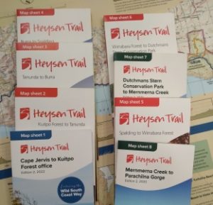
There are various maps available, including a series of eight official Heysen Trail sheetmaps. The Heysen Trail can also be viewed in Interactive Maps, and GPX files are available to download to use on a handheld GPS unit.
Official Map Sheets
 A series of 8 map sheets have been released by the Department for Environment and Water (DEW).
The mapsheets replaced two guide books, which are both now out of print.
From time to time, it is necessary to re-route sections of the Heysen Trail and occasionally sections of the trail are closed.
These mapsheets are available for purchase online. The mapsheets are also available from leading outdoor stores and map retailers.
Interactive Map Interface
View Interactive Map interface showing the Heysen Trail, photos, accommodation options, re-routes, Fire Ban Districts and Tourism Regions, updated 15/5/2025 v4.9.
FarOut Guides (previously Guthook) Heysen Trail map
Hike the Heysen Trail using your iPhone or Android device.
You can purchase an electronic version of the trail map from FarOut.
Firstly, download the FarOut Australia New Zealand app free of charge from your App Store.
Then from within the app search for the Heysen Trail map, purchase it (current price is $24.99) and download it to your device.
Google Earth file
Download the KML file for use in Google Earth, updated 15/5/2025 v4.9.
GPX File for GPS Units
 Download the GPX file for use with handheld GPS units, updated 15/5/2025 v4.9. Use the file as a navigational aid when walking the Heysen Trail (we strongly recommend also still carrying a map).
About Using the GPX Files
The GPX file may be too large for some older GPS units. You may want to check the specifications of your GPS unit. It needs to be able to accept:
- 31 tracks (12 main tracks for each guidebook chapter, 19 tracks for alternative routes or spur trails)
- up to 5,000 points per track
- 150 waypoints
If your unit only accepts 20 tracks, the first 11 tracks uploaded will be overwritten. To reduce the number of tracks to 20 you will need to delete or combine some tracks, this can be done via a program like Garmin Basecamp. These files may need some manipulation in order to reduce the amount of data available, as the file may be too large or cumbersome for your GPS unit, or contain a lot of data not relevant to your walk.
Most newer GPS units will accept the GPX file directly when saved into the GPS unit’s internal memory when connected via USB, or sometimes the memory card (often the memory card is dedicated to topographic base maps rather than tracks, routes and waypoints.) For older GPS Garmin units use a program like Garmin Basecamp to transfer the GPX file onto your GPS unit.
Useful links
- Garmin Basecamp (free software for manipulating and loading GPX files onto Garmin GPS units)
- GPSBabel (free/donation software for converting files from KML files to almost any GPS file type)
- GPS Utility (free software for converting file types and manipulating data – pay for full features)
- OziExplorer (software for converting files and manipulating data)
How-to Guide for Using a GPS Hiking
 GPS units have become quite affordable over the past few years. They can be a useful tool for hiking, but they can also be a little overwhelming. What are they useful for? Can they be useful along the Heysen Trail?
View the How-to Guide for Using a GPS Hiking (an article from our Spring 2011 Trailwalker magazine).
Simple Overview Trail Maps
There are a number of simple overview maps available showing different aspects of the Heysen Trail:
 1. Map of the Heysen Trail
Map showing terrain, roads and towns.
 2. Map of the Heysen Trail
A simple map showing the trail and nearby towns.
 3. Tourist Regions
Map showing relevant tourist regions the Heysen Trail passes through.
Use the map here to visit the South Australian Tourism Commission’s accommodation websites (divided into the Tourist Regions).
 4. Fire Ban Districts
Map showing relevant Fire Ban Districts the Heysen Trail passes through.
Use the map here to view relevant Fire Ban information on the Country Fire Service’s (CFS) websites.
The Heysen Trail Interactive Map has a layer showing the Fire Ban Districts, if more accurate information is required of the district boundaries.