View pdf map.
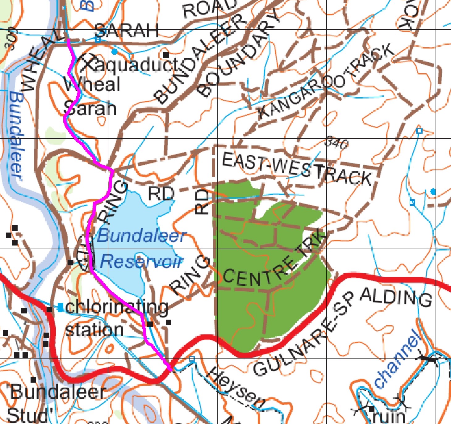
Where the Trail follows the channel from Spalding the reroute crosses into SA Water land on the southern side of the channel opposite the Spalding-Gulnare Road crossing.
- Walking from south to north, from the channel the reroute crosses the Gulnare-Spalding Road at grid reference 716 938 and over a stile next to the SA Water entrance gate.
- The Trail follows a track for 100 metres to a ford then directly up the hill to a stile that crosses into SA Water land.
- Within the SA Water land the Trail crosses to the Ring Road around the reservoir and follows this road across the dam wall and around to the Reservoir Car Park/Toilet at the NW corner of the reservoir at grid reference 710 958.
- The Trail leaves the car park on the western side and after 50 metres crosses a stile into private property. The Trail follows the northern channel but not in the fenced off channel land.
- The Trail then follows the fence within the private property until it reaches the aqueduct where it crosses a stile and meets up with the original Trail grid reference 706 969..
Download gpx file.
This re-reoute applies to these 2 sections:
View all re-routes for the Mapsheet 5, Spalding to Wirrabara Forest (August 2015)
View all re-routes for the Re-Routes