Greenock

Accommodation Option on the Heysen Trail

Accommodation
Town
Mapsheet
Mapsheet 3A, Tanunda to Kapunda
Coordinates
Longitude: 138.927094
Latitude: -34.457493
Download
Download GPX file for a GPS unit
Download KML file for Google Earth/Maps

Displaying 1 accommodation option in this town

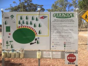
Camping at Greenock Oval

1 additional photo on
heysentrail.asn.au/?p=5600
Accommodation
Campsite,
Water Tank
Location

Greenock Centenary Park
Martin Street (off Murray Street)
Greenock SA

Coordinates
Grid ref: 097 848
Longitude: 138.928423
Latitude: -34.457802
Download
Download GPX file for a GPS unit
Download KML file for Google Earth/Maps
Facilities

Basic facilities including toilet. Town water available from several taps.
Camp beside oval.
No open fires except at the stone BBQ.

View full featured Interative Map of the Heysen Trail - showing additional information layers such as Re-routes, Guidebook map outlines, photos and Fire Ban Districts.

2 thoughts on “Greenock

Comments are closed.