Accommodation
Water only location
Water Tank Level
View latest reported tank level.
Report the tank level.
Mapsheet
Mapsheet 1C, Victor Harbor to Mount Cone
Location
Located in a small reserve above a Y road junction.
Coordinates
Contact
Friends of the Heysen Trail
Bookings
No
Fees
None
Facilities
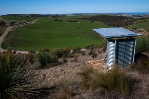
Shelter (seating only) with water tank.
Camping is not permitted here.
History
Photos of the construction of the shelter & water tank from December 2011: https://picasaweb.google.com/115827045141699129695/MountCone?authuser=0&feat=directlink#
Notes
A new facility established in December 2011. Shelter and water tank completed in early 2012.

Passed through 9/5/22. Water tank 100% full. A pity we can’t camp here on this long day!
S2N E2E there 9.5.21
Lovely views and easy walking for a change. Pity can’t camp there anymore. Water tank nearly full.
Mick and Carol.
Yes it certainly is a gem.
I liked this spot for a break. It was really quiet and well protected from wind. You can see Victor Harbor from here.
Sounds like someone didn’t like it being there.
I will report this to our Maintenance group
Thanks
Another great job by the Friends.
The Tank and shelter sit just below the peak (and trig point) at Mt Cone. On the day I hiked through, (early May 2012) there was quite a wind and the site was well protected. Tank was above 20% full.
The lower step on the stile over the fence has been removed or fallen off though.