This is a temporary re-route
View pdf map.
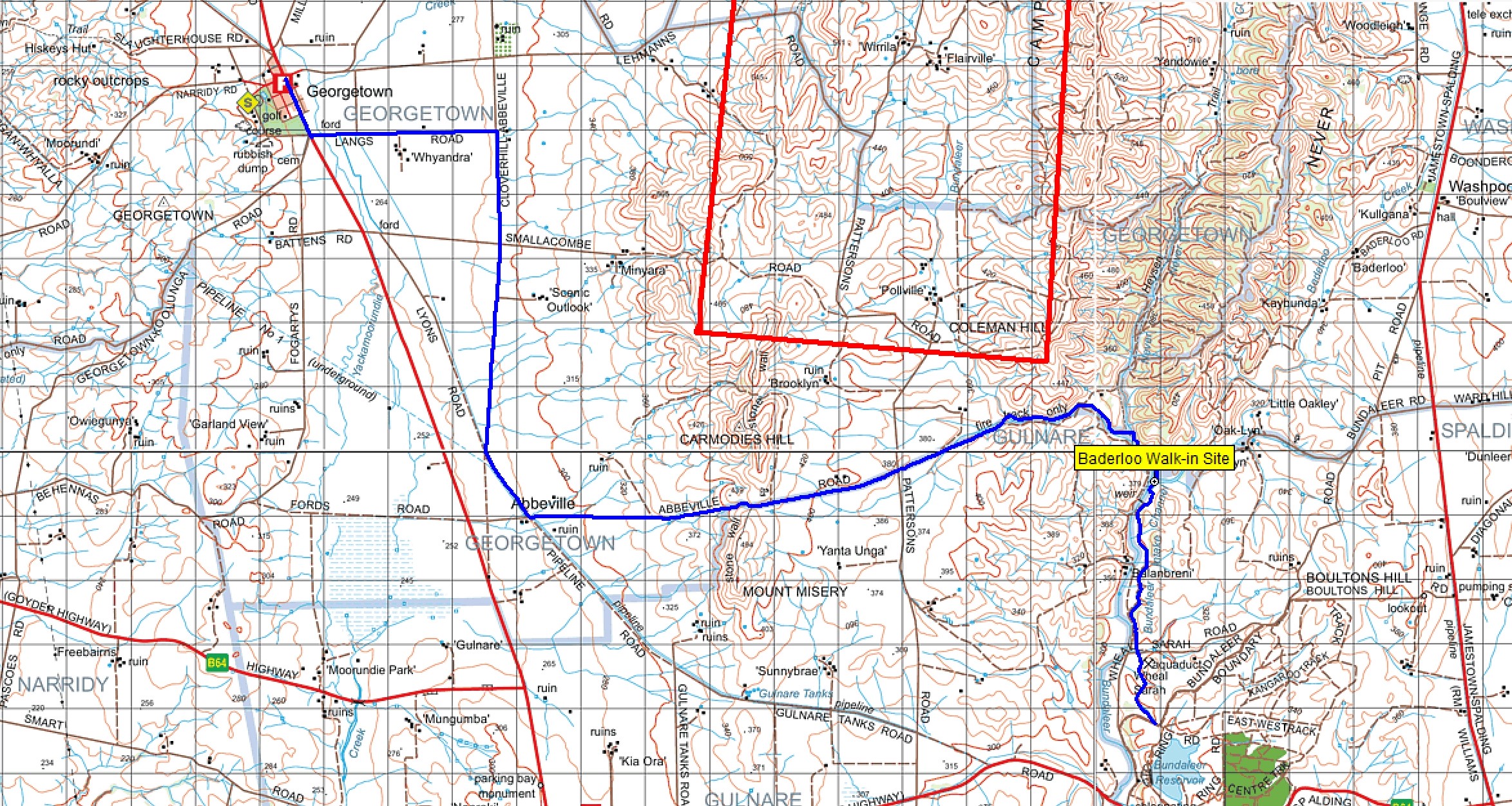
Aula Energy is constructing renewable power generation to the east of Georgetown, this will consist of both wind turbines and solar. This will have a significant effect on the Heysen Trail as it will take in all the ridge line of the Campbell Range between the old Bundaleer Forest and Lehmann Road. The windfarm construction is expected to take at least 2 years.
FoHT trail volunteers have installed a re-route to get around the construction zone. Travelling northwards, the re-route starts 750 m north of the Baderloo Walk-in camp site and heads west along Bundaleer creek following a fence on the left for approximately 5 km. Walkers should be aware that this is all private property and the FoHT are grateful to the landholder for allowing this access. Once the trail leaves the private land it follows Abbeville road, Pipeline road, Cloverhill road and Lang Road to enter Georgetown from the south.
Unfortunately the re-route goes off the current Heysen Trail Map sheet 5A.
For the duration of the re-route the trail will be one day-walk section shorter, particularly section 35 which cannot be hiked at all, this also means that Curnows Hut will no longer be on the trail.
FoHT trail volunteers have installed signage for the re-route and there will be signs at each end to help direct hikers.
During the construction period, there may also be some limitations to access at Hiskeys Hut due to building power lines, but hopefully this will occur when the trail is closed so should not affect hikers.
Negotiations with Aula Energy will continue during and after construction in order to return the Trail back along Cambell Range. The FOHT website and facebook will provide alerts and updates as the construction progresses.
(Photography/Image/Mapping Data supplied/copyright by Mapland | Department for Environment and Water.)
Download gpx file.
This re-reoute applies to these 3 sections:
View all re-routes for the Mapsheet 5, Spalding to Wirrabara Forest (August 2015)