Section 32: EE George Quarry to Spalding Rd

Region: Mid North

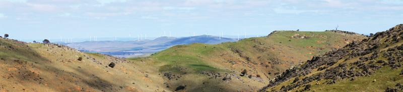
Most of this section is spent walking south, initially along the crest of Brown Hill Range, following the remnants of an old 1840s stone wall (the longest in SA). It is quite an undulating walk, with little shelter from the elements, however the views make up for any discomfort. The last 5-6 km follow rural back roads to the main Spalding to Burra road.

Map & GPS Files

View map in full screen format.
View full featured Interative Map of the Heysen Trail.

Download GPX file for a GPS unit.
Download KML file for Google Earth/Maps.
Download full-featured GPX and/or KML files of the Heysen Trail.

Mapsheet 4C, Hallett to Spalding

Southern Guidebook, chapter 6 map 9.
chapter 6 map 10.
chapter 6 map 11.

Distance
20km
Location of EE George Quarry
903 973
(290300 6297300 zone 54)
Latitude: -33.4432204083 (33° 26' 35.5935")
Longitude: 138.7440812056 (138° 44' 38.6923")
View in Google Maps
Location of Spalding Rd
825 846
(282500 6284600 zone 54)
Latitude: -33.5561195333 (33° 33' 22.0303")
Longitude: 138.6571471389 (138° 39' 25.7297")
View in Google Maps