


At 12.30 pm on Tuesday 25 April 1983, Anzac Day, a diverse and heavily laden group of eleven bushwalkers set off from the Cape Jervis jetty. There immediate destination was Cudlee Creek, ten walking days away. There ultimate destination was Mount Babbage at the northern tip of the Flinders Ranges, and their route was to be along built and yet to be built sections of the Heysen Trail. After many months of planning the walk, a South Australian Jubilee 150 event, was about to get underway.
At the time the walk began on Anzac Day Monday 25 April 1983 the only built sections of the Trail were from Newland Hill to the Barossa Valley and from Hawker to Parachilna Gorge.
Eleven was a large group to set out on an extended bushwalk, especially given the diverse range of people who had been attracted to participate in the walk. The group comprised males and females, aged from 20 to 60 years plus, and people with extensive bushwalking experience to those fit but with limited walking experience. Participating was Bob Nicolle, a commercial orchid grower, from Reynella; Cameron Storey, a tertiary student, from Hahndorf; Carlien Melrose, retired, from Adelaide; Dick Grant, a farmer from Penola; Graham Duke, a motor mechanic, from Yankalilla; Harold Woodward (Woody), retired, from Adelaide; John Dunn, a doctor, from Penola; Lyn Steven, home duties, from Adelaide; Monica Osbourne, retired, from Adelaide; Rob West, a Uniting Church minister, from Adelaide; and myself, Andrew Eastick, then a sheep farmer at Penola – a diverse group indeed.
In planning the walk my policy had been to accept allcomers – within reason – but to stress that each individual had to accept the need for the walking schedule to be maintained and they would therefore have to take responsibility for their own performance and ability to stay within the group. No-one would be asked to retire from the walk – that decision was left to each individual. Although I had meet all of the walkers in the weeks leading up to our arrival at Cape Jervis, most of the walkers were strangers to each other. As a consequence each walker was fully self-contained with regard to their food and equipment. In the circumstances this was the best arrangement. I reasoned that if retirement from the walk became necessary the effect on the other walkers would be minimal.
Following introductions, the mandatory photography session with our Jubilee 150 flag recording the start of the project, and farewells to friends and family members who had gathered to support us, we headed off.
Walking near a number of shacks we proceeded south adjacent to the coast, passing through thin scrub. Soon after Lands End our route along the coast turned east. After four kilometres we took our first break at Fishery Beach, where Fishery Creek flows into the sea. The Heysen Trail in this area had not yet been built. The route we were taking had been carefully selected after consultation with Trail builder, Terry Lavender. Permission had been obtained from the property owners whose land we need to cross because road reserves, made and unmade, were not always present where we wanted to go, and unmade road reserves are not always indicated by a delineating fence line. In this area we were walking on a coastal reserve, although it was unmarked and it was likely that in some places we would be on private property.
The extensive Ash Wednesday fires, just two months earlier, had resulted in uncertainty about some parts of our route ahead, although the early break to the season had alleviated concern about access to water.
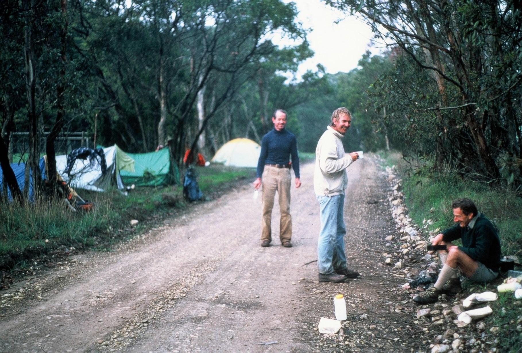
Leaving Fishery Beach we continued following the coastline, making use of occasional tracks leading in the appropriate direction. The numerous south flowing creeks, including Cooalinga Creek and then Rarkang Creek, cutting deeply across out path, slowed progress. Late in the afternoon, after passing Naiko Inlet, where Maurano Creek flows into the sea, we reached Blowhole Beach. After a short break we commenced a steep 250 metre climb over Cobbler Hill, reaching our first campsite soon after in the headwaters of Aaron Creek, just inside the Deep Creek Conservation Park. The rigours of the first day (actually a half day), and particularly the steep ascent away from the coast, had taken their toll and everyone had retired to their tents by 8.00 pm.
We woke to a cold and misty morning. Soon after 8.00 am we headed out, walking east through thick, wet scrub, crossing the headwaters of Aaron Creek and then Tent Rock Creek along the way. The weather improved as we passed near Tent Hill and we commenced down the walking track to where The Deep Creek flows into the sea, our planned lunch stop. Despite the large numbers in the walking party we were making good progress and keeping to our schedule. Immediately after lunch we walked upstream for a kilometre along scrub-choked The Deep Creek, and crossed the creek after considerable difficulty. Climbing 150 metres above the creek bed we found and followed a suitable track to the east.
Passing an abandoned house we continued following the track north-east towards Tapanappa Rocks, before again heading east and crossing Tapanappa Creek. Most of the surrounding scrub in this area had been burnt during the Ash Wednesday fires. The creeks, in particular, exhibited considerable erosion from the heavy opening rains which occurred only weeks after the fire. Late in the afternoon we followed a steeply descending track south-east and soon arrived at our planned campsite on Boat Harbour Beach. Some of the walkers had developed problems during the afternoon. Monica Osborne and Graham Duke had aggravated old knee injuries and Rob West had severe foot problems. Could we be facing the first withdrawals within days of starting?
John Dunn and I had an early morning swim in the sea before leaving camp the next morning. After skirting the cliff tops for several kilometres we reached the sandy Tunkalilla Beach. Monica was now having severe problems with her knees. As we passed Tunkalilla Downs homestead she decided to withdraw. By the time arrangements had been made for Monica’s return to Adelaide the group was well strung out along the beach. After crossing First Creek as it entered the sea and then Tunkalilla Creek at the eastern end of the five kilometre long beach we walked inland again, onto the Balquhidder property.
We had arranged to have lunch on the front lawn of the manager’s residence. Whilst preparing lunch Rob West and Graham Duke decided to retire because of their foot, leg and knee problems. Also whilst having lunch John Dunn caused a minor stir when, whilst boiling water for a cup of tea, his metho cooker, nested away from the wind under an ornamental shrub ignited the shrub. Fortunately the situation was quickly brought under control.
Following lunch our smaller group walked along the gravel road past the Balquhidder shearing shed before crossing Ballaparudda Creek. Soon after crossing the creek we commenced following a road reserve that lead us to the south-east and back to the coast. For the remainder of the afternoon we walked east along the coast, crossing Coolawang Creek where it entered the sea. In the late afternoon, after walking along Parsons Beach we reached Waitpinga Beach where we selected a campsite in the sandhills adjacent to the Waitpinga Creek estuary.
Early the next morning fishermen were already dotted at intervals along the beach as we walked through the sand to the eastern end of Waitpinga Beach and up onto Newland Head. The next few hours provided great enjoyment as we walked north-east along the top of spectacular 100 metre high coastal cliffs. An interesting find along the way was several groves of Barb Wire Bush (Daviesa lectinata). This fearsome bush evoked considerable interest and its true identity was not known until I returned with Lyn Stevens several months later to take samples for identification. In the late morning we diverted inland across farmland to the then start of the built section of the Heysen Trail near Newland Hill.
Lunch was taken at the start of the built section. Reaching this point was an important milestone and after lunch we walked north along a road reserve in high spirits. After negotiating a small swing bridge over Hall Creek we walked through cleared forest reserve land before joining Tugwell Road which lead us over Sheoak Hill (179 metres) and down into Back Valley. After crossing Back Valley Road we walked for about a kilometre up Keen Road and selected a campsite on the roadside adjacent to a large farm dam. Fresh milk was able to be obtained from a nearby diary. There had been no further retirements and the remaining members of the group appeared fit and well. Despite the ultimate goal of Mount Babbage being so distant, there was already great confidence that we would succeed in reaching that far away point.
Several of us made use of a nearby overhead fire water outlet for a (very) cold shower that night and early the next morning John Dunn, as the early morning mist hovered just above the water, swam in the nearby dam. We continued to walk north-west along Keen Road the next morning, soon reaching its junction with Hancock Road which we followed west for a kilometre before heading north again through a large plantation of young Pinus radiata. We reached the Inman Valley Road soon after, and arrived at Inman Valley mid morning.
After a series of telephone calls using the public telephone next to the store, advising friends and relatives of our progress, we followed the Trail north out of the valley, over Sugarloaf Hill (~ 310 metres) and onto our prearranged lunchtime rendezvous with Graham Duke’s wife, Margaret, at Moon Hill (356 metres). This was to be our only food resupply point for the ten days of the stage.
After our lunch break, extended by the need to sort out and repack our equipment and supplies, we walked along a little used track before diverting along a picturesque walking trail through the Myponga Conservation Park. After emerging on the western side of the Conservation Park the afternoon was spent walking through farmland and then tree lined gravel roads. Late in the afternoon we reached the sealed Inman Valley to Myponga Road where permission was obtained from a local dairy farmer to camp in a nearby paddock.
For the second successive night fresh milk was able to be brought direct from a diary and excellent milk coffees were a feature as we camped adjacent to a large farm dam. A bird alighting on the water soon after we retired to our tents brought several suggestions that John Dunn must be having yet another swim!
Our route was now to the east and soon we were walking along the northern edge of the Yulte Conservation Park. Soon after passing the Conservation Park, as we reached a high ridge overlooking Myponga, we had another withdrawal. Carlien Melrose had found the several steep climbs the previous afternoon difficult and with four days walking remaining to the end of the first stage at Cudlee Creek she felt it was best to retire as we passed close to Myponga. We had been walking together for five days and it was a sad occasion as we watched Carlien walk off towards Myponga to arrange transport back to Adelaide.
We continued east, reaching the Myponga to Victor Harbour Road which we followed south for several kilometres. Diverting east again we walked along a rough track, following a high ridge to the summit of Mount Cone (395 metres) where we stopped for lunch.
Soon after lunch we reached Haskett Road which we followed to the Mount Compass Butter Factory and then crossed the main Adelaide to Victor Harbour Road. The Trail continued east through farmland to Nangkita where we turned north, reaching our planned campsite on the banks of the Finniss River in the late afternoon.
We woke next morning to damp, foggy conditions. The meanderings of the Trail over the last few days now changed to a reasonably consistent northerly track. Passing through the burnt out Mount Magnificent Conservation Park the continuing, if not thickening, fog influenced us to pass up the opportunity to climb to the top of nearby Mount Magnificent. Emerging from the Conservation Park we walked north along Blackfellows Creek Road, then diverted through scrub and onto Kyeema Conservation Park. Just prior to lunch we entered extensive Pinus radiata plantations. Lunch was taken in a convenient clearing.
The steady northward progress of the morning was very satisfying. Much of the afternoon was spent walking along firebreaks and amongst Pinus radiata plantations, crossing the Meadows to Mount Compass Road and Meadows Creek in the process. We had arranged earlier to meet Graham Duke where we crossed over the Meadows to Mount Compass Road. Through his wife we had received a message that he believed he had recovered sufficiently to enable him to complete the remainder of the walk. As he had not yet arrived we left a conspicuous note advising him of our proposed campsite and moved on. We left the Pinus radiata plantations behind as we walked first along Mallawa Road and then Claren Road. Just north of the Claren Park property we established our campsite on the roadside. Graham arrived soon after we arrived.
We re-entered Pinus radiata plantations again soon after leaving the campsite the next morning. Several hours later we emerged from the plantation, passing the Police Training Reserve on our left. Soon after walking through the Glen Bold property we crossed the Onkaparinga River via a substantial suspension bridge, then followed a gravel road into Mylor.
A late lunch was taken in the town adjacent to a deli that sold a greater number of milkshakes than usual that day! Walking for the remainder of the day was varied, ranging from rough bush tracks in Mylor Reserve and in the National Trust’s Engelbrook Reserve where we crossed Cox‘s Creek, the verge of busy roads, and through quiet suburban streets. After passing through the centre of Bridgewater we passed John Dunn’s former Bridgewater Mill (a distant forebear of our John Dunn) and followed the mill race upstream to Cox’s Creek. We walked upstream along the banks of Cox’s Creek and passed under the South Eastern Freeway. Traversing parts of the Mount Lofty Golf Course we reached our campsite at Woodhouse Scout Centre. Although we erected and prepared our tents, whilst finishing tea a report on the small portable radio I carried indicated a storm warning for the Adelaide Hills later that night. Hurried arrangements were then made to sleep overnight in a nearby shed.
Although the rain had stopped by morning, conditions were very wet and low cloud enveloped the area. Passing vegetable fields in the Piccadilly district we followed a series of bitumen roads, arriving at the burnt out summit of Mount Lofty (727 metres) in the mid-morning.
There was a large group to greet as when we arrived. Carlien Melrose and her husband Ron; Kym Bonython and John Mitchell from the Jubilee 150 Board; Virginia Balmain from the Duke of Edinburgh Award Scheme and a reporter and cameraman from Channel Seven’s State Affair programme. Nearly an hour and a half later the formalities, the filming, had been completed and we left the summit.
Lunch was taken adjacent to the trail in the Cleland Conservation Park. Like the previous day, our afternoon walk was a mixture of bush tracks through Cleland, Horsnell Gully and Morialta Conservations Parks, busy bitumen roads and quiet country tracks. Early in the afternoon we passed over Rockdale Hill (~ 540 metres), providing extensive views over Adelaide and out to Gulf Saint Vincent. Walking past the Norton Summit Hotel in the mid afternoon proved too great a temptation and an enjoyable fifteen minutes was spent in the front bar. Struggling up the last steep slope of the day as we left Morialta Conservation Park heading for our campsite in the grounds of the Norton Summit Youth Hostel, we readily concluded that this had been the most difficult day of the walk thus far. We had left the Mount Lofty ridge three times since leaving Mount Lofty late that morning, having to regain several hundred metres of height each time to return to the top of the ridge.
The excellent weather of the first seven days of the walk had not been sustained and more rain was threatening. Some rain again fell during the night and it was overcast but fine when we left the Youth Hostel next morning. Walking first along a gravel road and then a bitumen road we passed through Monacute Heights before entering scrub. We followed a long ridge as it steadily dropped 350 metres in height to Deep Creek. After following Deep Creek downstream for a kilometre we crossed the creek and followed up a gravel road adjacent to a major tributary. Soon after we left the road and entered Montacute Conservation Park. We walked up a long ridge, gaining once again all of the height we had lost earlier that morning dropping down to Deep Creek. It commenced raining as we left the Conservation Park, lightly at first and then heavy. We followed a gravel road east and then entered a Pinus radiata plantation.
Lunch was taken as we crammed into a small pump shed near the Cudlee Creek Forest Headquarters. Our map showed a nearby feature, Mount Misery, about one and a half kilometres to the north-west. We all agreed that represented how we felt as we struggled to stay dry and keep warm.
Most of the Pinus radiata plantations in the area had been burnt in the Ash Wednesday fires and the wet, overcast conditions created an eerie atmosphere as we walked north after lunch. We were now only an hour’s walking from the Cudlee Creek township. As we descended we dropped under the clouds, left the burnt out Pinus radiata plantation, and joined a track which followed Holland Creek downstream to its junction with the River Torrens and then onto Gorge Road at the Cudlee Creek kiosk and camping area.
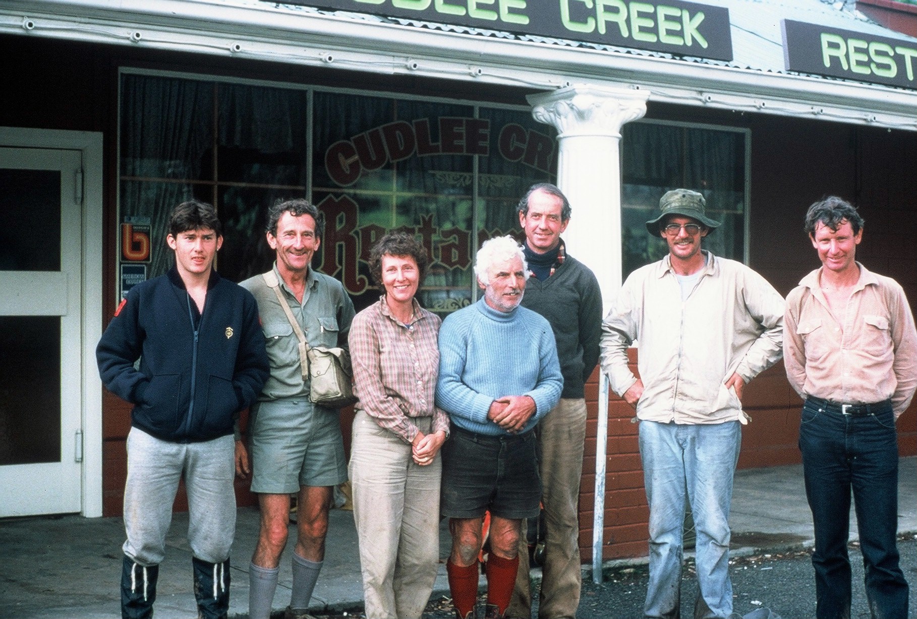
We had reached the end of the first of the eight stages of the journey to Mount Babbage at the northern end of the Flinders Ranges. It seemed to me such a long time ago that our much larger group left Cape Jervis. I was pleased we had been able to maintain the planned schedules without difficulty, and pathfinding, even on the unmarked sections of the trail, had been relatively straight forward.
Although a number of participants had retired, this was not entirely unexpected and I had deliberately started the trek at its southern, populated end, enabling those having to retire to do so with a minimum of difficulty. With myself, Dick Grant, Bob Nicolle, Cameron Storey, Lyn Steven, Harold (Woody) Woodward and John Dunn had successfully completed the first stage.
The next stage to Burra was planned to commence from Cudlee Creek in the spring. I hoped that they could each join in that and all of the remaining stages. The project was already proving to be a great adventure.
Jump to content:
- Introduction – The First End-to-End walk of the Heysen Trail
- Stage One – Cape Jervis to Cudlee Creek
- Stage Two – Cudlee Creek to Burra
- Stage Three – Burra to Melrose
- Stage Four – Melrose to Kanyaka Ruins
- Stage Five – Kanyaka Ruins to Aroona Hut
- Stage Six – Aroona Hut to Sliding Rock Mine
- Stage Seven – Sliding Rock Mine to Arkaroola
- Stage Eight – Arkaroola to Mount Babbage