Changes on the Heysen Trail

Walkers on the Heysen Trail are not aware of the changes and improvements that take place over time. Richard Savage has travelled from his Tennessee home in USA to walk the Heysen three times. Here he describes some changes noticed on his recent end to end, completed on 23 September 2013.

I travelled from Tennessee and began my first thru-hike of the Heysen Trail in May of 2004 … I enjoyed the hike so much that I returned in June of 2006 and walked the trail again.

I travelled from Tennessee and began my first thru-hike of the Heysen Trail in May of 2004 – walking the first three weeks with companions and the remainder solo. I enjoyed the hike so much that I returned in June of 2006 and walked the trail again. I had in mind at the time that I would write a book about my experiences on the trail sometime. During the years since that second walk I walked several other memorable trails including the Larapinta and Bibbulmun in Australia, the Chilkoot in Alaska and British Columbia, and the Colorado Trail. Finally I got back to the Heysen and hiked it this year from July 28 to September 23. As I had on my first two hikes, I walked south to north. Now I hope to write that book, but the topic of this article is how the trail has changed from 2004 to 2013.

Richard Savage

Richard Savage

Before getting to the trail itself, I should mention that in 2004 the trail maps that I used were a series of 15 strip maps. These maps were numbered in the order that the sections of the trail had been completed so that, for example, Mount Magnificent to Mount Lofty was number one. Trail descriptions were always written for the walker going north to south. In 2004 a guidebook for the southern section of the trail was printed with the one for the northern section to follow the next year. Now the orientation was reversed with descriptions given south to north.

A big improvement in the trail since 2004 has been the establishment of new campsites equipped with rainwater tanks. By my count, there were 11 campsites that hadn’t been there in 2004. In addition, Grays Hut has been opened in the intervening years and Bowmans Hut is now more accessible since it has been equipped with a combination lock. With water being more readily available, and by supplementing my water supply by filtering creek water when needed, I never carried more than three litres on the hike this year. In fact, most of the time I carried no more than two litres – only carrying more if I intended to camp between established campsites. On the previous hikes I carried up to five litres. There have many changes in the route of the trail since my 2004 hike. I will mention just a few of them which to me are among the most significant.

A big improvement in the trail since 2004 has been the establishment of new campsites equipped with rainwater tanks. By my count, there were 11 campsites that hadn’t been there in 2004.

First of all, in 2004 the trail bypassed the towns of Marrabel and Spalding. This time, with the trail going through both towns, I stayed a night in both and enjoyed the food, beer, and the company.

There have been several alterations in the trail between Cape Jervis and Victor Harbor in the last nine years – most of which have been undertaken to improve the route. My favourite might be the trail along Aaron Creek before the Eagle Waterhole shelter which includes a nice waterfall.

On my first walk, when the trail reached Hindmarsh Valley Road, there was a road walk of a couple of kilometres until the trail finally turned to the left at a cleverly hidden trail marker. The current route, making use of lightly travelled Lawless Lane and off of the busier road, is much nicer.

The route through Morialta Conservation Park has been much improved since 2004. On my first hike, soon after Third Falls, the trail turned up a steep hill and soon left the gorge. Now the trail stays on the side of the gorge with great views much longer.

A major change in the trail has been the rerouting of the trail to go northward from The Bluff to join the Go-Cart Track instead of turning eastward into Wirrabara Forest. I did miss seeing the views offered by the old trail right after The Bluff although the new trail is well done. The Apricot Track is another part of the old route which I particularly liked. It is now a spur trail from the main route which I did as a side trip this time.

There have been many changes in the trail before and after Melrose since 2004. The old route used some minor roads coming into Melrose hitting Main North Road at the silos, then following the road into Melrose, and after the summit of Mount Remarkable following the Mount Remarkable Range Track northward to near Spring Creek Mine. The only part of my 2004 route in the area still part of the Heysen is the trail from Melrose to the summit. I very much enjoyed the new route – especially the route along a flowing creek before reaching the Pines Track.

A minor reroute, but a good one in view of safety, is the trail bypassing the waterfall along the creek south of Mount Arden. I was glad the reroute was in place as I already have enough tales to tell about that waterfall from my first two hikes. Also minor is a change of the trail near the North Buckaringa campsite which now goes along a nice ridge where formerly I was walking an ocean of small rocks.

Finally, after the Trezona campground in 2004 the trail followed the Trezona Track northwards toward Aroona. I like the new trail over varied country which includes the spectacular Brachina Viewpoint.

I have been asked several times why I have done the same trail three times. I have friends in Tennessee who have completed the Appalachian Trail as many as four times and they get the analogous question.

I walked the Heysen Trail twice before I made any of my other long backpacking trips and now I have completed it for the third time. I have been asked several times why I have done the same trail three times. I have friends in Tennessee who have completed the Appalachian Trail as many as four times and they get the analogous question. I think that the answer is pretty much the same – we have formed an attachment to a trail and want to relive the experience. To me the variety of the Heysen is an outstanding feature of the trail. The trail is sometimes in the mountains, sometimes along creeks, goes along the coast, through farming and grazing country, through small towns, and so on. Its route gives a good representation of what South Australia is like. Although there are sections of the trail that I don’t find exciting, if one keeps walking soon the scenery will be very different. Also, I have enjoyed meeting many people during my hikes. I doubt that one could walk anywhere where the people are friendlier. On the other hand, walking the trail takes one through some very sparsely settled country. There have been times that I felt sure that there were no other people around for miles. It is hard to match the loneliness of the trail here in Tennessee and that loneliness appealed to me.

History of the Heysen Trail

It is now 18 years since the Heysen Trail was conceived; the first 9, under the State Planning Authority, were a period of enthusiastic planning changing to frustration; the second 9, under the Department of Recreation & Sport, have been a period of steady building of the trail and further promotion of the idea behind it.

Mindful of the long-distance walking trails then coming into vogue overseas … I suggested at a National Trust symposium in July of that year that there was now scope for one in South Australia.

The conception came in 1969. At that time a network of walking trails was being established in the Adelaide Hills by the National Fitness Council. Mindful of the long-distance walking trails then coming into vogue overseas -in America the 3,200-km Appalachian Trail and the 4,000-km Pacific Crest Trail, and in Britain the 400-km Pennine Way, I suggested at a National Trust symposium in July of that year that there was now scope for one in South Australia. I was thinking in the context of a trail in the Mount Lofty Ranges, but I also carried fresh in my mind the memory of my trek, completed the year before, along the full length of the Flinders Ranges. The end result was a combination of the two.

Even if it had been conceded that my suggestion had merit it still might have languished unimplemented for years had it not happened that a Minister of the Crown, the Hon. Murray Hill, MLC, attended that symposium and heard what I said. It is to his eternal credit that he latched on to the idea and took it up with his Government. The sequel, coming out of a Cabinet edict, was the formation in early 1970 of a body called the Long Distance Trail Committee. Its remit was to investigate and develop a walking and horse-riding trail of length and general route now well known to us.

The Chairman of the Long Distance Trail Committee in 1970 was the Surveyor-General, George Kennedy, and the members were Stuart Hart, Albert Simpson and I. (After Kennedy retired in 1971 I became Chairman for the committee’s remaining seven years of existence).

So at the beginning, full of fervour and hope, we settled down to planning and establishing the trail under the legislative umbrella of the Planning and Development Act, supported by the staff and financial resources of the State Planning Authority. We decided to concentrate initially on a route for walking only.

we then thought of Sir Hans Heysen, the great artist, who had perfected the artistic rendering of the gum-tree in the Mount Lofty Ranges and had then brought the glories of the Flinders Ranges to the world’s notice. Not a formal bushwalker, Heysen could be a most energetic walker in pursuit of his work.

An early task was to find a name. There is no single geographical name for the geologically contemporaneous Mount Lofty Ranges and Flinders Ranges areas, nor was it easy to identify any one individual explorer or prominent citizen – in South Australian history whose name could meaningfully be linked with both areas. However, we then thought of Sir Hans Heysen, the great artist, who had perfected the artistic rendering of the gum-tree in the Mount Lofty Ranges and had then brought the glories of the Flinders Ranges to the world’s notice. Not a formal bushwalker, Heysen could be a most energetic walker in pursuit of his work.

With “Heysen” as the proper name we next looked for the type name among “Trail”, “Way” and “Track”. “Trail” had an American connotation and “Way” a restricted English usage. “Track” alone seemed appropriately Australian, but it was compromised in applications like Birdsville Track – a road for motor vehicles. We wanted above all a route characteristically free from motorized transport, so “Trail” was finally chosen.

Our first three years, 1970-72, was a period of confident and enthusiastic planning and data collection. Five very competent and dedicated young officers of the State Planning Authority worked for us. Their labours and achievements – chiefly unremembered now – constituted important spade-work which contributed towards the eventual blossoming of the Heysen Trail after 1978. Posterity ought to know about them and what they did.

Their names were A. Lothian, A.L. Withy, G. Perkin, R.J. Teague, H. Showell and D.D. Brodeur. They field surveyed and mapped alternative routes – mainly in southern Fleurieu Peninsula, they interviewed landholders and they addressed meetings under the auspices of District Councils, including some in the Lower North.

The first obstacle was a general resistance to the innovative Heysen Trail idea and the open hostility of certain councils to it. The latter would raise objections such as the walkers being likely to start bushfires and to perpetrate vandalism (charges which walkers – that most responsible section of the community vehemently denied).

Other fears expressed were over the safety of the property and stock of landholders through whose land the trail would pass. The Committee’s assurance that trail-users would be required to observe a set of strict regulations as to their conduct failed to mollify the objectors.

However, not every council was opposed to the trail; the D.C. of Crystal Brook was keen for the route to be varied so as to pass through its area.

The next obstacle emerged in 1974 when the Crown Law Department queried the power of the State Planning Authority to expend its funds on the trail. We conferred with our Minister (the Hon. Glen Broomhill, MP) who as the result agreed to the drafting of a “Recreation Trails” Bill – to cover not only the Heysen Trail but other walking Trails as well. It was duly prepared, but no further progress seemed to be made; we endured a long period without receiving positive information. Meanwhile in 1976 the S.P.A. was definitely told that it could not expend its funds on the Heysen Trail.

A third obstacle then appeared. A shortage in staff numbers forced the S.P.A. progressively to withdraw those staff seconded for development of the trail. Trail planning slowly ground to a halt.

While they were still hoping for passage of the lagging Bill the committee made a desperate effort to get the trail started by constructing and opening a nine-kilometre section within the Cleland Conservation Park, using largely the resources of the National Parks and Wildlife Service. The Governor, Sir Mark Oliphant, opened it on 1 May 1976.

The Recreation Trails Bill was a comprehensive nineteen-page document. An aspect of its thrust is illustrated by Part IV which opened with – “Public ownership of the land forming the trail is the best means of ensuring the permanence of the trail and its proper management”. It was known to be in the Government’s legislative “pipeline” late in 1976, but Parliament rose without its being tabled; it was not heard of again. I believe that it was thought to be too controversial politically because it also incorporated the power of compulsory acquisition of land.

The stalemate continued through 1977. I recall meeting in August of that year with the Minister for Planning (the Hon. Hugh Hudson, MP) and John Mant to try to help the trail along, but the Government had other ideas.

On 14 November 1977 State Cabinet, in a milestone decision, accepted a group of recommendations on the “Development and Management of Conservation, Recreation and other Reserves”. I learnt this much later, at another interview with the Minister on 30 March 1978, being told that one of the recommendations was that the responsibility for all walking trails should be transferred to the Department of Tourism, Recreation and Sport – this to embrace the former National Fitness Council network as well as the Heysen Trail.

So I then made a call on the Minister of Tourism, Recreation and Sport (the Hon. Tom Casey, MLC) to press the points that the Heysen Trail should not be down-graded to “just one of the trails”, but that it should be allowed to keep its own identity and that it should be promoted with some priority. I am glad to say he took these points well.

I chaired the thirty-ninth, and last, meeting of the Long Distance Trail Conmiittee on 11 April 1978. Members attending were Ron Caldicott, Terry Lavender, Albert Simpson and D.E. Wilsdon, with Secretary R.E. Vieraitis. (Alex McDonald and B.C. Thompson sent apologies). It was an emotive and nostalgic climax to that first eight years. Two months later – on 13 June 1978, we were formally disbanded. I felt dispirited by all the past frustrations, so I went off on a trek in the Himalayas to forget about them.

There was little to show in the way of a trail, but some of the spade-work done undoubtedly rubbed off to good effect in the second phase soon to be described. I mentioned some in Part 3. In addition the Committee had made a comprehensive survey of potential trail users, had prepared a manual of walking trail design and construction for South Australian conditions and had devised a detailed system for sign-posting trails.

In 1978 the Department of Tourism, Recreation and Sport went to work with a will on walking trails. The Heysen Trail was to keep its special identity.

The Minister appointed Terry Lavender to plan and develop it, and he has dominated the scene ever since. His skill, enthusiasm and energy began making their mark when permission was given in 1978 to develop a 50-kilometre pilot section between Mount Lofty and Mount Magnificent.

I was delighted when, later that year, the Minister invited me formally to open this section. The ceremony took place at Arbury Park on 19 November in the presence of the Minister (the Hon. Tom Casey, MLC), the Director (B.J. Taylor), former Committee members, the Heysen family, the Mayor of Meadows and, of course Terry Lavender, his helpers and a good crowd of trail-walkers. [As a post- script, ten years later – in July 1988 – Heysen Trail supporters met at this same spot with the Deputy Premier and Minister for Environment and Planning (the Hon. Don Hopgood, MP) to agree on saving the priceless surrounding bushland by incorporating it into the State’s national parks system.

Warren Bonython opening of the Heysen Trail

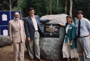
Heysen Trail opening 4 April, 1993. C Warren Bonython, Lynn Arnold AO, … (Left-right)

This test section caught the public’s imagination, and all Government departments supported the proposal. The future of the trail was assured. On 22 July 1979 the Hon. J.C. Bannon opened the section from Mount Lofty to the Barossa Valley. On 18 October 1981 I was again asked to open a new section from Mount Magnificent to Newland Hill.

Since then further sections have been commissioned – Parachilna Gorge to Wilpena, Wilpena to Hawker, Wilmington to Crystal Brook and Cape Jervis to Newland Head – so that now 780 kilometres of made trail exists.

The cause of the Heysen Trail was meanwhile championed by Dr Derek Whitelock, assisted by Dr David Corbett and Joan Paton, who published it on film and in print.

After 1978 I had little direct involvement, although I have now come closer again in the ‘Friends…’ movement. The history of the second phase of the Heysen Trail – from 1978 onwards – is not for me to tell. Terry Lavender, the father figure of this era, should do so.

The Canberra Bushwalking Club walks the Heysen Trail

It is about 1500 km in length and is a long way from Canberra. That’s why it has taken me six years to walk from end to end of the Heysen Trail in South Australia.

Only 68 persons are recorded as ‘doing’ the whole thing; some have done it in less time, and others have walked the whole trail in a single hit, but that would clearly involve some complicated logistics, for this trail passes close to only a few towns and access by public transport is very limited.

People ask what the trail is like and I find myself unable to give a clear answer. It cannot be compared with any long distance walk on the eastern seaboard; after all it is in South Australia. I think of it as comprising three ill-defined sections.

Bushwalking Club hiking the Heysen Trail 3a) The first is in the south from Cape Jervis to Tanunda in the Barossa Valley.Edward Fleming at Bunyeroo From the start the rugged coastline is followed through the beauty of the Deep Creek Conservation Park with constant views out to sea and to Kangaroo Island and possible glimpses of the occasional whale. It is characterised by short, steep climbs and descents and significant beach walking. North of Victor Harbour the trail passes through much ‘developed small-farm land but maximum use is made of green’ roads and unfrequented gravel roads, and wherever possible stiles give access to tracks across private property. Myponga and Yulte Conservation Parks are rugged, scrubby or forested and are a prelude to the climb up Mt Cone and onward to cross the Finnis River before ascending Mt Magnificent with its 360 degree views.

Beyond Mt Magnificent the track traverses the extensive Kuitpo Forests and also passes through the old goldfields at Jupiters Creek and Echunga before skirting the eastern edge of Adelaide’s urban sprawl to ascend Mt Lofty. After Mt Lofty the trail undulates steeply through native or pine forest as well as crossing through hills orchard country. Beyond Kersbrook a section through the Warren Conservation Park passes through dense native forest, a habitat for millions of orchids. More large pine forests follow and Mt Crawford makes demands on the walker, but after that the trail crosses beautiful park like grazing country, then through parts of the Kaiserstuhl Conservation Park to drop suddenly out of the Barossa Range to enter Tanunda at the old Lutheran village of Bethany.

b) Beyond Tanunda the trail passes through the very highly ‘developed’ Barossa Valley in which it is sensitively restricted to ‘green’ roads or country back lanes. North of Kapunda, Peters Hill must be negotiated before heading east to the Tothill Range which is followed to Logans Gap. Here the nature of the walk changes again as the track crosses steeply undulating treeless exposed hills to bring the walker to Burra-a town of considerable historic interest.

Canberra Bushwalking Club hiking the Heysen Trail 1Beyond Burra walking is again very demanding as the trail rises and falls precipitately over steep treeless hills, slavishly following fence lines and denying all attempts or desire to adhere to contours. As with much of the walk, water is scarce and adequate reserves must always be carried – indeed the trail now heads east into country which could only be perceived as semi- mallee as it approaches Touralie Gorge. Through the rock of this rugged pass, pioneer track-makers have carved a route for the bullock wagons to cart produce to Adelaide.

The next challenge is Mt Bryan, another demanding climb to its 936 m summit before descending down the Toolang Valley to Hallett. Curnows HutThen more hard exposed walking following old stone fences which traverse the ridgeline of the Brown Hill Range, finally dropping into the Spalding Valley where the trail suddenly becomes easy following the now disused aqueduct which formerly collected water for Whyalla.

Spalding is by-passed but there is a pleasant campsite at Freshwater Weir on the aqueduct. Many more kilometers beside the aqueduct lead to the Bundaleer Reservoir (not seen from the track) and on to the Never Never Creek valley with its own unique rugged beauty, passing Yandowie Station (grazing) before entering a forest of exotic trees in which Curnows Hut is situated. More hard walking ahead over steep open grazing land with some superb views ranging from Mt Remarkable and the Flinders Ranges north to St Vincents and Flinders Gulfs west. There is now an opportunity to take a 2 km spur track to a property called Wirrilla, where accommodation in the shearers’ quarters is available, before embarking on the impending long trudge via Georgetown, over the Rocky River to Crystal Brook.

Bushwalking Club hiking the Heysen Trail 2c) There is now a dramatic change in the trail. A road bash takes you to Bowman Park from where the track follows the lovely valley of Crystal Brook to Hughes Gap. A long ascent of some 600 m partly along rural roads, more along a remote 4WD track, leads to The Bluff, 750 m directly above the shore line of Flinders Gulf, and festooned with TV towers. View from The Bluff This is densely timbered country and the trail next leads steeply down into the Wirrabara Forest before returning steeply to a ridgeline at Frypan Hill and the Go Cart track. Another steep descent leads to a densely timbered valley and the track then climbs intimately up a lush and bushy creek to regain the pine forest.

Beyond the Wirrabara Forest is a long slog following ‘green’ roads to reach the historic village of Melrose. The reward for this bash is the sight of Mt Remarkable looming closer. The ascent of Mt Remarkable is spectacular – formerly brutally steep and abrupt, a new brilliantly graded foot track traverses a number of enormous scree slopes in its 6 km journey to the summit (named by James Eyre in 1840), but there are no views from the top.

A long undulating ridge-top fire trail leads to the old copper mine at Spring Creek and the trail then follows this beautiful valley with its magnificent red gums for a couple of km before a very steep climb to another fire frail leading to Stony Creek and a campsite. Recently the Friends of the Heysen Trail have been installing ‘shelters’ and water tanks in this northern section, and at some sites toilets are also being constructed – but the ‘shelters’ are merely a means of collecting rainwater and provide no shelter for walkers in bad weather.

North of Horrocks Pass a long, undulating ascent takes the walker to the top of Mt Brown (940 m), first climbed by members of Flinders’ team aboard Investigator in 1802. From here to the end at Parachilna Gorge, the trail passes through dry but consistently spectacular country with massive craggy ranges such as Dutchmans Stern or Mt Arden, crossing open saltbush plains to gain the central Flinders Ranges, following the mighty Elder range. Dry, rocky creek beds are followed and Wilpena Pound is crossed before reaching the old Aroona homestead site and continuing between the Heysen and the ABC Ranges to reach the end at Parachilna Gorge.

Many whose bushwalking ‘thing’ is the heavily forested country of Victoria and NSW might be dismissive of this truly great long distance trail. It is by no means easy, but it has been well marked, and for the most part signage is excellent and not obtrusive. The availability of water remains a problem and many parts are accessible only to 4WD vehicles, way beyond any public transport. Those who walk it should accept it for what it is – a representation of what the greater part of Australia happens to be – arid, sparsely settled, grossly and indiscriminately overcleared and now overstocked, quite unforgiving but possessed of a huge variety of beauty which is uniquely Australian.

Completed Labours are Pleasant

A few weeks ago I made the mistake of informing Arthur Smith that on the 4th August last my wife and I completed our walk of the entire mapped section of the Heysen Trail from Cape Jervis to Parachilna Gorge. As a form of penance for this indiscretion of disclosure I agreed to write a short note on the subject for inclusion in The Trailwalker. When will I ever learn to keep my trap shut?

To restrict the written acreage to a minimum I will relate only topics and details of a general nature instead of giving a day by day account of the entire saga.

Brief data

Jean & Bill Tibbles on reaching the end of the Trail at Parachilna Gorge

Jean & Bill Tibbles on reaching the end of the Trail at Parachilna Gorge

Total distance 1036 km. (This is a conservative figure as measured on a flat map surface and makes no allowance for such matters as track meandering in stream beds and variations in terrain elevation)

Time taken
57 walking days (averaging 18.17 km/day)

The effort was spread over three years:

  1. 1993 Cape Jervis to Greenock- 16 days-287 km
  2. 1994 Greenock to Hallett – 12 days – 222 km
  3. 1995 Hallett to Parachilna Gorge -29 days -527 km

We only carried large packs on six days, those being 1 – 4, Cape Jervis to Newland Head Conservation Park,and 52 & 53, Wonoka to Moralana Scenic Drive.

For the remaining 51 days we each carried a small day pack only.

Shortest day (distance): day 4 – Coolawang Creek to Newland Head C.P. = 8 km.
Shortest day (time): day 39 – Lynwood to Melrose 12 km 2 hours and 10 minutes. Longest day (distance): day 15 – Springton Rd to Tanunda = 27 km.
Longest day (time): day 48 – Eyre Depot to Buckaringa Gorge, 9 hours and 55 minutes. (19km)

This last mentioned walk was on Wednesday 26th July 1995 when almost the whole of South Australia was experiencing very nasty weather.

At precisely 1.40 pm on this day we passed east abeam the radio masts on top of Mount Arden, and the hail was coming at us horizontally.

Flinders Ranges scene

Flinders Ranges scene

The trail notes on the reverse of Heysen Trail map no. 14 say, inter alia, ‘Despite the rigour of the walk, rewards are enormous. As the trail begins to gain height the views become more and more extensive until on the summit of Mt. Arden the countryside for hundreds of kilometres around in all directions can be seen’.

Codswallop! On this particular day visibility was down, on occasions to 50 metes or less but the bit about the walk being rigorous’ was spot on.

By this stage of the game we were both wet through and had been for several hours.To make matters worse, the uppers of my left boot decided there and then to part company with the sole. Lack of scenic views did not seem important somehow.

I called to mind the entry I had seen in a visitor’s book on the Pascoe property near Yapoona Springs, which we had passed back on day 42.

The entry was in the remarks’ column and merely said “I want my daddy.” I could now relate to that.

The last day, 57. was a short stroll of some 17km from Aroona to Parachilna Gorge and was completed on my 57th birthday, Friday 4th August 1995. She that must be obeyed is two years my senior and she climbed over the last stile on the Trail at 11.30 am that

morning. This day also marked the 95th birthday of the Queen Mother but, as was the case in previous years, she did not bother to ring me.

She may have known that I was out.

Reflections

Each day whenever possible we commenced walking at first light and this mainly for two reasons:

  1. there seems to be more bird and animal life around at this time and all scurries are worth viewing.
  2. in case of mishap, the back up team have a better chance of retrieval before darkness falls.

We each carried a walking stick which over rough terrain can act as a RoIf Harris extra leg. We both found them especially helpful when negotiating the narrow tracks around the cliff edges to the east of Cape Jervis. Ours were not elaborate. expensive affairs but merely rough straight sections cut from scrubland on a fnends property at Paris Creek. Jean’s stick was from strong but very lightweighted stringy bark and mine was of heavier and more sturdy wattle.

Another item of innumerable uses is a large plastic garbage bag cut open so as to form a flat sheet. We each carried one of the lightweight items and found them very useful as groundsheets to sit on, shelters from the elements etc.

Our day packs also contained a face cloth and a small light and very water absorbent towel. We found these very handy on day 54 when approaching Wilpena we were obliged to remove our boots and socks to wade through the icy cold water that,at the time, was flowing as a wide stream across the Trail at This location. I fear that I have now placed myself in the predicament where I may be attempting ‘to teach granny to suck eggs’ so I will desist forthwith.

Records

With the exception of two days (42 and 49) my wife Jean carried a video camera with her so that we now have a video record of most of our journey. From this material she has produced a film of just under four hours duration and this she has given to the ‘Friends’, It is quite disjointed and amateurish but may help to give would-be walkers some idea of the terrain and trail markings they are likely
to encounter if they decide to tackle the Heyson Trail. I made notes every walking day from which I have now compiled a more comprehensive write-up. Once this has been typed and placed in a more presentable format I will forward a copy to the ‘Friends’. Jean and I wish to stress that neither viewing nor reading is compulsory.

We were very fortunate when walking the northern section of the Trail to have the assistance of our good friends and neighbours Bill and Margaret Scott. Using my 4WD vehicle they would drop us off in the morning and collect us again at a prearranged time and place later in the day, thus they were able to keep a SAR watch over us (SAR = search and rescue). Not only that, they cooked our evening meal for us each day.

Summation

I must say with honesty that the walk was a most rewarding and satisfying venture. It is also true to say that we had our occasional frustrating moments. No navigator worth his salt will ever admit to being lost, he is merely temporarily uncertain of his position. Well in the dim distant past I was a flight navigator and must concede that during our long stroll I was on a very few occasions temporarily uncertain of my position. Sometimes vandalism of markers was to blame, at other times poor or non- existent marking was the cause of our problems, but for the most part it was our own inability to correctly assimilate all the information that was presented to us. Fortunately we quickly learned from our mistakes.

I would like to take this opportunity to thank sincerely all those responsible for the initiation and preservation of this wonderful state asset, the Heysen Trail.

Back to the title for a moment. What Cicero probably said was, “I’m glad that’s over.” I can relate to that too.

Walking the Heysen Trail with ARPA

No, I would never walk the whole Heysen Trail! Think of all those long boring road sections! Yes, I had said that several times. So how is it that I have just completed the very last step of the 1200km Trail?

In 1997, a group of eleven bushwalkers from ARPA (Australian Retired Persons Association), was planning to follow The Heysen Trail northward starting at Mt. Remarkable This satisfied the desire of some to walk part of the Trail and the desire of others to walk more in the Flinders Ranges. Because this area was unfamiliar to Glen and me, we joined this group but committed ourselves initially to nine days only.

Having climbed Mt. Remarkable, Mt Brown and Mt Arden and the numerous ups and downs in between, we were hooked!

Very soon we realised we liked the participants. We admired the leaders and their organisation; and we enjoyed the activity. Having climbed Mt. Remarkable, Mt Brown and Mt Arden and the numerous ups and downs in between, we were hooked!

We quickly reorganised commitments and were off again to complete the northern section. By now the group had increased to 22 the new members planning ‘make-ups’ as required. Unfortunately, the plan to cross the top stile at Angorichina at that time had to be aborted due to enormous rains which prevented access to take off points. The top three days however, were walked the following year.

The stretches between Mt.Compass and Kapunda were covered by day walks out of Adelaide. In 1990 the group walked the southern section. We did not join then but managed, with a friend, 2-day, 1-night stints to fit in with our calendars. Kapunda-Burra, Burra-Spalding and Spalding-Melrose were covered in three stages in 1999 back to our starting point. Great rejoicing!

Originally the group had dined at the North Star in Melrose. Great was the celebration when we dined there again having walked the whole wonderful Heysen Trail.

 We saw seals, dolphins and even whales … In most areas, kangaroos and emus were prolific. An occasional echidna thrilled us.

In that time, we had seen parts of South Australia inaccessible except by foot. We learnt that Mt. Bryan was the highest peak of the Mt. Lofty Ranges. We shivered on its summit. The Trail passes over it just as over Mt.Lofty further south. We saw seals, dolphins and even whales as we traversed the rugged sections overlooking Kangaroo Island, the Pages and The Bluff. In most areas, kangaroos and emus were prolific. An occasional echidna thrilled us.

Walking along Tunkalilla Beach

Walking along Tunkalilla Beach

There were too many foxes but few rabbits. The eradication of these, together with goat culling and good rains made the Flinders Ranges a contrast of lush green growth with red, towering cliffs and gorges. With the changes of seasons, we saw delicate native orchids, spiky yakkas, a plethora of wild flowers, as well as quandong trees bearing edible fruit. Bird lovers enjoyed a multitude of birds including huge eagles. I thrilled to see my first red-capped robin. Depending on the time of year, the paddocks in the mid-north changed from dry stubble, to dark brown freshly ploughed soil, through the ‘filmy haze of greenness’ to the high waving fields of green wheat and gold canola. We saw cattle and sheep in thousands.

We learnt things and went places in our own State we’d never heard of or visited before,-the Tothill Ranges, Touralie Gorge and Jarvis Hill to name a few.Walkers on Tunkalilla BeachWe traversed a vertical metal ladder, a high wooden ladder, a wood and chain sand ladder, a raised bog ladder, a tunnel and many swing bridges as we followed the red and white Trail markers.

On hot days the vision of a coldie kept us going; in bitter cold we could not stop even to rest. Clothed in substantial wet weather gear, through rain sleet and hail we trudged in uncomplaining misery. But, mostly the weather was lovely. At lunch and other breaks, we lay back, relaxed and enjoyed the views, realising ‘God’s in His heaven, all is right with the world’ and saying; ‘aren’t we lucky to be doing this!’

And-those boring bits of road? What boring bits of road?

And-those boring bits of road? What boring bits of road? Those sections often gave views of blue hills in the distance and beautiful variations of colour, while walking was safe and easy. As well, what looked on the map to be a ‘boring road’ frequently proved to be a Road Reserve with its natural, unspoilt vegetation and even mushrooms in season.

We got to know new people and made wonderful friendships. We kept to ourselves our sore feet, blisters and stiff legs and backs. We shared our pleasures and enjoyed tremendous fun, especially at briefings at the end of the day with nibbles and a warming red.

So, don’t be put off by what may appear difficult or boring on the map. It is just one foot after another. And, if you have the opportunity to walk the whole Heysen Trail, take it and enjoy it.

Discovering Elapidae

serpens bestia [Latin] crawling beast

I remember viewing the reptile exhibit of the Detroit Zoo shortly before coming to Australia. Essential ‘snake facts’ reminded me that the greatest population and variety of poisonous snakes on earth could be found in Australia. OK…let’s rethink this plan. Sure, we have bears and mountain lions around the place, but I’ve managed to live a relatively active outdoor life for 35 years without so much as a claw mark.

My first snake encounter occurred on a walk near Mt. Compass, shortly after arriving in Australia….  this was my first real ‘bush’ walk

My first snake encounter occurred on a walk near Mt. Compass, shortly after arriving in Australia. I’d been walking since the start of the season, but this was my first real ‘bush’ walk, as the early term walks were held in park lands around the city. I was at the front with two other women, having just mentioned that the tall grass on either side of the track would be perfect for snakes to be lurking.

Their low laughter and dismissive comments were still crisp in the air when my next half-step was filled with a rapidly moving black glistening form. It seemed to take forever to fully cross my path, flowing like poured oil. The next few seconds are a bit of a blur. My chest pounding, not yet fully breathing, I launched myself skyward and tore off straight ahead, my feet touching the ground as lightly as a Jacana on waterlillies. I didn’t quite know where I was going, but absolutely certain that this thing was right behind me. I finally stopped when I came to a gravel road, ensuring to position myself directly in the centre providing a clear equal radius of comfort on all sides. Several minutes passed. Where were the others? Surely something terrible has happened back there. My concerns were replaced by embarrassment as the approaching voices assured me that all had enjoyed my lively performance. Legend has it that the snake went back to his people, reporting “I think I may have just seen a Canadian, but I can’t be sure – it was moving pretty quick”.

T-shirt made up for Sue by husband Julian

T-shirt made up for Sue by husband Julian

Still in my early walking days, Julian and I had a day out walking through Kyeema. Once again I was at the front, walking along a single file, quite overgrown track. I was a bit snake nervous, but up ahead could see that the track opened to a sunny low-grassed area. As I broke into the open, quite like stepping on a rake a straight black figure shot up a few meters in front of me. In a split second I was behind Julian, having climbed his back in search of higher ground. Half clinging to his pack, desperately trying to keep my feet in the air, I watched over Julian’s shoulder as this upright ophidian weaved in front of us. It seemed to me that Julian was far too calm and controlled, as this incubus (since determined to be a black tiger snake) gently melted to the ground and slipped off in another direction.

A few years ago Colin Edwards led us on an overnight walk through the Newickie Creek area. It was last the few kilometers on the last day. Trees and bush were at a premium since we left the creek, so my full bladder was relieved to see that we were having a short stop at a ruin along the way. There was just one leafless bush behind the ruin, clearly my only choice for a private moment. Concerned that I may be on transparent display behind this sparse shelter, I circled the far perimeter, crouching down to have a good look at the porosity of the branches.

Satisfied with the ‘if I can’t see them, they can’t see me’ rule, I swung comfortably close to the bush and peeled down clothing. In a half-crouch, endeavouring to steady myself on a branch, I was suddenly face to face (so to speak) with an enormous brown snake, draped seductively on the dark dry branches of the bush. Immediately I was aware that my breathing stopped, the only sound a deep thudding from the inside of my chest. Phrases like ‘ lightning quick’ and ‘coiled to strike’ flashed through my mind. Knees bent, shorts at half mast, I took slow sideways steps. Reflecting on this now, I recall that I was looking at a very beautiful creature- deep golden brown, smooth and powerful with light yellow lips. We never lost eye contact as I safely backed away. Why didn’t it strike? Could it be that I posed no threat, therefore I was allowed to pass? Perhaps the poor fellow was simply blinded by the iridescent glow of my right butt cheek. Either way, I felt blessed. Curiously, my bladder matter was no longer an issue as I was quite happy to finish the walk without another break.

Sometime last year, Bob Randall led a few of us on a nice walk through Parra Wirra. Once again, I was at the front, with Bob immediately behind me. About to cross a small creek, I spotted a sizeable black serpent on the path ahead. My initial reaction was surprisingly controlled, as I froze to the spot. For a short moment, it seemed as if the snake was indecisive as to where it would slither, when instantly it faced us and raced in our direction. As I perched myself safely on Bob’s back, I watched from his shoulder viewing area as the long dark form disappeared into a log about two meters in front of us. Clearly I was honing my skills as a back climber, but climbing down after the fact never fails to be a mortifying experience.

Easter 2001 found us in the most heavenly Grampians. The walk from Jimmy Creek, across the Major Mitchell Plateau, through Boundary Gap and up to Mt. William is absolutely spectacular. We had to make an early start to fit it all into one day. I was stoked. It was a glorious morning with nearly horizontal rays of sunshine managing to pierce the lush bush as we began the long steady climb to the plateau. I led the way (will I ever learn?) bounding from rock to rock enjoying the crisp cool morning air. Does it ever get any better than this? Shattering my trance, I heard a pained gasp from the track behind me. I raced back to find Bob stopped on the track, a writhing snake immediately in front of him. Without realising what I had done, I had somehow stepped on this poor creature, flattening it just behind the head. I was overcome with remorse as I watched the crippled open mouth search through the air for relief. I chose to believe Bob when he decided that the injury wasn’t so severe as to not expect a full recovery, although he didn’t rule out a killer headache. David had now caught up to us and it was decided that the safest course of action would be to move the poor wounded thing off the track. Carefully manoeuvring two sticks, David and Bob worked together to lift my flat headed friend off the ground, placing him in bushes away from the track. I modified my position in the group for the remainder of the walk, selecting the post of back-marker. Although the remainder of the walk continued to be wonderfully satisfying and incredibly beautiful, I thought about the little fellow throughout the day. He was most likely enjoying the morning just as much as I was, looking forward to a relaxing day under a rock Little did he suspect the Scarpa treatment.

My latest adventure was a few weeks ago at Thomas Hill. I was not alone at the front this time, joined instead by Colin, Cliff and Eve spread in line across a fire track. The track graded down around a sharp bend, when Colin suddenly spun vertically through the air to avoid putting his weight down on a large brown snake. Cliff ran backwards out of harms way, opening the circle to reveal the flapping serpent struggling to launch itself up the low embankment into the tall grass. Twice it leaped and twice it fell, exposing white belly scales as it wriggled madly in front of us. It was then that I took notice of Eve, my own right hand clasped tightly around her left wrist, preventing her from deciding any survival action of her own. Was I trying to protect my friend, or was I too afraid to be left alone? Perhaps instinctively I knew that, although her body was that of a trained athlete, her decidedly feminine frame might not support my full weight if I attempted the climb. The third leap attempted by the snake was successful, and as we watched it disappear into the yellow grass I relaxed my grip, finally releasing my prisoner. I’m hoping that this is one of those things that we’ll laugh about one day…

I’ve now been bushwalking regularly in Australia for eleven years. I’ve certainly lost that Canadian hysteria and innocence and have decided that snakes – preferably from a safe distance – are beautiful creatures that play an important role and definitely belong in the Australian bush. But alas, I’m nobody’s hero.

Hey Mister – What’s a Heysen Trail?

Good question son, like a mirage, a lot depends on who you are, where you’ve come from and how you answer yourself.

Rain of course means water, perhaps the biggest gauntlet thrown down by the Trail

The trail is many things to many people, even its length seems to vary, my guess is 1060 km. At the physical level the trail rises from sea-level to over 1100 metres if you include a quick detour up St. Marys Peak. And you know for an arid track it can be mighty wet at times. But let’s not knock the rain for without it we wouldn’t have the yellow (politically correct) canola, Jane’s blue or those myriads of tiny little wildflowers that cushion our lumping boots. Rain of course means water, perhaps the biggest gauntlet thrown down by the Trail.

Descending from Mt Bryan

Descending from Mt Bryan

Man (politically incorrect) rises to more than the physical I hear you say. Indeed son, it is on the mystical plane that the Heysen Trail becomes an intangible will-o-the-wisp. The landform is sea, sand, forest, rugged crags and many highly forgettable kilometres of mid-north rolling plain, though I’m sure many a walker has welcomed the easier walking. Who am I to impose my values anyway. Either way, choose your own, a gentle day stroll or a hard slog. The Trail can be a burning passionate challenge or a thing to get around to one-day. For sure though it’s not really a practical way to get from one place to another. It offers two chances, some wonderful fellowship or real solitude in contemplation of an emptiness full of wind, open space, grass, trees and even a bird or two.

A great South Australian has, albeit posthumously, lent his name to our very own Trail. I’m sure he wouldn’t mind sharing that tribute with many other people. As always, too numerous to mention but here goes, to the landowners who let us cross their properties, to the visionaries who inspired the concept, to the volunteers and professionals who negotiated, marked and still maintain our long and winding Trail.

Perhaps it’s that mirror on this country of ours – the uneasy truce between eucalypt and pine in Wirrabara Forest, the two standing side by side, each waiting for the other to give ground.

I walked with clubs, like-minded impromptu groups, sometimes using two cars, or one car and two bicycles, walk out and hitch-hike back.

Son, be gentle on an old guy – the highlight – what will probably stick in my mind the longest will be seeking shelter in a storm on top of Stein Hill. Is that ever a paradox. Other than that, sand on the south coast, yet another Wild Dog Creek or a pub meal in Burra. Perhaps it’s that mirror on this country of ours – the uneasy truce between eucalypt and pine in Wirrabara Forest, the two standing side by side, each waiting for the other to give ground. It was eerie too, clothed in a September mist.

Good question son, try it some time and find out. Take with you though the Golden Rules of the Heysen Ttrail.

  1. The density of the marker posts is in inverse relationship with the difficulty of the track.
  2. The duller the section you want to do next, the fewer companions you can find to come with you.
  3. The longer and hotter the day, the longer and hotter the length of bitumen you need to cover to get to the car.

Mt Lofty: A View Down Through the Early Years

Mt. Lofty, that high “bump” on the skyline of the ranges overlooking the city, has been held near and dear by local residents from the very first days of the fledgling colony. Elsewhere in Australia only Canberra and Hobart share with us the privilege of having a mountain destination at their very doorstep, a fact now being appreciated by increasing numbers of Adelaide residents, and for many of us a short, fifteen-minute drive can find us soon tackling the lower slopes of the mountain.

…at the summit of Mount Lofty, which is 2,400 feet above sea level, you will be rewarded with one of the most glorious views in Australia.” Vivienne, 1908.

The rugged, western slopes of the ranges – known as “the Tiers” in the early days – are impressive by any measure. Although Mt. Lofty lost its true wilderness values within the first years of settlement, a climb to its summit is still a rewarding experience, and the view in all directions is superb. A series of long, time-rounded spurs –seasonally adjusted from summer brown to winter green – radiate from Mt. Lofty down to the Adelaide Plains. These majestic spurs and the deep valleys between them provide straightforward and pleasant access to the summit, and today fall largely within Cleland Conservation Park.

Mt. Lofty is a lady, reclining on her lawns,
And giving smiling welcome to all who pass that way.
She clothes herself in modest mist, and never slights or scorns The many willing worshippers who pass her, day by day.
D.D. Harris, 1943.

Today, the Heysen Trail provides ample opportunities to view the mountain – scrub permitting – from a distant perspective at various points along the ridgeline of the Mt. Lofty Ranges, both north and south. On approaching the summit itself, the Trail threads its way through scrub around the mountain’s upper contours, requiring a short deviation to attain the actual summit. Mt. Lofty can also be climbed from the Piccadilly Valley, and an approach from this less- visited side gives a wonderful panorama of the eastern side of the ranges. However most people still access Mt. Lofty from the more dramatic western slopes, climbing up from either Waterfall Gully, Woolshed Gully, Chambers Gully or Horsnells Gully. There are three classic views of Mt. Lofty from these slopes: a good close view of the summit can be glimpsed through dense forest on the Wine Shanty Track, another from the ETSA Spur Track directly above Waterfall Gully, and also from Gleesons Ridge above Waterfall Gully Road.

In aboriginal times the Kaurna, though largely confined to the Adelaide Plains, appear to have made visits to the ranges during spring and autumn. The purpose of these seasonal pilgrimages was to collect the gum resin of the golden wattle for use in the manufacture of their tools, and to collect the bark of the stringybark for their winter shelters. Possums and wallabies were also hunted to provide skins for sleeping rugs and cloaks for winter protection. This prudent seasonal use of the ranges by the Kaurna allowed the game population time to recover and thus provided a relatively steady and assured supply of food.

However the Kaurna did not proceed above the 450-metre line in the ranges – the point where blue gum woodland changes to dense stringybark forest – to avoid contact with the neighbouring Permamangk tribe, with whom they practised conflicting religious beliefs and rites. One Kaurna tale tells the story of Jureidla, an ancestral giant who attacked from the east and was duly killed. His huge fallen body then formed part of the Mt. Lofty Ranges, his ears being the twin points of Mt. Lofty and Mt. Bonython, with the body lying to the north. Consistent with the confusing practice of European nomenclature at that time, Jureidla was later corrupted to Uraidla, and this name was duly bestowed upon the cosy hills township now nestled unobtrusively behind “the two ears.”

Matthew Flinders was responsible for the naming of Mt. Lofty. Sailing across Investigator Strait from Kangaroo Island, Flinders makes this reference in his log of 27 March 1802: “At daylight I recognised Mount Lofty, upon the highest part of the ridge of mountains which, from Cape Jervis, extends northward behind the eastern shore of the inlet.” Three days later, when describing the extent of the Mt. Lofty Ranges Flinders makes a further reference: “There are some considerable elevations on the southern part; Mount Lofty is one of them, and its height appeared nearly equal to that of Mount Brown to the north, or about three thousand feet.” (Mt. Lofty is in fact 2,384 feet or 727 metres above sea level.)

Some decades were to pass before Mt. Lofty received its first European visitors. In April of 1831, Captain Collett Barker, his servant, Mills, and a certain Mr. Kent made the first ascent of Mt. Lofty. Kent’s notes indicate that they may have climbed up the long backbone of Gleeson’s Hill. This is the long spur rising from the Adelaide Plains near Beaumont and directly above today’s Waterfall Gully Road, from where they would have gained a magnificent view of Mt. Lofty. They then skirted “the smooth and grassy sides of a deep ravine,” which was probably Waterfall Gully. Kent also observed that “The sides and summit of the Ranges were covered in verdure, and the trees upon them were of more than ordinary size.” Kent was not exaggerating – “upon the immediate brow of the Mount” the party found one botanical giant with a girth measuring 13 metres (43 feet).

The first recorded ascent of Mt. Lofty by a SA settler came the following year, in April 1837.

Colonel William Light is believed to have decided on the site for Adelaide when viewing the Adelaide Plains from the hills near Waterfall Gully in 1836. The first recorded ascent of Mt. Lofty by a SA settler came the following year, in April 1837. Bingham Hutchinson, a young man newly-arrived on the Buffalo, was joined at the summit by his servant, William Burt. Clearly an adventurous and persevering pair, they finally reached the summit on their third attempt. Later, Hutchinson described his initial foray into wild, unknown country: “Our first attempt to gain the summit of Mount Lofty, which was represented to me as an undertaking requiring considerable exertion and perseverance, as well as a night’s rest among the hills, was by tracing the course of a brook, which flows from a ravine (Waterfall Gully) in the direction of the Mount…our progress was slow, and attended with great difficulty.

In his writings Hutchinson gives us a rare glimpse of how wild the ranges must have appeared around the time of colonisation. On an early attempt to reach Mt. Lofty, Hutchinson and Burt had tried to force their way up to Waterfall Gully, but “the luxuriance of the plants and underwood by the side of the brook, being in many places over our heads, and the lower parts interlaced with creeping plants, made progress slow…”

Timber felling in “The Tiers” (W A Cawthorne, Mitchell Library)

Timber felling in “The Tiers” (W A Cawthorne, Mitchell Library)

SA’s second Governor, Gawler, arrived in the State in late 1838, and journeyed into the “interior” to make an ascent of Mt. Lofty. By this time timber-getters were already very busy – both legally and illegally – in the stringybark forests on the upper slopes of Mt. Lofty. In 1839 a notable early visitor to the Mt. Lofty region was the orthonolgogist John Gould, who reported sighting a male Pink Robin in a deep ravine below Mt. Lofty. Ironically, this rare sighting of the bird was probably an accidental occurrence as the species confines its visits to the extreme south-east of SA – as a winter visitor only.

In 1840 a young colonist by the name of Robert Frew – whose name is now commemorated in the suburb of Frewville – sought refuge in the scrub near Mt. Lofty when caught in a thunderstorm.

Also in 1840 a stone cairn and flagpole was built on the summit of Mt. Lofty. This pointwas used in the first trigonometrical survey of the State commenced by ColonelLight and carried out by Sergeant Forrest.

He “came upon a large prostrate gum tree from which there was a little smoke curling.” Frew was astonished to find “sitting in the hollow of the tree, twelve natives.” Visitors to the region today will no longer find trees of such enormous size. With European settlement came more frequent bushfires and prolific timber felling which changed and modified the nature of the forest forever. No longer the realm of tall, substantial gums and areas of closed forest, today the region merely supports areas of low, open forest with small trees growing in mallee form.

Mt Lofty Summit, November 1843 (W A Cawthorne Mitchell Library NSW)

Mt Lofty Summit, November 1843 (W A Cawthorne Mitchell Library NSW)

Also in 1840 a stone cairn and flagpole was built on the summit of Mt. Lofty. This point was used in the first trigonometrical survey of the State commenced by Colonel Light and carried out by Sergeant Forrest. In the first few years of settlement expansion into the hills was slow and the area was rarely visited. This situation was aggravated by the activities of The Tiersmen, who lived in huts in the steep gullies behind Mt. Lofty. These included horse and cattle thieves who raided the Adelaide Plains by night. Governor Gawler described The Tiersmen as a “very low class of man, lawless vagrants, principally runaway sailors and escaped convicts from the other colonies” who “wantonly or carelessly destroyed almost as much (timber) as they turn to profitable use” a commodity “valuable and in great demand by splitters for making shingles.”

In 1885 the present obelisk was built at the summit. Located with great care, the obelisk’s primary function was that of a Trigonmetrical Survey Station. Formally named “The Mount Lofty Observing Tower,” it was used to establish the latitude and longitude of places near Adelaide by utilising a series of apertures set at 60-degree intervals. In 1902 – the centenary of Flinders’ sighting and naming of Mt. Lofty – the obelisk was dedicated to Matthew Flinders in a ceremony officiated by the then-Governor, Lord Tennyson. In 2002 the event was again commemorated when a plaque was unveiled at the base of Flinders Column by SA’s Governor Marjorie Jackson-Nelson.

Today, despite the periodic ravages of bushfires across the ranges, Flinders Column is still visible from many places on the Adelaide Plains, and stands as a tangible link with Mt. Lofty’s interesting early years

References

1. “The Paddocks Beneath,” by Elizabeth Warburton, 1981.
2. “The Nature of Cleland,” by Anne Hardy, 1989.
3. “Terra Australis – Matthew Flinders’ Great Adventures in the Circumnavigation of Australia, edited by Tim Flannery, 2000.
4. “Cleland Conservation Park,” Draft Management Plan, 1979.

The Unfolding Drama of Two Bushwalkers at Deep Creek

The plan was simple enough. Check out a circuit at Deep Creek for the purpose of printing a map showing all the relevant features to enable anyone to be able to do the walk. Simple plans have this strange habit of not remaining true to form.

Bob Randall and I headed for Delamere and from there to Three Bridges Road, but as we left Delamere we noticed a heavy cloud of smoke coming from the forest and not far out we were stopped at a police road block. They were diverting traffic off the main road down toward Deep Creek as there was a large forest fire to the north. Being only vaguely familiar with the area it took a certain amount of going up and down tracks until eventually we came upon Tapanappa Road and drove on to Gate 70, the start of our walk.

We stepped out into smoke and a strong off shore wind- maps blowing everywhere, hat wanting to go elsewhere. The tape recorder that I was going to use for track notes proved to be a very good recording of strong wind blowing! By now we began thinking that this was not a good start and things had better improve; but in fact the further we walked down toward the coast the stronger the wind got. The only redeeming feature was that it was not a cold wind. Map reading was not a simple matter but we were both traveling OK and Bob’s knee was not causing any problem after a recent oil change and service.

After a couple of hours of “interesting” walking, leaning on the wind, we arrived at Boat Harbour and were amazed to find that it was sheltered from the wind – a good place for an early lunch. I had by now come to the conclusion that our day was going to continue on the same way; difficult. Although the wind was uncomfortable to cope with it was not cold, there was some cloud but it did not look as if we would get any rain.

Lunch over we headed across the creek, then up and over to the next cove ready to wind our way up Tapanappa Hill with the wind getting worse and of course the cloud building up and, yes, it looked very much like rain was on the way. There’s nothing like a day being consistent. Bob had recently been having a problem with a diagnosed hiatus hernia, which had caused some considerable discomfort in the past, but up to now had shown no sign of recurring. However, true to form with the day so far, immediately we began the long narrow, winding uphill track Bob started having a problem which got worse and worse with every uphill step. Bob was in trouble with severe reflux problems and breathlessness and we were only at the bottom of the hill. What could I do? A phone call to Julian , I might be able to get some useful advice – looking, looking in my pack for my mobile phone and sure enough because of the struggle with our gear in the wind at the start, I had left it in the car. Why did I bother getting out of bed this morning. Still I comfort myself that if I had the phone with me it probably would have been out of range anyway.

I suggested to Bob that I would have preferred him to have broken a leg – then I could have done something useful.

I considered the predicament we were in and the only positives I could come up with were that we were sheltered from the wind by the scrub we were walking through, it was not cold, and we had plenty of daylight left as it was only about 12.30 at this stage. On the negative side, we were at the bottom of a very long steep hill on a very narrow track through the bush, I couldn’t leave Bob in such an inaccessible spot nor was I able to carry him, his problem was getting worse with every step and of course the weather was changing and we had already had some rain. I think it was about this time of my deliberations that I suggested to Bob that I would have preferred him to have broken a leg – then I could have done something useful – as distinct from the feeling of uselessness I had at this time. Humour was not a major part of our conversation at this stage! Although I had brief thoughts that Bob may have a far more significant problem (maybe his heart) I dismissed these doubts as Bob had been diagnosed with a hernia. However, because he was having such difficulty with breathing my main concern was whether I could remember enough about mouth- to- mouth resuscitation. What a day!

I could only suggest to Bob that he take it as slow as he wanted, but I would stay with him until we reached the top where I could at least leave him at the car park while I did a 6 or 7km dash back to the car. Other than this I was quite useless and it took two and a half hours and a lot of willpower for Bob to reach the top – a tribute to his own level of fitness and absolute perseverance.

Having reached the car park Bob got settled in a reasonably comfortable spot as I had suggested to him that it would take maybe two hours for me to get to the car and return. Then, just as I was heading off we had our first piece of good fortune. Very few cars would venture down that track and especially on a day like this. I suspect, probably the only car of the day arrived at the car park. A few words to the driver and their camping gear was shoved aside, Bob and I were aboard and in ten minutes or so we were back at our car. My first thought was to get the mobile phone and speak to Julian who sounded a bit suspicious about the problem but suggested some milk may help to settle things for Bob. Our Good Samaritans, Grieg and Shiella were the most attentive helpers we could have found and a glass of milk appeared like magic. I did not want to delay any longer than necessary as my plan was to get back down to Delamere get some more milk and Quick-Eze then on to find a doctor at Yankallila. I think Grieg and Shiella were not that confident with us and chose to follow me back to Delamere, just in case. Considering our day to date I don’t blame them.

So, one piece of good fortune was followed by another. The forest fire from earlier in the day had brought a lot of fire fighters, trucks, communication van, police and a first-aid station, all gathered together at Delamere after completing mopping up at the scene of the forest fire. The attendants at the first-aid station quickly swung into action and had Bob seated, rugged up in blankets and on oxygen in rapid order. They checked blood pressure and pulse several times, asked lots of questions, filled out forms and generally everything settled down (including my blood pressure). Then, as a parting gesture lightning struck the pole next to the shed we were in. An almighty bang, the power went off momentarily and the thunder took over, rumbling off into the distance. Not because of this, although it didn’t’t help, a brief discussion led to an ambulance being called and Bob continued to be fussed over. I suggested to Bob that this was a rather extreme case of attention seeking. The ambulance arrived in what seemed to me a very short space of time, Bob was checked again, loaded in the ambulance and was on his way to Flinders Hospital. The first-aiders, the ambulance medicos and the attention at Flinders was amazingly efficient and for the first time in the day everything started to fall into place properly.

Following on Bob and Colins adventure, some friends thought it appropriate to brush up on their CPR skills

Following on Bob and Colins adventure, some friends thought it appropriate to brush up on their CPR skills

The purpose of this article is not about the particular problems of the day as we have all had “one of those days” occasionally, but to illustrate how vulnerable we are when we are out in the bush and how there are so many ways in which we can get into trouble. Problems can occur that we cannot control nor foresee and a generous first-aid kit is not always the answer. In this case a mobile phone, if it was in range, would only have helped in giving moral support as I had no useful medication. However, it does reinforce the proposition that there should always be a minimum of three members in a walking group – but again in this case it would not have helped as we were lucky to get a quick ride back to our car. It may have helped to have a third person sit with Bob, but then again it may not have helped. We still had to get a quick ride back to the car. Importantly, though, aren’t we fortunate to be able to indulge in our bushwalking and still have at our disposal such a range of professional assistance.

Finally to put everyone’s mind at rest Bob is alive and well and going through the process of having some arteries unclogged. I have already suggested he comes with me on this really nice walk I have planned in Deep Creek! As the song says, “it was just of those days – just one of those crazy days” but it could have been much worse.

Terry Lavender, O.A.

Born in England Terry Lavender is more Australian than most of us who claim Australia as our birthplace. His knowledge of South Australian history is quite astounding and in relating historical facts about a particular area, for those privileged to join him, one is guaranteed of an absorbing and entertaining account of occurrences in the area dating back to the earliest days of the colony.

Terry Lavender

Terry Lavender

With a background of working in the outdoors Terry arrived in Australia and worked for the National Fitness Council in Adelaide, then joined the Department of Tourism, Recreation and Sport when the government placed responsibility for walking trails with that department. The idea of a walking trail to connect the Mount Lofty and Hinders Ranges was first suggested by Warren Bonython as a member of a Long Distance Walking Trails Committee in 1969.

Terry Lavender was later given the task of delineating and marking the route the Trail would follow. With a small staff overcame seemingly insurmountable obstacles associated with access, district councils and landowners by patient, sensitive and successful negotiation, at the same time earning the lasting respect and friendship of many farmers along the way. He also resolved the inadequacy of sufficient staff to implement the work of marking the Trail by calling a meeting of walkers to form a volunteer group to assist with the task. The meeting held in June, 1986 and the Friends of the Heysen Trail and Other Walking Trails was formed. With the enthusiastic support of the volunteers and under the capable supervision, guidance and assistance of Terry and his staff, marking of the Heysen Trail was completed in 1992.

The meeting held in June, 1986 and the Friends of the Heysen Trail and Other Walking Trails was formed.

Terry Lavender’s leadership and dedication inspired both staff and volunteers in their enthusiastic support of the project. Both his public life and his private life, with his wife Anne and son Anthony, completely revolved around this outstanding achievement that has given to all Australians, particularly South

Australians, the opportunity to travel into scenic areas of the State not previously available to them. He is held in the highest esteem, both throughout the bushwalking and the wider community for his continuing commitment and contribution to the development of a South Australian icon. He was also responsible for the marking and mapping of the Mount Lofty Walking Trails in the Barossa district and part of the Onkaparinga area. The award of a Churchill Fellowship to travel overseas to study walking trails in England, U.S.A. and Europe added to his mountain of knowledge and understanding of his subject.

Terry was awarded the Medal of the Order of Australia, announced in the Australia Day Awards in 1994, for his achievement.

Through the establishment of his company Lavender Trailmaster he guides interstate and overseas tourists, school groups and local bushwalkers along and beyond the trails he was commissioned to develop. He has also produced various maps and a number of books for publication and is currently designing a walking trail to celebrate Federation of the Nation. The protection of road reserves for recreational use is another area where Terry’s efforts continue to be significant, defending the retention of roads identified by the Committee Reviewing Road Reserves for Recreational Use and supporting the activities of the Walking Federation of South Australia for the benefit of all bushwalkers.

Terry was awarded the Medal of the Order of Australia, announced in the Australia Day Awards in 1994, for his achievement.