Bundaleer Sport & Recreation Grounds

Accommodation Option on the Heysen Trail

Accommodation
Campsite,
Water Tank
Mapsheet
Mapsheet 5A, Spalding to Hiskeys Hut
Guidebook
Northern Guidebook, chapter 1, map 4
Coordinates
Grid ref: 739 152
Longitude: 138.572980
Latitude: -33.278305
Download
Download GPX file for a GPS unit
Download KML file for Google Earth/Maps
Contact
Jamestown Visitor Centre, Ph (+61) 0429 129 132
Bookings
Not required
Fees
Please use the honesty box on site
Facilities
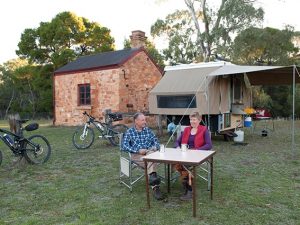
Overnight hiker camping is available at the picnic ground with access to toilets and water.
View full featured Interative Map of the Heysen Trail - showing additional information layers such as Re-routes, Guidebook map outlines, photos and Fire Ban Districts.

Leave a Reply

Your email address will not be published. Required fields are marked *