


On Wednesday 22 May 1985 the remaining participants in the Jubilee 150 Heysen Trail Walking project reconvened at the historic Kanyaka Ruins to walk, over the next ten days, to Aroona Hut. Several changes had occurred in the walking group from those that reached the Kanyaka Ruins in September the previous year.
The next morning we woke to a persistent drizzle and low cloud. The plan for the day was to climb Pompey Pillar, the summit of which is just metres lower than the summit of St Mary Peak, the highest point in the Flinders Ranges.
The group comprised Bob Nicolle, Dick Grant, Carlien Melrose, Lynn Steven and an Israeli backpacker, Zig, who had heard of our venture and independently found his way to the Kanyaka Ruins in time to start the walk. Harold Woodward had decided not to continue his participation.
Following the customary group photograph session in front of the ruins, with our now much travelled Jubilee 150 flag, taken by Maureen Nicolle, we set off to the north, immediately crossing the bed of the Kanyaka Creek and passing the small Kanyaka cemetery to our right.
The route for the first two days was along unmade road reserves through open saltbush and blue bush sheep grazing country. Passing Kanyaka Hill on our left we continued to walk north for five kilometres. The road reserve then trended to the west around the base of the range of hills that included Hut Hill.
We left our packs at the base of the range and climbed the 260 metres to the top of Hut Hill (560 metres). A feature as we neared the summit was following a dry stone wall right up to the trig point. Hut Hill provided excellent views to all points of the compass, enabling reminiscence of our adventures to the south, including significant waypoints during our walk from Melrose in Spring the previous year, and to the north providing the opportunity to consider the significant peaks we were to visit in the coming days.
Returning to our packs we walked north-west to a road reserve adjacent to Calabrinda Creek, adjacent to the eastern base of the southern end of the Yappala Range, which we followed to the north-east for several kilometres. The route along the base of the Range, along the western side of the broad Wilson Valley, then took us north for ten kilometres.
In the early afternoon, after passing The Oaks homestead to the east, we reached the point to the south of Mount Elm where a rough bush track passes via a low saddle through the Range. After a quick lunch at the top of the saddle (~ 530 metres) several of my companions and I scrambled one and a half kilometres along the ridge, aptly known as the Razorback, to the top of Mount Elm (686 metres). As our route was now to take us north on the western side of the Range, initially adjacent to the south flowing Bobby Creek and then the north flowing Yappala Creek, the visit to Mount Elm provided the opportunity to gain an impression of the country we were about to visit.
Returning to our packs and companions waiting at the saddle we headed west down the steep track and then north when we reached the base of the range, in the headwaters of Bobby Creek. Following a track north we soon entered the headwaters of Yappala Creek. Five kilometres on, soon after passing Yappala Peak to the east, we rested and replenished water supplies at a windmill and tank, also a favourite watering point for hundreds of finches that we observed sitting on wires of the many fences that congregated at the windmill and associated troughs.
The last walking period for the day brought us to the McDill Graves near the Hawker to Hookina Road. As always the camp on the first night of a new stage of the walk provided the opportunity to catch up on what each of us had been doing since the completion of the previous stage. There was now a number of shared experiences from the previous four stages that prompted much reminiscing on the good and also the challenging events.
Leaving the campsite the next morning at the customary 8.00 am we walked east for several kilometres along the road to Hawker before heading north-east across a flat cleared area for several more kilometres to intersect with the Hawker to Parachilna Road near Robert Bruce’s Grave, which we visited briefly, and the entrance road into the Wonoka homestead. At this point we reached the start of a further section of the built section of the Heysen Trail, which we were to follow for the remainder of the current stage and for the first two days of the next, Stage Six, to Parachilna Gorge.
A kilometre to the north, along the homestead track, with the abandoned and dismantled narrow gauge (Port Augusta to Alice Springs) railway on our left, we again left our packs and proceeded to climb nearby Wonoka Hill. We following a sealed road to the communications tower on the ridge south of the summit (588 metres) and then walked north along a ridge to the summit (630 metres). The weather was overcast and threatening rain, which didn’t in the end eventuate, so after a quick assessment of the country to the north, where The Wide Range dropped steadily to plain level at Mayo Gorge, and the Elder Range rose steeply in the other side of the Gorge, we quickly retraced our steps to our packs for lunch.
We walked briskly north in cool conditions following lunch. Soon after the dismantled railway diverged to the west, and we passed the Wonoka homestead on the bank of Wonoka Creek to the east.
In the mid-afternoon we reached Wonoka Creek which joined with Mernmerna Creek and flowed west out of Mayo Gorge. We walked upstream through the Gorge, to the east, along the bank of Mernmerna Creek. As evening approached we selected a pleasant campsite at the southern end of Red Range, near the junction of Mernmerna Creek and Slaty Creek.
We left camp the following morning in a state of high expectation as our route for the remainder of the walk was to take us through some of the most rugged and picturesque sections of the Flinders Ranges.
Following the marked trail to the north-east along the banks of Slaty Creek we were in a valley with the spectacular eastern face of Elder Range towering over us to the west and the lower but picturesque native pine clad Red Range to our east. And this was our experience for the remainder of the day. Lunch was taken in a wonderful shaded glen – a more ideal spot for a bushwalkers lunch would be hard to imagine.
Mid-afternoon the direction of the trail changed to the north-west and we passed the Umberutna ruins. Having left the headwaters of Slaty Creek we were now following Beatrice Creek downstream. Soon after we rounded the northern end of Red Range and entered a short narrow gorge before emerging onto an attractive flat area at the base of Mount Ide.
After quickly setting up our tents and preparing for tea we climbed the 90 metres to the summit of Mount Ide (~ 410 metres). The views in all directions in the late afternoon sun were magnificent. To the south-west we were able to make out the ‘great stone gully’ on the Elder Range that was to be part of our route to the summit of Mount Aleck the following day. To the north-east we were able to make out our route north through Bunbinyunna Range at Black Gap and onto Bridle Gap in the Wilpena Pound Range.
Next morning, with just our lunch and sufficient water for a strenuous day, we left our campsite at 7.00 am to climb Mount Aleck. It was to be a big day. After following the Heysen Trail markers back to the south for several kilometres and leaving Beatrice Creek we followed a tributary through a low range of hills to the base of the steep and formidable ‘great stone gully’.
After resting we very carefully commenced the 500 metre ascent, with further frequent short rests, whilst taking in the magnificent views to the north and north-east and assessing the best path forward to the next rest spot.
After reaching the top of the Elder Range ridge a kilometre north of Mount Aleck we followed the narrow, rugged and thickly vegetated ridge to Mount Aleck (1,095 metres), arriving in time for an early and leisurely lunch whilst taking in the 360 degree views and reading the notes left by previous climbers in a container found at the base of the summit cairn.
One and a half hours after arriving at the summit we reluctantly commenced retracing our steps along the ridge to the head of the ‘great stone gully’ and began a careful descent. After arriving back at our Mount Ide campsite in the mid-afternoon and a short break we packed up and walked north-east along the Heysen Trail to its junction with the Moralana Scenic Drive, the planned rendezvous point with Maureen Nicolle and her and Bob’s children.
Together we walked upstream along Bunbinyunna Creek and through Black Gap where we selected an attractive campsite just off the Trail. We reflected on our exhausting but thrilling day as we erected our tents and prepared our meals in semi-darkness.
The next morning, well rested, we headed of at 8.00 am, following the Heysen Trail markers to Bridle Gap (690 metres), 250 metres above our campsite, before dropping gradually down just 100 metres onto the floor of Wilpena Pound. Mid-morning, a kilometre or so short of the junction of the Heysen Trail with the inside St Mary Peak walking track, we selected a suitable campsite adjacent to the Trail.
Again with lunch and sufficient water for the remainder of the day we headed north-west across the initially flat Pound floor and after joining the inside St Mary Peak walking track we passed Cooinda Camp on our way to Edeowie Gorge. After lunch on the saddle separating the headwaters of North Wilpena Creek and the west flowing Edeowie Creek (~ 740 metres), and the head of Edeowie Gorge, we headed down the Gorge, reaching the top of Glenora Falls (~500 metres) before retracing our steps to our campsite on the Pound floor.
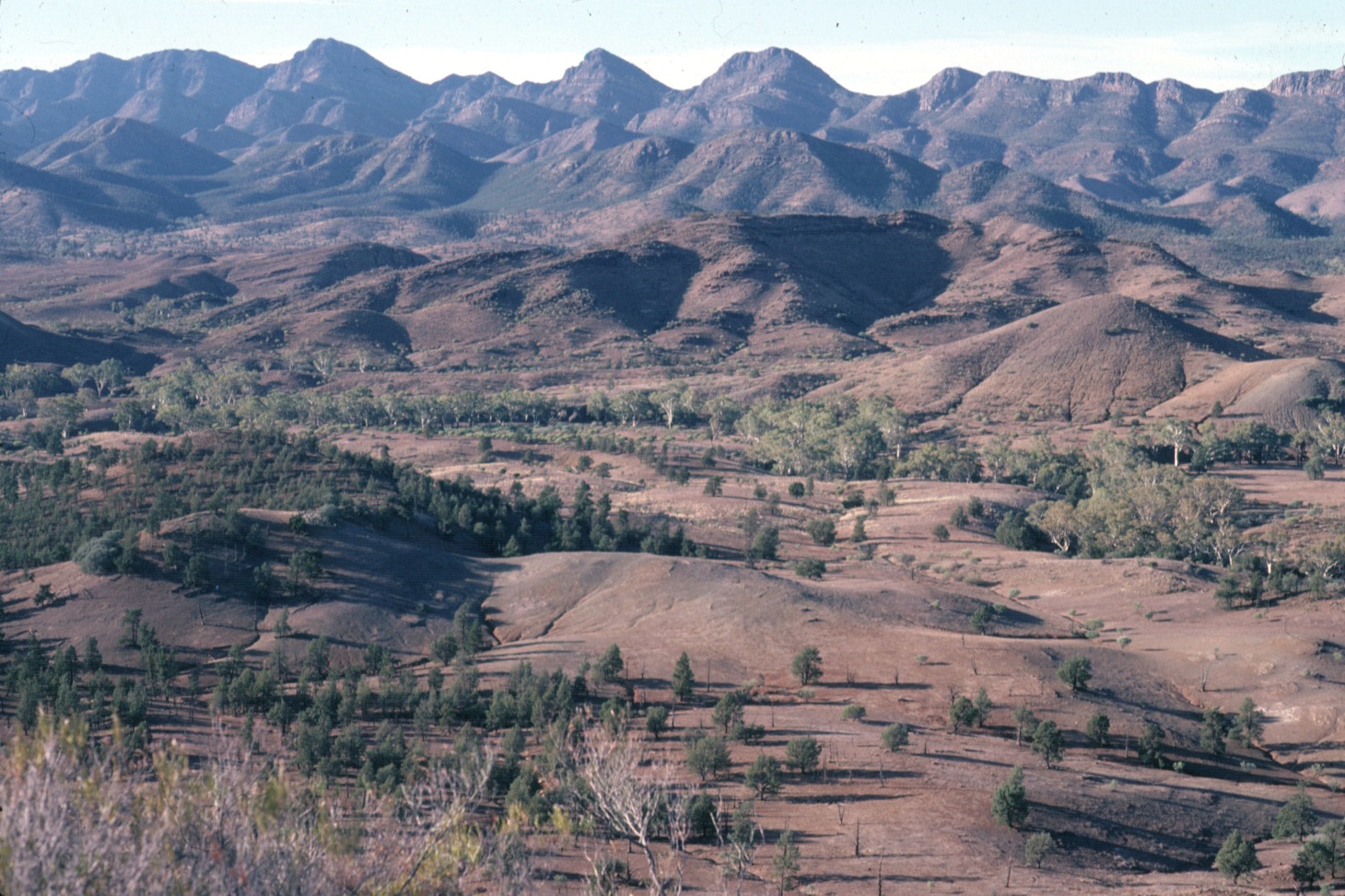
The next morning we woke to a persistent drizzle and low cloud. The plan for the day was to climb Pompey Pillar, the summit of which is just metres lower than the summit of St Mary Peak, the highest point in the Flinders Ranges.
Unless the clouds lifted during the morning as we proceeded towards Pompey Pillar finding the summit would require some particularly skilful map reading and dead reckoning. Carlien, Lynn and Dick decided to walk onto the Wilpena Pound campsite which was to be our campsite that evening whist Bob, Zig and I headed to Pompey Pillar.
Leaving our saturated tents up, in the hope that the weather would improve during the time we were away, we left at 7.30 am. Our initial route was north-west along the Pound floor staying clear of the inside St Marys Peak walking track. The strategy was to select the spur that lead to Pompey Pillar whilst at a low attitude and visibility, albeit, gave the best guide to the summit.
After an hour of walking as the drizzle become rain, believing that, despite limited visual references, we were at the base of the right spur we headed south-west along the steadily rising spur. The increase of height from the point of leaving the Pound floor to the summit of Pompey Pillar was 470 metres, over a distance of just one and a half kilometres. Soon the journey up the spur became quite steep.
As we ascended the visibility reduced even further as the clouds become thicker. At 11.00 am we reached the summit of Pompey Pillar (1,168 metres), marked by a small cairn. Thick clouds swirled around and visibility was less than 50 metres. Finding a somewhat sheltered area amongst rocks just below the summit we ate a quick lunch, reconciled that we were not going to see what we knew would be a stunning view in clear weather, and then headed back to our campsite. Working on the principle that as long as in descending we maintained a generally north-easterly direction, thereby avoiding entering Edeowie Gorge, we would eventually reach the Pound floor made for less stressful navigation. We did however need to stay on spurs and avoid entering creek beds which were heavily vegetated and rugged.
It was still drizzling, although the clouds were higher giving greater visibility, when we reached our campsite in the mid-afternoon. Unfortunately our tents were still very damp so we had no alternative to pack them wet before following the Heysen Trail markers across the Pound floor, to the intersection with the inside St Mary Peak walking trail near the abandoned homestead, and then past Sliding Rock and through the Pound entrance to the picturesque Wilpena Pound camping ground beyond.
Arriving in the late afternoon we sought out Maureen Nicolle’s campsite and were soon, with light drizzle still falling, attempting to dry our wet clothes before a largish fire. Fortunately we were able to sleep overnight in the Nicolle’s large annexe tent, thereby avoiding the need to erect and sleep in wet tents.
The weather was still overcast but fortunately dry as we headed out from the camping ground the next morning, following the Heysen Trail markers to the north-west, also the route for the outside St Mary Peak walking trail. After an hour we reached the point where the Heysen Trail continued on along an old fence line and the St Mary Peak walking trail commenced a steady 530 metre climb up the outside of the Pound wall to the summit of St Mary Peak.
Leaving our packs a short distance off the Trail, after spreading our still wet tents and other wet equipment out on nearby bushes to dry, we headed up the walking trail, in an hour reaching Tanderra Saddle (910 metres) and then 45 minutes later the summit of St Mary Peak (1,170 metres).
After half an hour on the summit, spent looking as some of the features we would be visiting in the few days remaining of this stage and the first four days of the next stage, including the just visible Patawarta Hill, beyond the built section of the Heysen Trail, more than 60 kilometres to the north, we headed back down. The return to our packs took an hour and half and after a quick lunch we packed our now dry tents and equipment and followed the Heysen Trail markers to the north-west and then to the north-east through a range of low hills to Wilcolo Creek at the base of the southern end of the ABC Range. After following the Creek downstream for several hours we selected an attractive campsite on the banks of the Creek with Mount Abrupt prominent to the west.
Our route the next morning took us north for three and a half kilometres before heading east, upstream along a creek that passed through two of the ABC Range peaks. The route gradually ascended to and then followed a north leading fire access track on a ridge overlooking Bunyeroo Valley further to the east.
Leaving the fire access track we then followed a tributary of Bunyeroo Creek north and then north-east, arriving at its headwaters adjacent to Yanyanna Hut and Yard, where we stopped for lunch. After lunch we followed the Heysen Trail markers along the undulating Yanyanna Walking and Fire Access Track north, passing Old Etatina and another old hut and yards near Etina Creek. Crossing over the Brachina Gorge road and Brachina Creek we selected a campsite adjacent to the Creek.
The next morning we continued north along the gently undulating Trezona Walking and Fire Access Track and then after a short break we commenced walking west along the Bulls Gap Walking Track, passing over Red Hill Lookout (537 metres), before descending to, crossing and briefly following Yuluna Creek. Our route continued west across a low saddle through the ABC Range before emerging in the early afternoon in the Aroona Valley near Aroona Ruins, the end of the Stage Five.
The walk had been a great success. Our journey over three and a half years to Mount Babbage was now well over the half-way point. The next stage however, in the spring of 1985, would take us beyond Parachilna Gorge, the end point of the built section of the Heysen Trail. That had a particular interest for me as it was being argued by some that the Trail, originally conceived as a walking trail to the northern tip of the Flinders Ranges should, on safety grounds, finish at Parachilna Gorge. I was, unsuccessfully, a vocal advocate for retaining the original concept.
A further 30 days of walking would bring us to Mount Babbage. After the first three days of the next stage we would be walking a section of the Heysen Trail which should, and might still one day be?
Jump to content:
- Introduction – The First End-to-End walk of the Heysen Trail
- Stage One – Cape Jervis to Cudlee Creek
- Stage Two – Cudlee Creek to Burra
- Stage Three – Burra to Melrose
- Stage Four – Melrose to Kanyaka Ruins
- Stage Five – Kanyaka Ruins to Aroona Hut
- Stage Six – Aroona Hut to Sliding Rock Mine
- Stage Seven – Sliding Rock Mine to Arkaroola
- Stage Eight – Arkaroola to Mount Babbage