View all news articles below, or select a news category to the right.
Take a survey for a student: hiking the Heysen Trail
Hayley McCreath, a senior student from Woodcroft College, is researching hiking on the Heysen Trail for her SACE Research Project. Her question is “What preparations would need to be considered when walking the whole Heysen Trail?”.
Take a moment to fill in her survey: http://www.surveymonkey.com/s/M98WDB8
Answers are anonymous. The survey will take 2-7 minutes to fill in.
Hayley says, “I think that the trail is one of South Australia’s hidden gems so if you can help me to promote it through my Research Project I will be very grateful.”
Talk on safety for people hiking in remote areas

A talk on safety for people hiking in remote areas will be held on Tuesday 12 March at 7.30pm.
Hosted by WalkingSA, the guest speakers are Trevor Arnold, SES Commander North Region (including Flinders Ranges) and Manager, Technical Services, and Anthony Chan, Manager, Electric Bug.
Trevor will speak about when and why bushwalkers should carry a safety device; how the SES is alerted to and responds to an emergency; the time delay from distress signal to arrival on site, for remote areas like Parachilna; and what is the surest device to achieve the surest response in the shortest time?
Anthony Chan will speak compare devices, including looking at initial costs, recurring costs and reliability.
The talk will be at the Greening Australia Building, 5 Fitzgerald Road, Pasadena, on Tuesday 12 March at 7.30pm. Please RSVP to Walking SA via office@walkingsa.org.au or (08) 8276 5090.
Re-route of the Heysen Trail affecting Map 1.2, February 2013
View pdf map.
A minor re-route north of the Bundaleer Tank Camp Site, the trail no longer crosses the weir, and remains on the eastern side of Never Never Creek.

View all re-routes for the 2010 Northern Guidebook, 2nd Edition
Re-route of the Heysen Trail affecting Map 2.4, February 2013
View pdf map.
A new campsite has been constructed at Beetaloo Tank Camp Site, on the dirt track named Mills Road, adjacent to Beetaloo Creek. The campsite includes a small shelter with bench, primarily designed to collect rainwater. The campsite is midway between the Bowmans Hut and the Go-Cart Track campsite – 19.9km from Bowmans Hut and 20.2km from the Go-Cart Track campsite.
View all re-routes for the 2010 Northern Guidebook, 2nd Edition
New look website – works on smartphones and tablets

Our website has been refreshed and is now optimized to work on smartphones, tablets and desktop/laptop computers.
Visit our new-look website.
> NOW
The website reformats itself to display on different devices – meaning it is always easy to read and easy to use regardless of whether you are using a smartphone, like an iPhone or Android, or a tablet, like a iPad or Galaxy, or a laptop or desktop computer.
Registering for a walk on your smartphone will now be an easy task. As well as a new look, the front page has been streamlined to provide key information of interest to independent hikers, and people hiking with the Friends.
The Interactive Maps page has been upgraded so it now works natively on smartphones and tablets. The End-to-End points have also been updated and re-installed to the Interactive Map.
A new area of the website has been created featuring the Day on the Heysen Trail – the Warren Bonython Memorial Walk (Sunday 6 October 2013). This will be updated in coming months with more information, including a feature allowing people to choose the different section of the trail they could walk, and include other event information.
> SOON
Soon the registration system will be upgraded. This will allow you to log-in, making walk registration easy, and you will be able to review your walk history. The complicated PayPal payment system will be replaced by a simple NAB payment interface.
> LATER
Later, our forums and shop areas of the website will be upgraded so they too work on smartphones and tablets. Our shop will feature all the products sold in our physical shop.
Visit our new-look website now.


Public Consultation of 104km Adelaide Hills trail

The Adelaide Hills Council is seeking public feedback concerning their Draft 20 Year Trail Strategy. The vision is of a 104km core trail, with additional loops, linking Hills townships and existing trails within the council area.
The strategy builds on popular trails such as the Amy Gillett, Mawson and Heysen Trails to create greater connectivity between townships and to link popular attractions, cellar doors and market villages.
More information is available here:
- Adelaide Hills Trail Strategy
- Draft mapping document (11MB)
- Survey 5-10 mins (open to both Hills and non-Hills residents)
The consultation process ends on 15 February, 2013.
A hasty hiking escape from a bushfire. Where have you been hiking this summer?

It gets pretty hot over the summer months in South Australia. Often our members head elsewhere to cooler climates to continue hiking.
But even when it’s cooler, bushfires can still be a risk. One of our members, Jeremy, found himself hiking towards a large fire front on the Tasman Peninsula in Tasmania. Here’s a photo he has shared with us when he first noticed the fire as he came out of dense forest.
You can read more about his escape on his Notes from a Trailhead blog.
Don’t forget our Twilight walking program is underway, a two hour walk each Wednesday evening. www.heysentrail.asn.au/walks
Where have you been hiking over recent weeks? Perhaps leave a comment on our Facebook page, where this same post has been made.
Stay safe everyone!
Summer 2013
Issue 126
December 2012
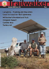 Highlights include:
- Larapinta - Training and Execution
- Coast to Coast for Rett Syndrome
- Mt Rainier’s Wonderland Trail
- Simpson Desert
- Camino Inca
- Tanks a lot
Working Bee at the Southern Trailhead
There is a working bee near the southern trailhead of the Heysen Trail at Cape Jervis. Run by the Cape Jervis Coastal Community Group, volunteers are needed to assist on the weekend of the 1st and 2nd December.
Saturday 1st December
10am – 12.30pm: removing tree guards near Lands End (tree guards to be re-used by the Friends of the Heysen Trail)
12.30pm – 2pm: BBQ lunch provided
2pm – 4pm: woody weed lopping and seed collecting
Sunday 2nd December
10am – 12noon: seed sowing
Please contact Carolyn or Liz for more information and directions.
Walking SA survey
As you may be aware, Walking SA is undergoing a review of governance and operations.
Please assist them with the process by taking the time to fill in this 10 min survey. https://www.research.net/s/FK2LWLV
PKF Organisation Development has been engaged to undertake this process. Your responses will be sent directly to PKF in order to ensure that all answers remain confidential. Only key themes will be reported, therefore please ensure that you are as honest in your responses as possible. The information collected will be an integral part of the consulting process and they encourage you to be open in your comments and suggestions.
You may forward this email to friends.
The survey will close at 5pm Wednesday 28th of November.
If you have any questions in relation to the survey please contact Hayley Lokan or Scott Way from PKF Organisation Development on orgdev@pkf.com.au or 08 7421 1400. If you would like to make a more detailed submission regarding the questions in this survey, once again please contact PKF on the details provided above.
Re-route of the Heysen Trail affecting Any/All Maps in this Guidebook, November 2012
With the release of the recent Southern Guidebook reprint, support for this 2007 Southern Guidebook edition has been suspended. Re-route notifications for this guidebook will no longer be posted on the website.

View all re-routes for the 2007 Southern Guidebook, 2nd Edition
Re-route of the Heysen Trail affecting Any/All Maps in this Guidebook, November 2012
With the release of the recent Southern Guidebook reprint, support for this 2005 Northern Guidebook edition has been suspended. Re-route notifications for this guidebook will no longer be posted on the website.

View all re-routes for the 2005 Northern Guidebook, 1st Edition
Re-route of the Heysen Trail affecting Any/All Maps in this Guidebook, November 2012
With the release of the recent Southern Guidebook reprint, support for this 2004 Southern Guidebook edition have been suspended. Re-route notifications for this guidebook will no longer be posted on the website.

View all re-routes for the 2004 Southern Guidebook, 1st Edition
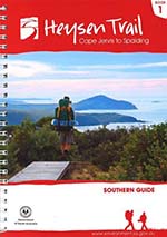
New Southern Guidebook, older guidebooks no longer supported

The re-print of the Southern Guidebook has been released. Stocks of the 2010 edition ran out mid this year.
The new guidebook has the same cover as the 2010 edition, but includes re-routes from the previous two years like the new spur trail into Victor Harbor. A few recent re-routes have not been included, these re-routes can be viewed on our website.
With the release of this edition, support for three older guidebooks has been suspended. Re-route notifications for the original 2004 Southern Guidebook, 2005 Northern Guidebook and 2007 Southern Guidebook will no longer be posted on the website.
Re-route of the Heysen Trail affecting Map 2.1, September 2012
View pdf map.
The spur trail from Kings Beach into Victor Harbor has been opened. The trail follows the coast from Kings Beach, via the Bluff and the Esplanade, to Kent Reserve, near the town centre.

View all re-routes for the 2010 Southern Guidebook, 3rd Edition
Re-route of the Heysen Trail affecting Map 1.6, September 2012
View pdf map.
The spur trail from Kings Beach into Victor Harbor has been opened. The trail follows the coast from Kings Beach, via the Bluff and the Esplanade, to Kent Reserve, near the town centre.
View all re-routes for the 2010 Southern Guidebook, 3rd Edition
Re-route of the Heysen Trail affecting Map 6.9, September 2012
View pdf map.
A new camp site has been constructed at a trig between Hallett and Spalding. We anticipate water will be available for the 2013 hiking season.
This campsite replaces the former water source at Willalo Hall. It is 22.5km from Hallett and 26km from Spalding.
The camp site features a shelter with water tank and bench. It is in a windy and exposed location, so may not be suitable for all tents.
More info in the accommodation forum at http://www.heysentrail.asn.au/forums/viewtopic.php?t=697&accom_id=697&name=Whistling%20Trig%20Tank
View all re-routes for the 2012 and 2013 Southern Guidebooks, 4th & 5th Editions
Re-route of the Heysen Trail affecting Map 5.11, September 2012
View pdf map.
A new camp site is being constructed just north of Worlds End/Burra Gorge. The new hike-in camp site will be completed in October 2012, and we anticipate water will be available for the 2013 hiking season.
The camp site features a shelter with water tank and bench, and a square bench/table.
More info, including photos, will be posted on this page later: http://www.heysentrail.asn.au/forums/viewtopic.php?t=685&accom_id=685&name=Worlds End Hike-in Camp Site
Distances:
Huppatz Hut to Worlds End Hike-in Camp Site – 21.3km
Worlds End Hike-in Camp Site to Burra – 23.0km
View all re-routes for the 2012 and 2013 Southern Guidebooks, 4th & 5th Editions
Re-route of the Heysen Trail affecting Map 5.7, September 2012
View pdf map.
A new camp site is being constructed at Webb Gap. The new camp site will be completed in October 2012, and we anticipate water will be available for the 2013 hiking season.
The camp site features a shelter with water tank and bench, and a square bench/table.
More info, including photos, will be posted on this page later: http://www.heysentrail.asn.au/forums/viewtopic.php?t=684&accom_id=684&name=Webb Gap Camp Site
Distances:
Smith Hill Camp Site to Webb Gap Camp Site – 13.3km
Webb Gap Camp Site to Huppatz Hut – 16.2km
View all re-routes for the 2012 and 2013 Southern Guidebooks, 4th & 5th Editions
Re-route of the Heysen Trail affecting Map 5.6, September 2012
View pdf map.
A new camp site is being constructed on Smith Hill. The new camp site will be completed in October 2012, and we anticipate water will be available for the 2013 hiking season.
The camp site features a shelter with water tank and bench, and a square bench/table.
More info, including photos, will be posted on this page later: http://www.heysentrail.asn.au/forums/viewtopic.php?t=683&accom_id=683&name=Smith Hill Camp Site
Distances:
Maschalls Hut to Marabel – 8.6km
Marabel to Smith Hill Camp Site – 17.3km
View all re-routes for the 2012 and 2013 Southern Guidebooks, 4th & 5th Editions