View all news articles below, or select a news category to the right.
Volunteer opportunity in Central Australia

NT Parks and Wildlife Service have a two week volunteer opportunity assisting park rangers in Larapinta Trail maintenance in the West MacDonnell National Park.
This volunteer opportunity is open to all ages and anyone interested can apply, registrations close Wednesday 21 March.
Further information can be found in this leaflet, or by contacting Kelly Knights on 08 8956 7799 or email on gov..
Autumn 2012
Issue 123
March 2012
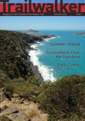 Highlights include:
- Where Our Members Been Hiking Over Summer
- Somewhere Over the Rainbow - classic NZ tramp
- Falls Creek with ARPA
- AGM Notice & Agenda
Check out our Heysen-sational article

Check out the Heysen-sational article in the latest Great Walks magazine, Feb-Mar 2012. Focuses on tips for walking the trail, both short and long treks.
Great Walks is available from good newsagents.
We were also listed in the Australian Photography magazine, Dec 2011, as one of Australia’s top 10 walks, in an article about photography and trekking.
Australia Day BBQ

Don’t forget, tomorrow (Thu 26th) we have our Australia Day BBQ and walk at Kingston Park, under the trees.
Coastal walk at 3pm with Gavin, length depending on sea breeze. Return by 5pm for a swim and the BBQ.
BBQ at 5pm. BBQ plate and table provided. BYO meat, salads, drinks and chairs.
No cost to attend. No booking required for the walk or BBQ, just turn up to enjoy.
View the location map.
Have you been hiking over summer?

Have you been hiking over summer?
We’re compiling a couple of pages for the next Trailwalker with a collection of short statements about where members have been hiking since November. Morning walks, day hikes or multi-day hikes. Local, interstate or overseas. Send us up to 50-100 words and a photo.
Email your short statement to trailwalker@heysentrail.asn.au
If you’re keen to write more, consider writing an article, email trailwalker@heysentrail.asn.au to discuss. Article guidelines can be found at www.heysentrail.asn.au/trailwalker/
Start the New Year with a Downhill Walk?

A downhill walk or run on the George Driscoll Sea to Summit Trail, Mt Lofty to Brighton Beach. On the public holiday Monday, 2 January, 7.00am. Three distance options – 34km, 18.5km or 14km. Run or walk. No cost, no registration required.
Organised by SARRC (South Australian Road Runners and Walkers Club). Unlike their mid-year annual uphill run, there are no support crews available along the way. Bus available from Brighton to Mt Lofty for $10. Finish with a swim.
More info on the SARRC website.
Re-route of the Heysen Trail affecting Map 2.7, December 2011
View pdf map showing re-route
A new campsite has been established at Finniss River. The campsite is at GR 892 884, immediately north-west of road on the southern bank of the river, 150m down a small side road from intersection off Heysen Trail.

View all re-routes for the 2010 Southern Guidebook, 3rd Edition
Re-route of the Heysen Trail affecting Map 2.7, December 2011
View pdf map showing re-route
A new campsite has been established at Finniss River. The campsite is at GR 892 884, immediately north-west of road on the southern bank of the river, 150m down a small side road from intersection off Heysen Trail.

View all re-routes for the 2007 Southern Guidebook, 2nd Edition
Re-route of the Heysen Trail affecting Map 2.7, January 2011
View pdf map showing re-route
A new campsite has been established at Finniss River. The campsite is at GR 892 884, immediately north-west of road on the southern bank of the river, 150m down a small side road from intersection off Heysen Trail.

View all re-routes for the 2004 Southern Guidebook, 1st Edition
Re-route of the Heysen Trail affecting Map 2.5, December 2011
View pdf map showing re-route
A new campsite has been established at Mt Cone, at GR 784 803, in a small reserve above a Y road junction.
View all re-routes for the 2010 Southern Guidebook, 3rd Edition
Re-route of the Heysen Trail affecting Map 2.5, December 2011
View pdf map showing re-route
A new campsite has been established at Mt Cone, at GR 784 803, in a small reserve above a Y road junction.
View all re-routes for the 2007 Southern Guidebook, 2nd Edition
Re-route of the Heysen Trail affecting Map 2.5, December 2011
View pdf map showing re-route
A new campsite has been established at Mt Cone, at GR 784 803, in a small reserve above a Y road junction.
View all re-routes for the 2004 Southern Guidebook, 1st Edition
Re-route of the Heysen Trail affecting Map 2.2, December 2011
View pdf map showing re-route
A new campsite has been established at Robinson Hill. The campsite is located at GR 720 666, 50m south of road on top of Robinson Hill, 800m east along Hancock Road from where the trail turns to the north off Hancock Road (1.1km east of the ruined church).
View all re-routes for the 2010 Southern Guidebook, 3rd Edition
Re-route of the Heysen Trail affecting Map 2.2, December 2011
View pdf map showing re-route
A new campsite has been established at Robinson Hill. The campsite is located at GR 720 666, 50m south of road on top of Robinson Hill, 800m east along Hancock Road from where the trail turns to the north off Hancock Road (1.1km east of the ruined church).
View all re-routes for the 2007 Southern Guidebook, 2nd Edition
Re-route of the Heysen Trail affecting Map 2.2, December 2011
View pdf map showing re-route
A new campsite has been established at Robinson Hill. The campsite is located at GR 720 666, 50m south of road on top of Robinson Hill, 800m east along Hancock Road from where the trail turns to the north off Hancock Road (1.1km east of the ruined church).
View all re-routes for the 2004 Southern Guidebook, 1st Edition
Four new shelters and water tanks erected

Work has begun on four of ten new water tanks and shelters. The frames for the shelters were erected over the weekend, they will be completed in the new year.
The four water tanks and shelters have been erected at four new campsites:
- Balquhidder campsite (photos | map), a campsite which is marked in the recent 2010 published guidebook
- Robinson Hill campsite (photos | map), located between Waitpinga and Inman Valley
- Mt Cone campsite (photos | map), between Myponga and Mt Compass
- Finniss River campsite (photos | map), between Mt Compass and Kuitpo Forest
These new shelters and water tanks close up some of the longer gaps between camp sites and water supplies:
- Newland Hill campsite to Robinson Hill campsite – 17.7km
- Robinson Hill campsite to Myponga – 23km (or 18.8km to Heysen’s Rest B&B)
- Myponga to Mt Cone campsite – 14km (or 16.2km from Heysen’s Rest B&B)
- Mt Cone campsite to Finniss River campsite – 17.3km
Thanks to Bronte Leak from DENR, Colin Edwards, John Potter, Bob Gentle, Albert Schmidke, Peter Solomon, Simon Cameron and Julian Monfries for their work in the construction effort.
Six more shelters and water tanks have been fabricated and will be erected in the new year.
WA’s Bibbulmun Track wins Silver at Tourism Awards

Western Australia’s Bibbulmun Track won the Silver Medal in the Tourist Attraction category at the recent 2011 WA Tourism Awards.
Congratulations to the volunteers and staff at the Bibbulmun Track Foundation!
More info:
New Zealand’s 3,000km Walking Trail Opens

This morning three ceremonies in New Zealand officially opened the 3,000km Te Araroa walking trail. Te Araroa, meaning ‘the long pathway’, is a national foot trail running the length of country.
A ceremony was held at the north trailhead, south trailhead and the midway point at Wellington, coinciding with the release of the a trail guide, The Walking Guide to Te Araroa, written by Geoff Chapple (the Te Araroa Trust chief) and published by Random House.
The trail explores New Zealand’s unique landscape, its volcanoes, its range and mountain uplift, its rivers, lakes and valleys. From Cape Reinga at the top of the North Island it traverses the length of the country down to Stirling Pt in Bluff at the bottom of the South Island. Envisionaged in 1975, it was not until the late 90s that material progress was acheived. Some 45% of the trail consists of smaller trails linked together, the remaining 55% consists of new trails. Just 13.5% is along roads.
By the mid-2000s and well ahead of the trail’s completion, eager walkers were already hitting the trail – up to 10 a year, using roads as by-passes where necessary. It is predicted that about 100 people will walk the length of the trail annually, 7000 people will walk overnight sections and 350,000 people will use the trail for day walks.
Anyone have three or four months to spare next year?
Further info can be found on the Te Araroa website: http://www.teararoa.org.nz
Summer 2012
Issue 122
December 2011
 Highlights include:
- Bibbulmun - The Northern Half
- A Short Cut to Machu Picchu
- The Fearless Five Women on the Heysen Trail
- DIY Stove Windshield
- Nominations for Honorary Membership
Upgrade of Waterfall Gully track completed

The $1.2 million upgrade of the popular Waterfall Gully to Mt Lofty track has been completed, says South Australian Environment Minister Paul Caica.
The four kilometre upgrade has been completed in stages over the past three years. The trail alignment, surface, drainage and signage has been upgraded. More rest areas, including an area safe for children to play and explore, have also been included.
An estimated 400,000 walkers enjoy the trail each year.
Read more in Paul Caica’s press release.