A 2 km reroute away from the road at Tapanappa and a spur trail from Tapanappa into the Yapari Ngawanthi Cliffs campsite.
Download gpx file.
This re-reoute applies to: Section 2: Cobbler Hill to Tapanappa
The Friends AGM will be held on 22 April 2026. Join us to celebrate 40 years of the Heysen Trail. Read more
 | Mapsheet 1: Cape Jervis to Kuitpo Forest inc the Wild South Coast Way (Edition 2, 2022)Occasionally, due to weather or maintenance issues, it is necessary to realign sections of the Heysen Trail. Minor reroutes, necessitated by such things as sand blowouts in coastal areas, protection of native vegetation, erosion control, or requests from landholders, are also frequently carried out. Harvesting operations in Kuitpo Forest: ForestrySA operations in Kuitpo Forest will impact the Heysen Trail into the foreseeable future. Walkers in this forest may encounter closed plantation blocks as harvesting operations are undertaken. The presence of heavy machinery and falling trees makes it highly dangerous, and heavy trucks using the haul roads add to the risk. Walkers must not enter the harvesting areas under any circumstance (penalties apply). ForestrySA Rangers and Friends of the Heysen Trail volunteers will ensure that safe reroutes are in place and are clearly marked. Walkers should follow the marked reroute trail until the new track rejoins the Heysen Trail. Reroute signs will be placed at the start and finish of the reroute. From time to time, it will be necessary to reroute the Trail along public roads. Walkers are advised to take extra care on public roads, to always walk on the right, facing traffic and to always walk in single file. |
A 2 km reroute away from the road at Tapanappa and a spur trail from Tapanappa into the Yapari Ngawanthi Cliffs campsite.
Download gpx file.
This re-reoute applies to: Section 2: Cobbler Hill to Tapanappa
View pdf map.
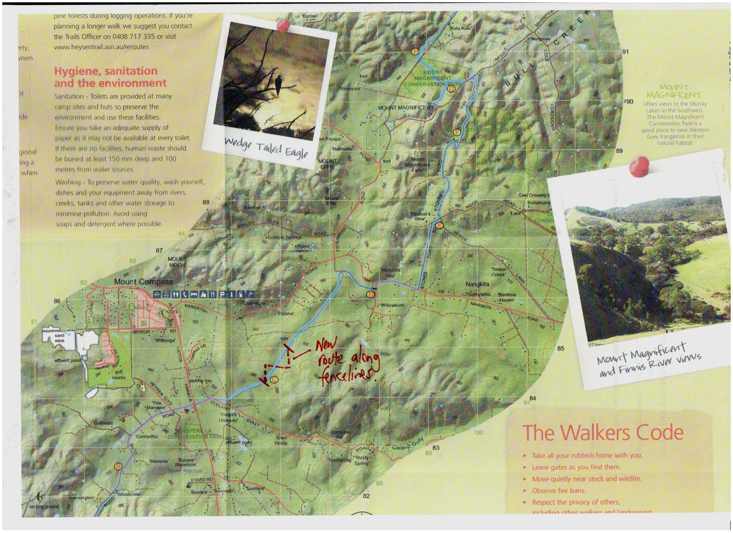
A 1.1 km reroute which takes the Trail along a series of fencelines on the Willowburn property.
Download gpx file.
This re-reoute applies to: Section 9: Mt Compass to Kyeema
View pdf map.
A 3.5 km loop has been added in the Mount Magnificent Conservation Park approximately 100 metres west of the park entrance off Mount Magnificent Road, providing easier access to the summit. The loop follows the Parks SA ‘Mount Magnificent Loop Trail’ and has red Heysen Trail markers. The original spur 500 metres west of Mount Magnificent Road remains.
South – northbound walkers can use the new spur trail. This part of the loop gradually gets closer to the road before turning west to join the original spur just below the summit.
Walkers then return to the Trail by turning around to descend, this time following the old spur trail north.
If you don’t wish to take the loop there is a shorter 500 metre east to west section which is now marked as an alternative Heysen Trail route with black arrows.
Download gpx file.
This re-reoute applies to: Section 9: Mt Compass to Kyeema
View pdf map.
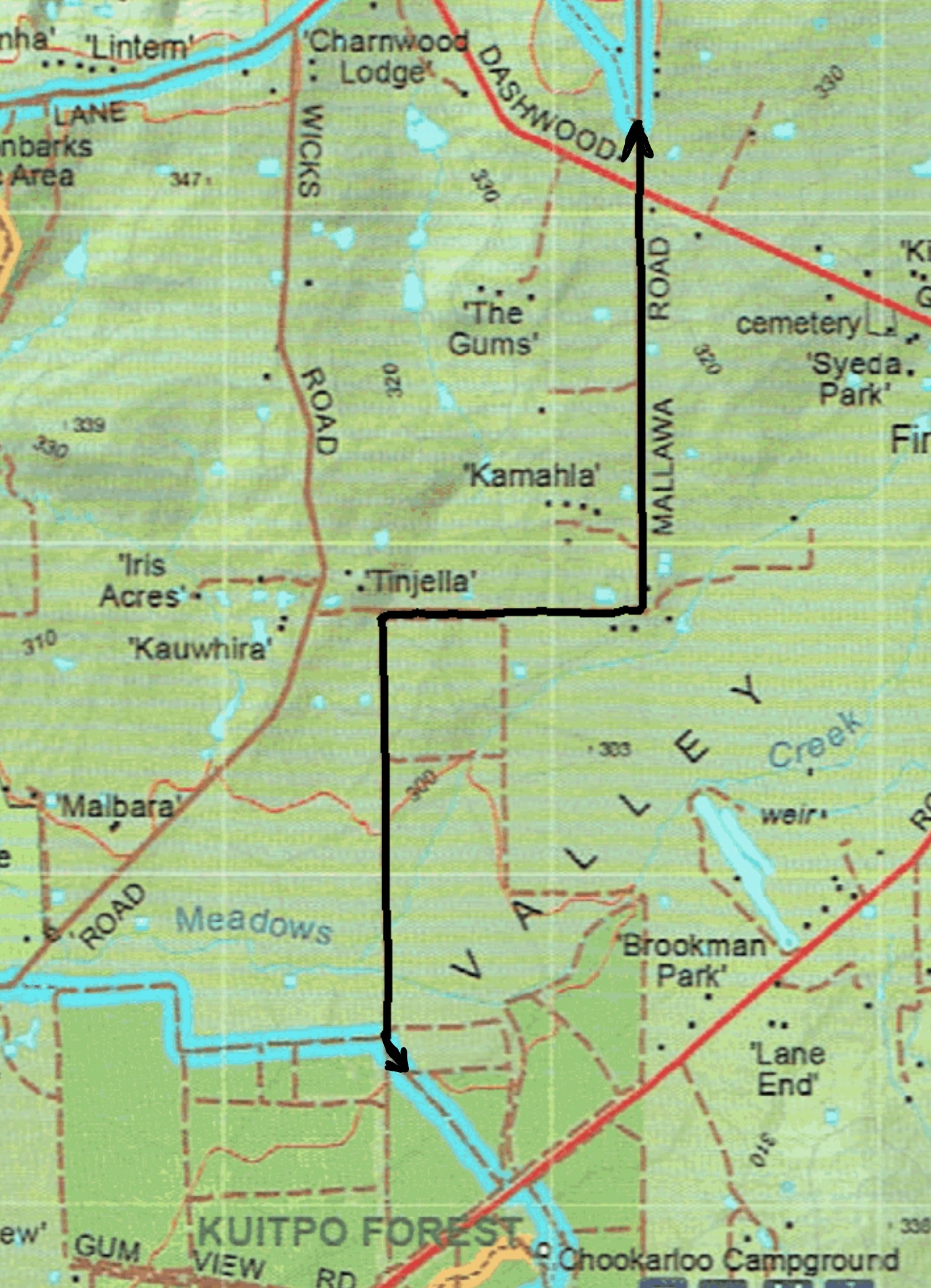
The Trail has been permanently rerouted through Kyeema Conservation Park parallel to Woodgate Hill Road but completely within the Park boundary. Northbound, it enters the Park through the gate at the junction of Woodgate Hill and Blackfellows Creek Roads (Mapsheet 1D grid reference 909 942). The new route runs along the southern boundary of the Park until it re-joins the main Trail at grid reference 899 943, near the Kyeema car park.
Please take care when crossing Woodgate Hill Road near the junction with Blackfellows Creek Road.
Download gpx file.
This re-reoute applies to: Section 9: Mt Compass to Kyeema
Logging is underway in Kuitpo Forest which impacts parts of the Trail. Logging is extremely dangerous and safe reroutes have been signposted. Please take extra care where reroutes take you along public roads. Penalties apply where there is unauthorised entry to logging areas.
This re-reoute applies to these 2 sections:
View pdf map.
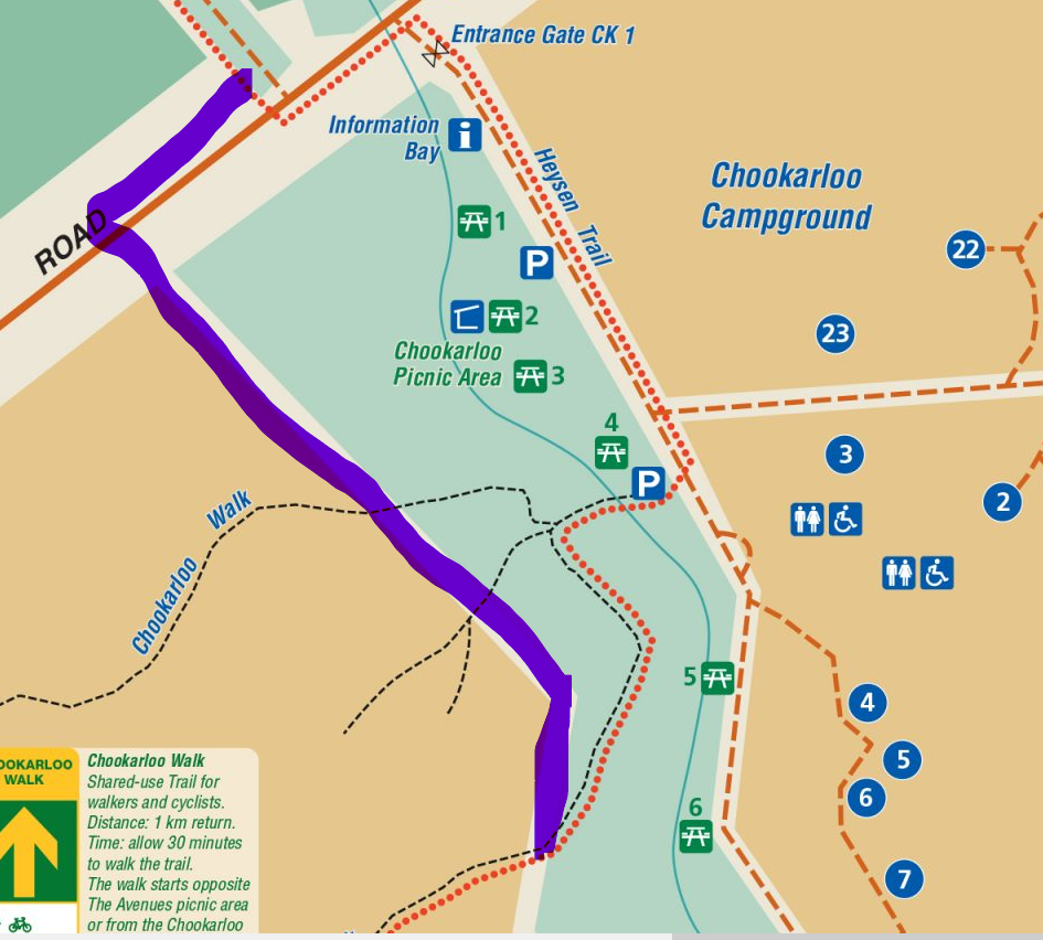
The new route directs walkers away from the Kuitpo Tree Climb and car park.
Northbound it deviates from the original Trail at the Avenues Picnic Ground (Mapsheet 2A at grid reference 916 015), runs parallel with Black Nursery Road for 200 metres before crossing the road. It then enters the forest at grid reference 918 015. After a short meander through a dense eucalypt forest it rejoins the Trail just to the north of the tree climb area.
There is another 500 metre redirection of the trail just further north which bypasses the Chookarloo Campsite.
Northbound walkers leaving the eucalypt plantation surrounding the Kuitpo Tree Climb at grid reference 919019 now follow the northern edge of the plantation west to the boundary fence. Walkers will then cross Brookman Road via a step-over before heading north towards the pedestrian gate at grid reference 918020 before rejoining the Trail.
The two hike-in campsites at Chookarloo have been closed, but the other 21 campsites in this campground are still available.
Please be aware of increased road traffic when crossing Black Nursery Road and avoid entering the tree climb facility. There is now a cafe at the facility.
Download gpx file.
This re-reoute applies to: Section 10: Kyeema to Dashwood Gully
View pdf map.
This reroute is being combined with the previous reroute (Mapsheet 1D and 2A: Re-route at Chookarloo Campground, Kuitpo).
Refer to that reroute for the comprehensive description of the two reroutes.
The PDF map & GPX file currently showing on this page are in the process of being combined with those of the previous reroute.
Download gpx file.
This re-reoute applies to: Section 10: Kyeema to Dashwood Gully
This is a temporary re-route
View pdf map.
Download gpx file.
This re-reoute applies to: Section 10: Kyeema to Dashwood Gully