Night time caution on the Heysen Trail due to feral cat control in the Ikara-Flinders Ranges National Park

642310-89230a6c-e9e5-11e3-9fa0-1bddff48c580A number of tracks within the Ikara-Flinders Ranges National Park, will be closed each night over the next 11 months.

The purpose of the extended closures is to ensure the safety of the public during a feral cat control program to be conducted after dark. The aim is to protect the populations of recently reintroduced Western Quolls and Brushtail Possums.

The evening closures commence on Thursday, 3 November 2016 and will continue through to Saturday, 30 September 2017.

As daylight hours vary over the period of the control program, there are a range of closure times. They are:

  • Thursday, 3 November to Wednesday, 30 November 2016                  8.30pm to 5am
  • Wednesday, 30 November 2016 to Tuesday 31 January 2017              9pm to 5am
  • Tuesday, 31 January 2017 to Tuesday, 28 February 2017                      8.30pm to 5am
  • Tuesday, 28 February 2017 to Sunday, 30 April 2017                            8pm to 5am
  • Sunday, 30 April 2017 to Tuesday, 31 July 2017                                      6pm to 5am
  • Tuesday, 31 July 2017 to Saturday, 30 September 2017                         6.30pm to 5am

Tracks and walking trails will remain open outside of these times.

The Heysen Trail will remain open at all times, however walkers must:

  • remain in designated campgrounds and huts, or
  • camp within 20 metres of the Heysen Trail within the park after dark.

Walkers camping in the park may see spotlights and occasionally hear firearms in the distance at night. The Rangers have advised that the control program will not take place in the vicinity of campgrounds or huts.

The tracks that will be closed at night include –

  • Trezona Track
  • Mount Sunderland Track
  • Rifle Range Track
  • Old Blinman Track
  • Jones Camp Track
  • Telegraph Track
  • St Mary Peak outside trail
  • Cooinda Track
  • Pound Gap Track

Further information on the feral animal control program and the nightly trail closures can be obtained from the Natural Resources, SA Arid Lands or by phoning them on (08) 8648 5344 or 0428 116 035.

Storms damage some sections of the Heysen Trail

The Heysen Trail near Kings Beach - photo by Martin Chapman.

The Heysen Trail near Kings Beach – photo by Martin Chapman.

Walkers are advised that some sections of the Heysen Trail have suffered damage during the recent weather events.

As a result

are closed until further notice. Refer to the Parks closures webpage for the latest information.

Walkers need to take care on the trail and particularly near the following locations:

  • Kings Beach (near Encounter Bay) – Southern Guide Book Map 1.5 and Sheet Map 1B.
  • Giles Conservation Park (near Ashton) – Southern Guide Book Map 3.4 and Sheet Map 2B.

While conditions are generally expected to improve over the next week, it may be sometime before the necessary work can be completed on these sections.

If you find any damage on the trail, please report it to the Friend’s office. To assist our Trail Development volunteers, please advise

  • the location and map reference,
  • describe the nature of the work required (i.e. marker post has been knocked over) and
  • if possible, send a photo.


Park Closure – The Telowie Gorge Conservation Park and Napperby Block (Mount Remarkable National Park) 23 Sept 2016 to 29 Sept 2016

across the Gulf

Telowie Gorge Conservation Park and Napperby Block (Mount Remarkable National Park) will be closed from 6am Friday, 23 September 2016 to 6pm Thursday, 29 September 2016

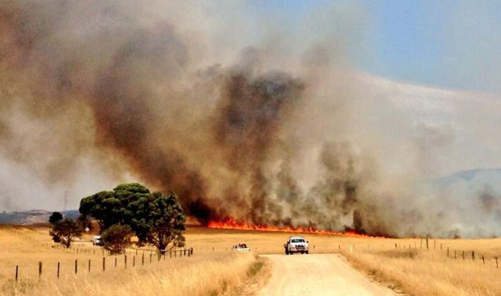
The purpose of the park closure is to ensure the safety of the public during a pest control program within the parks during the period indicated.
The Heysen Trail passes along the eastern edge of these parks.  Hence – Do not divert for the Heysen Trail and attempt to enter these parks at those times.

Especially Relevant – The Go Cart Track Shelter is alongside the HT and within the Telowie Gorge Conservation Park. This shelter may be closed during these times.

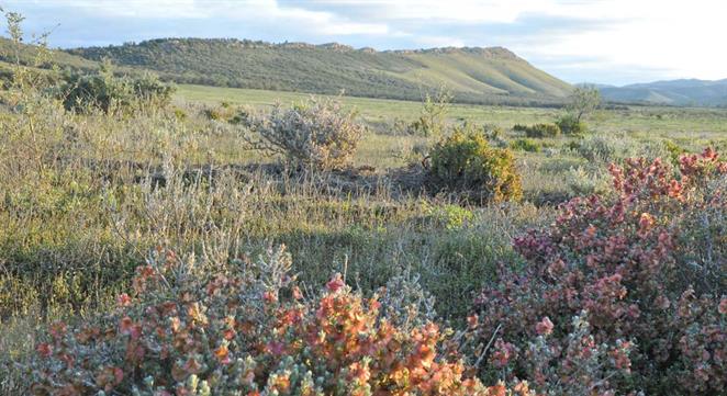
The parks are north of Crystal Brook and to the west of the Wirrabara Forest.telowie-napperby-block-closure-flyer-_3_

For Heysen Trail (HT) users:
Napperby Block is on HT Map Sheet 5B
or on HT Northern Guide Map 2.5

Telowie Gorge CP is on HT Map is Sheet 5B & 6A
or on HT Northern Guide Map 2.6-2.7.

The Go Cart shelter is on HT Map Sheet 6A
or on HT Northern Guide Map 2.7

Please direct any enquiries to Department of Environment, Water and Natural Resources Northern & Yorke. (08) 8841 3400.

Heysen Trail closure in Mt Brown & Dutchmans Stern Conservation Parks from Thursday 1st to Friday 9th September.

dutchmansstern-sign-hero

The Dutchmans Stern and Mt Brown Conservation Parks will be closed from 6pm on Thursday 1 September 2016 until 6am on Friday 9 September 2016.

The purpose of the closure is to ensure the safety of the public during a pest control program within the parks during the period indicated.

The Heysen Trail passes through these parks, so you are warned not to attempt to enter them at those times.

The Mount Brown Conservation Park is located between Wilmington and Quorn:

  • Chapter 3, map 7 of the Northern Guidebook and
  • Mapheet 6C, Wirrabara Forest to Dutchmans Stern Conservation Park.

The Dutchmans Stern Conservation Park is just north of Quorn and can be found on the following maps

  • Chapter 4, map 2 of the Northern Guidebook and
  • Mapheets 6D, Wirrabara Forest to Dutchmans Stern Conservation Park and
    7A, Dutchmans Stern Conservation Park to Mernmerna Creek.

Signs will be placed at points where the Heysen Trail enters the parks during the closure.

Please direct any enquiries to Natural Resources, Northern & Yorke.

Heysen Trail returns to Wirrabara Forest & Sampson Flat Fireground

Heysen Trail returns to Wirrabara ForestWirrabara Forest Trail Open

Following on from our earlier update, we’ve been negotiating with stakeholders and can now announce that the Heysen Trail has been restored and re-marked to the original route through Wirrabara Forest. This removes the 44km temporary re-route which went around the entire forest and via the town of Wirrabara.

There are two small re-routes in the northern section of the forest.

Sampson Flat Fireground Re-Opening and Re-Routes

Following the January 2015 Sampson Flat Bushfire the Heysen Trail has been re-marked through the fireground, from Nugget Road to near Kersbrook.

A temporary re-route is in place from Chain of Ponds to Kersbook.

View re-routes:

Buckaringa Sanctuary Feral Control Closure, 19-22 June 2015

Buckaringa Sanctuary, managed by the Australian Wildlife Conservancy

The Australian Wildlife Conservancy will be undertaking feral animal control in Buckaringa Sanctuary during coming months.

The cull program is somewhat opportunistic depending on numbers of goats present and availability of shooters so we cannot provide a set of dates when access to the sanctuary may be closed. The next planned closure is evening of 19th June through to the morning of 22nd June 2015.

The Heysen Trail passes through the sancuary between Quorn and Hawker, on map 6, chapter 4, of the Northern Guidebook.

Signs will be placed at points where the Heysen Trail enters the Sanctuary during all times of closure.

We remind hikers to obey these signs, and also to not camp within the sanctuary (a campsite that was located there was closed in 2006).

The sanctuary is home to many Yellow-footed Rock-wallabies.

Heavy Rains Filling Water Tanks

Photo courtesy of @creber295, 17/04/2015, titled '5 hour wait for 120mm of rain to settle so we could get through.' https://instagram.com/p/1kjFboo4Hm/

Photo courtesy of @creber295, 17/04/2015, titled ‘5 hour wait for 120mm of rain to settle so we could get through.’ https://instagram.com/p/1kjFboo4Hm/

Heavy rains on Friday in the Flinders and to an extent in the Mid North will be welcomed by this season’s hikers on the Heysen Trail.

During audits conducted from January to early April we were aware that some tanks were low, and with the hiking season starting soon (with the end of the Bushfire Danger Season) we were about to remind hikers to be vigilant with water planning.

The advice though should always be followed: when planning multi-day walks and camping, ensure that upon entering a campsite you still have sufficient water to make it to a known water supply, should the water tank be found to be unexpectedly too low.

We anticipate that Friday’s rains have had a positive effect on tank levels. Reports late night suggest that Yanyanna Hut, which we knew to be almost empty, has been filled to half full. We knew of a number of other tanks that had fallen to 1/4 level, and we hope they too have been filled.

The rains will be welcomed by farmers, and we hope will bring new life to the landscape.

The Bureau of Meteorology’s 8th April 2015 assessment lists much of the area of the southern 2/3 of the trail as facing a Serious or Severe Deficiency in rainfall. Heavy rains that fell over Easter only resulted in 1-5mm of rain (low) in the northern Mt Lofty Ranges and Flinders Ranges.

Heysen Trail through Wirrabara Forest to Re-Open

Wirrabara Forest views - Heysen Trail through Wirrabara Forest to ReopenThe Heysen Trail will soon be restored to its original alignment through Wirrabara Forest.

A temporary 44km re-route has taken the Trail around the forest since the devastating January 2014 Bangor Bushfire.

We are currently undertaking re-marking works. Extensive trail signs and infrastructure in the 41km section were damaged or lost. We will publish advice when the trail is re-opened to hikers. In the meantime hikers will need to continue to use the 44km re-route. Re-marking of the original alignment will include removing signs pointing to the temporary re-route.

UPDATE July 2015: The trail through Wirrabara Forest has been restored, with two minor re-routes.

Fire Danger Season Brought Forward 2014/15

Fire Danger Season

The dates for the 2014/2015 Fire Danger Season have been brought forward. The Heysen Trail is closed during these high risk times.

Fire Ban District Start Date End Date
Mount Lofty Ranges 1 December 17 November 2014    30 April 2015
Adelaide Metropolitan    1 December 2014 30 April 2015
Mid North 15 November 1 November 2014 30 April 2015
Flinders 1 November 15 October 2014 15 April 2015

Walkers are reminded to be extra vigilant of fire weather conditions in coming months. Check the Fire Danger Rating before setting out on a hike, monitor changing weather conditions, and always have a back-up plan. Download the CFS smartphone app.

Find which Fire Ban District your planned hike is in on our Interactive Map, by turning on the Fire Ban Districts checkbox layer.

Some short sections of the Heysen Trail remain open year round, principally those sections not on private land. These sections include public roads, Conservation Parks and Reserves (closed on days of Total Fire Ban), Forests (closed on days of Total Fire Ban) and vacant land.

Major Re-Route of Heysen Trail around Bangor Bushfire

Bangor bushfire damage at Wirrabara nurseryA major re-route of the Heysen Trail is in place around Wirrabara Forest, the site of the January/February 2014 Bangor Bushfire.

The temporary 44km re-route replaces a 41km section of the Heysen Trail and affects the Northern Guidebook from Map 2.3 through to Map 2.8.

The re-route trail is marked, and takes the trail along roads through Laura. The re-route continues along the shared-use railtrail, and along backroads to rejoin the original trail alignment south of Murraytown.

Wirrabara Forest remains closed indefinitely to the public due to the risk of falling trees and to allow salvage harvest operations. Forest access is limited.

Beetaloo Tank Camp Site is still accessible. It has suffered some damage but is functional.

DOWNLOAD MAPS

BUNDALEER REMINDER

The Heysen Trail through Bundaleer Forest remains closed following the January 2013 Bundaleer Bushfire. A marked temporary re-route is in place.