View all news articles below, or select a news category to the right.
Minor Re-route near Hupputz Hut, map 5.9, May 2014
View pdf map showing re-route
The Heysen Trail near Hupputz Hut has been re-routed. This is a minor re-route north of the hut, and takes the trail into the hills earlier.
Download gpx file for loading onto your GPS unit.
View all re-routes for the 2012 and 2013 Southern Guidebooks, 4th & 5th Editions
Minor Re-route near Hupputz Hut, map 5.9, May 2014
View pdf map showing re-route
The Heysen Trail near Hupputz Hut has been re-routed. This is a minor re-route north of the hut, and takes the trail into the hills earlier.
Download gpx file for loading onto your GPS unit.

View all re-routes for the 2010 Southern Guidebook, 3rd Edition
Keen Road, into Inman Valley, maps 2.2 and 2.3, May 2014
View pdf map showing re-route
The Heysen Trail has been re-routed into Inman Valley, near Robinson Hill Campsite.
From Back Valley the trail now follows Keen Road.
Download gpx file for loading onto your GPS unit.
View all re-routes for the 2012 and 2013 Southern Guidebooks, 4th & 5th Editions
Keen Road, into Inman Valley, maps 2.2 and 2.3, May 2014
View pdf map showing re-route
The Heysen Trail has been re-routed into Inman Valley, near Robinson Hill Campsite.
From Back Valley the trail now follows Keen Road.
Download gpx file for loading onto your GPS unit.
View all re-routes for the 2010 Southern Guidebook, 3rd Edition
Winter 2014
Issue 132
June 2014
 Highlights include:
- Alligator Gorge
- The Lares Trek
- Cafe Latte Heart Starter
- AGM Reports
Interview between Friends Council and ultra-marathon runner Richard Bowles
The Council of the Friends of the Heysen Trail was able to sit down and chat with ultra-marathon runner Richard Bowles, who recently completed his 15-day run of the 1,200 km Heysen Trail.
In the interview he talks about his excellent experience with the Heysen Trail – the scenery, the way marking, the huts, the people. He goes on to describing himself as not a runner or superhuman, yet why he undertakes such runs, talking about headspace and motivation. He talks about food, shoes and why he camped on the trail.
Captions are available in the video.
Transcript:
Richard Bowles >> I’ve ran many trails around the world and if I’m honest this [the Heysen Trail] is the best marked, the best looked after, the huts are amazing, you guys have done a wonderful job. You should give yourselves a round of applause.
Video of Ultra-Marathon Runner Finishing the Heysen Trail
Further to yesterday’s email about ultra-marathon runner Richard Bowlescompleting his 15-day run of the Heysen Trail, you can view the Seven News TV video at https://au.news.yahoo.com/sa/video/watch/23626381/run-richard-run/.
Richard ran to promote the work of Red Dust Role Models.
“Health is a basic human right” says Richard. Red Dust state it is essential to the social development of Indigenous people in remote communities.
Health promotion strategies improve and transform lives and have a sustainable impact on social, economic and environmental conditions. Health promotion is a practical approach to achieving greater equality and closing the gap.
You can donate funds to the cause at
Ultra-marathon runner finishes Heysen Trail in 15 days – watch Seven News tonight
 Ultra-marathon runner Richard Bowles has completed his run of the Heysen Trail. Finishing this afternoon at Cape Jervis after 14 days, 8 hours and 32 minutes on the trail. He was welcomed by his crew and our President Robert Alcock, who was there with a nice cold beer on hand. Well earnt mate!
He was interviewed at Cape Jervis by Seven News, so you can catch the story on tonight’s news.
Walk Leaders Training Day
 Walk Leaders Training Day
Saturday June 21st 2014
9.30am to 2.00pm
Want to know more about leading walks? A no-obligation day, looking at the topic of leading walks. This is your chance to find out how the Friends organises walks.
Book online, no charge.
Lunch and drinks provided.
Woodville Lawn Bowls Club
Oval Ave, Woodville
Topics to be covered include:
- The Heysen Trail and the Friends
- Leadership
- Leading a walk
- Tail-ender role
- Administrative tasks
- Basic map reading and navigation
- Equipment
- Issues
For more information contact the office.
Runner to Complete the Heysen Trail in 14 Days
 Starting Sunday ultra-marathon runner Richard Bowles is running the entire 1,200km of the Heysen Trail in 14 days.
Follow The Dingo of the Heysen Trail progress on his Nixon Red Dust Run via:
- Facebook:facebook.com/UltraRunnerRich
- The livetracker on his website:richardbowles.com.au/#!heysen-trail-/cgd4
Having arrived in Adelaide, he met up with president Robert Alcock this morning.
Richard Bowles is an Australian ultramarathon runner and adventurer based in Melbourne, Victoria. Richard has many world records running trails that cover the length of entire countries.
Major Re-Route of Heysen Trail around Bangor Bushfire
 A major re-route of the Heysen Trail is in place around Wirrabara Forest, the site of the January/February 2014 Bangor Bushfire.
The temporary 44km re-route replaces a 41km section of the Heysen Trail and affects the Northern Guidebook from Map 2.3 through to Map 2.8.
The re-route trail is marked, and takes the trail along roads through Laura. The re-route continues along the shared-use railtrail, and along backroads to rejoin the original trail alignment south of Murraytown.
Wirrabara Forest remains closed indefinitely to the public due to the risk of falling trees and to allow salvage harvest operations. Forest access is limited.
Beetaloo Tank Camp Site is still accessible. It has suffered some damage but is functional.
DOWNLOAD MAPS
- Download a PDF map of the re-route (3 pages)
- Download GPX file for loading onto your GPS unit
BUNDALEER REMINDER
The Heysen Trail through Bundaleer Forest remains closed following the January 2013 Bundaleer Bushfire. A marked temporary re-route is in place.
Registrations Extended for End-to-End 9
 Registrations have been extended for our new End-to-End walking group, starting the Heysen Trail at Cape Jervis on May 18.
We have put on an extra bus to allow for increased capacity.
End-to-End 9 is the ninth group to make this undertaking since 2001. The group will commence hiking the entire Heysen Trail at Cape Jervis, walking one Sunday a month during the walk season, progressing up the 1,200km Heysen Trail to Parachilna Gorge over a number of years. End-to-end walks are run as part of our walk programme, and are for those wishing to complete the entire Heysen Trail. As the schedule and trail logistics are done by the Friends organisation it is easy for walkers to participate, and many enjoy the social aspect of the group.
Find out more about:
- May 18’s End-to-End 9 walk event
- our End-to-End group walking program (we have 5 groups)
Trail Closure through Wirrabara Forest due to Bushfire Damage, February 2014
This is a temporary re-route
View pdf map showing re-route
Temporary 44km re-route around Bangor/Wirrabara Bushfire
A major re-route of the Heysen Trail is in place around Wirrabara Forest, the site of the January/February 2014 Bangor Bushfire.
The temporary 44km re-route replaces a 41km section of the Heysen Trail and affects the Northern Guidebook from Map 2.3 through to Map 2.8.
The re-route trail is marked, and takes the trail along roads through Laura. The re-route continues along the shared-use railtrail, and along backroads to rejoin the original trail alignment south of Murraytown.
Wirrabara Forest remains closed indefinitely to the public due to the risk of falling trees and to allow salvage harvest operations. Forest access is limited to eastern areas.
Beetaloo Tank Camp Site is still accessible. It has suffered some damage but is functional.
Download gpx file for loading onto your GPS unit.

View all re-routes for the 2010 Northern Guidebook, 2nd Edition
Re-route of the Heysen Trail at Horrock’s Pass affecting Maps 3.4 and 3.5, March 2014
View pdf map showing re-route
This re-route takes the Heysen Trail off of the bitumen roadside and takes in along the vegetation corridor above the bitumen road.
The re-route begins where the dirt road Hancocks Lookout Road meets the bitumen Main North Road (which goes through Horrocks Pass), and ends at the Horrocks Memorial.
Download gpx file for loading onto your GPS unit.
View all re-routes for the 2010 Northern Guidebook, 2nd Edition
Re-route of the Heysen Trail in Kuitpo Forest, map 3.1, adjoining Mt Bold, April 2014 (from 2011)
View pdf map showing re-route.
This re-route notification is to publish a re-route that was undertaken by Forestry SA sometime around 2011.
The trail has been routed along the forest rather than through it.
In September 2014 this re-route was returned to the original trail route through the forest as originally published in the guidebook.
View all re-routes for the 2012 and 2013 Southern Guidebooks, 4th & 5th Editions
Kuitpo Forest, adjoining Mt Bold, Map 3.1, April 2014 (from 2011)
View pdf map showing re-route.
This re-route notification is to publish a re-route that was undertaken by Forestry SA sometime around 2011.
The trail has been routed along the forest rather than through it.
In September 2014 this re-route was returned to the original trail route through the forest as originally published in the guidebook.
View all re-routes for the 2010 Southern Guidebook, 3rd Edition
Trail Closure through Wirrabara Forest due to Bushfire Damage, February 2014
This is a temporary re-route
View pdf map showing re-route
Temporary 44km re-route around Bangor/Wirrabara Bushfire
JULY 2015 UPDATE: This temporary re-route has been closed, and the Trail has been restored and re-marked to the original Heysen Trail route over The Bluff. However there are two small temporary re-routes.
A major re-route of the Heysen Trail is in place around Wirrabara Forest, the site of the January/February 2014 Bangor Bushfire.
The temporary 44km re-route replaces a 41km section of the Heysen Trail and affects the Northern Guidebook from Map 2.3 through to Map 2.8.
The re-route trail is marked, and takes the trail along roads through Laura. The re-route continues along the shared-use railtrail, and along backroads to rejoin the original trail alignment south of Murraytown.
Wirrabara Forest remains closed indefinitely to the public due to the risk of falling trees and to allow salvage harvest operations. Forest access is limited to eastern areas.
Beetaloo Tank Camp Site is still accessible. It has suffered some damage but is functional.
Download gpx file for loading onto your GPS unit.
View all re-routes for the 2014 Northern Guidebook, 3rd Edition
Re-route of the Heysen Trail at Horrock’s Pass affecting Maps 3.4 and 3.5, March 2014
View pdf map showing re-route
This re-route takes the Heysen Trail off of the bitumen roadside and takes in along the vegetation corridor above the bitumen road.
The re-route begins where the dirt road Hancocks Lookout Road meets the bitumen Main North Road (which goes through Horrocks Pass), and ends at the Horrocks Memorial.
Download gpx file for loading onto your GPS unit.
View all re-routes for the 2014 Northern Guidebook, 3rd Edition
Autumn 2014
Issue 131
March 2014
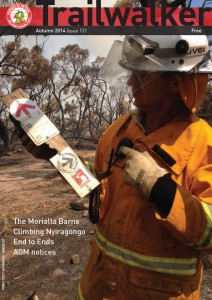 Highlights include:
- Bushfire reports
- The Morialta Barns
- Climbing Nyiragongo
- End to Ends
Billionaire Kerry Stokes in talks to buy coastal land to reroute Heysen Trail
 Plans are afoot to re-route a section of the Heysen Trail near Balquhidder Station and Tunkalilla Beach to take in more of the spectacular coastline.
An article on news.com.au (and in today’s Advertiser) has brought to light that billionaire Kerry Stokes is in “secret talks” with the state government to buy a parcel of coastal land at Tunkalilla Beach.
The Advertiser quotes Mr Stokes as saying “This is an amazing part of South Australia and I am looking forward to ensuring its heritage and also opening up the Heysen Trail.”
“We were approached by the department to extend The Heysen Trail and create some hard-stand facilities for youth engagement.”
The re-route of the Heysen Trail along the coast through Balquihidder Station is something we’ve been keen on for a while. A re-route and upgrade of the Heysen Trail along the South Coast could see the Trail become a significant drawcard for walkers both locally, nationionally and internationally.
We welcome the prospect of improved facilities for people of all ages to hike the highlight section of the Heysen Trail South Coast from Cape Jervis to Victor Harbor.