View all news articles below, or select a news category to the right.
Problems with NAB Payment System
Payment processing affecting walk registrations involving payments, and online store payments
UPDATE: 9pm Thursday 4th June: login issues that commenced at 2pm today have now been resolved.
UPDATE: 3pm Thursday 4th June: There have been significant issues with our online payment system during May, until 2pm Thursday 4th June.
This was due to technical issues with the payment system provided by NAB. These issues affected 1,000s of Australian e-commerce websites.
Whilst we think these issues have now been resolved, we are monitoring the situation. We thank you for your patience when submitting payment processing details.
UPDATE 11:00am Wednesday 3rd June: payment processing is down. Please consider delaying making your registration until later this week, or contact our office to register for walks and make over-the-phone payment.
9:00am Tuesday 2nd June: We are experiencing significant difficulties with NAB payment processing. NAB has issued a public apology and is working hard to resolve their system failure.
Our e-commerce provider NAB has been experiencing ongoing issues. This has meant that customers have been experiencing difficulties submitting payments online. NAB recognises the impact this is having on customers and apologies for the inconvenience. NAB is working to resolve these ongoing issues as soon as possible.
View current status of NAB payment systems.
Heavy Rains Filling Water Tanks

Photo courtesy of @creber295, 17/04/2015, titled ‘5 hour wait for 120mm of rain to settle so we could get through.’ https://instagram.com/p/1kjFboo4Hm/
Heavy rains on Friday in the Flinders and to an extent in the Mid North will be welcomed by this season’s hikers on the Heysen Trail.
During audits conducted from January to early April we were aware that some tanks were low, and with the hiking season starting soon (with the end of the Bushfire Danger Season) we were about to remind hikers to be vigilant with water planning.
The advice though should always be followed: when planning multi-day walks and camping, ensure that upon entering a campsite you still have sufficient water to make it to a known water supply, should the water tank be found to be unexpectedly too low.
We anticipate that Friday’s rains have had a positive effect on tank levels. Reports late night suggest that Yanyanna Hut, which we knew to be almost empty, has been filled to half full. We knew of a number of other tanks that had fallen to 1/4 level, and we hope they too have been filled.
The rains will be welcomed by farmers, and we hope will bring new life to the landscape.
The Bureau of Meteorology’s 8th April 2015 assessment lists much of the area of the southern 2/3 of the trail as facing a Serious or Severe Deficiency in rainfall. Heavy rains that fell over Easter only resulted in 1-5mm of rain (low) in the northern Mt Lofty Ranges and Flinders Ranges.
Negotiation for Re-route over Headland at Balquhidder Continue

The State Government is still in negotiation to secure a re-route of the Heysen Trail across the spectacular headland at Balquhidder Station.
A story published in the Australian Financial Review on 15th April 2015:
Billionaire Kerry Stokes’ marathon land talks with SA enter sixth year
Marathon negotiations between billionaire Kerry Stokes and the South Australian government over a potential re-routing of a popular bushwalking trail through the $25 million Balquhidder Station pastoral property owned by the businessman are dragging into their sixth year, as talks also continue about a potential acquisition of adjacent clifftop land by Mr Stokes.
SA Environment Minister Ian Hunter says $1.1 million was allocated in the 2014-15 state budget for the Heysen Trail project on the Fleurieu Peninsula, south of Adelaide, but work hasn’t been able to start yet because the lengthy negotiations are still continuing. They first began in 2009.
Mr Stokes, who is the executive chairman of television and mining services group Seven Group Holdings which this week anointed his 38-year-old son Ryan Stokes as its next chief executive, bought Balquhidder Station in 2007 for close to $25 million through one of his private companies, Australian Capital Equity.
The SA government has been negotiating with the management of Mr Stokes’ private entities to gain public access to a spectacular clifftop coastal strip of the 3064-hectare property, and as part of the overall project there have also been lengthy talks over a proposal by Mr Stokes to buy a separate 31-hectare parcel of land which adjoins the property. That 31-hectare parcel at Tunkalilla Beach also has prime coastal views.
Mr Hunter told the SA Parliament last month that negotiations were still continuing, but the government was determined to press on with a “realignment” of the trail that would require the agreement of the private owners of Balquhidder Station, which runs large numbers of sheep and cattle.
“The ideal outcome would be to have the Heysen Trail continue along the spectacular clifftop landscapes down that part of the Fleurieu,” Mr Hunter said.
He said that section was one of the most spectacular parts of the region, with the Heysen Trail route currently moving back inland away from the coast around the Balquhidder Station land.
It is understood an agreement was close to being finalised just prior to the March 2014 SA election won by Premier Jay Weatherill. But then further complications set in, including changes in the people heading the negotiations.
The SA government had previously tried to negotiate with the former owners of Balquidder Station, the McGregor family, about gaining access to the coastal land to enable an extended 18-kilometre strip of the trail to proceed. The entire Heysen Trail runs for 1200 kilometres, starting near the Flinders Ranges in northern SA, but the most popular section is on the Fleurieu Peninsula closer to Adelaide.
The McGregor family had owned the pastoral property, which has more than nine kilometres of coastal frontage and spectacular views across the ocean to Kangaroo Island, for more than 50 years.
Warren Bonython Recognised with a New Walking Trail at Hiltaba Station
Warren Bonython has been recognised with a new Walking Trail named after him.
Robert Alcock and Andrew Robertson represented the Friends of the Heysen Trail at the opening ceremonies last Thursday and Friday at Hiltaba Nature Reserve, Gawler Ranges, 650km from Adelaide.
Warren Bonython Loop Walk
10km loop walk, 5 hours
Leaving from Hiltaba Homestead and traversing over Mt Hiltaba.
Betty and Bob Lewis Loop Walk
2km loop walk, 1 hour
Leaving from Pretty Point
Heysen Trail through Wirrabara Forest to Re-Open
 The Heysen Trail will soon be restored to its original alignment through Wirrabara Forest.
A temporary 44km re-route has taken the Trail around the forest since the devastating January 2014 Bangor Bushfire.
We are currently undertaking re-marking works. Extensive trail signs and infrastructure in the 41km section were damaged or lost. We will publish advice when the trail is re-opened to hikers. In the meantime hikers will need to continue to use the 44km re-route. Re-marking of the original alignment will include removing signs pointing to the temporary re-route.
UPDATE July 2015: The trail through Wirrabara Forest has been restored, with two minor re-routes.
Public Talk: Fire – the Effect of Climate Change on the Flora and Fauna of the Mt Lofty Ranges
![]() Thursday 19th March 2015, 5.30pm
Thursday 19th March 2015, 5.30pm
Goodman Lecture Theatre, Hackney Road
Presented by the Royal Geographical Society of SA
Mr Allan Holmes will present a discussion on the issue of fire vs natural amenity of the Mt Lofty Ranges. Allan will draw on his experience as Director of SA National Parks and Chief Executive of the Department of Environment. Allan will provide an insight into the role that government can play in dealing. He is also keen to views from the floor.
The Mount Lofty Ranges form a picturesque backdrop to the city of Adelaide and a valuable environmental buffer. The rugged landscape has ensured that significant areas have remained as verdant forest and bushland.
That this region lies so close to urban centres poses major challenges in land use management. Along with the usual competition for open space, there is also ongoing debate regarding the retention and management of bush land to provide amenity, while also providing a safe environment for residents and visitors.
The use of fire as a management tool is often cited as a necessary part of this program. Regular controlled fires are seen to be a naturally occurring management tool, designed to reduce the accumulation of large amounts of combustible material.
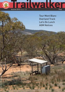
Autumn 2015
Issue 135
March 2015
 Highlights include:
- Tour Mont Blanc
- Overland Track
- Let’s Do Lunch
- AGM Notices
- The First End-to-End walk of the Heysen Trail
Historic images of Morialta exhibition
2015 will be 100 years since Morialta was declared a National Pleasure Resort on 15 July 1915.
The Friends of Black Hill and Morialta Inc with support from Natural Resources Adelaide and Mount Lofty Ranges are to deliver a number of public events in 2015 to celebrate the centenary of Morialta Conservation Park.
The Friends of the Heysen Trail have sponsored two images. All images are available through an online silent auction, open until November, and any proceeds we receive will go towards our work on the Heysen Trail.
Exhibition Schedule
| Coventry Library, Stirling | 3 – 13 March 2015 |
| Cleland Wildlife Park | 15 – 31 March 2015 |
| The Summit Community Centre, Norton Summit | 2 – 30 April 2015 |
| Campbelltown Library | 2 – 29 May 2015 |
| Burnside Civic Centre Atrium | 3 – 26 June 2015 |
| Gumeracha Library | 30 June – 30 July 2015 |
| Tea Tree Gully Library | 2 – 28 August 2015 |
| The Long Gallery, St Peters Town Hall Complex | 1 – 16 September 2015 |
| The Long Gallery, St Peters Town Hall Complex | 22 – 30 September 2015 |
| Cleland Wildlife Park | 2 – 31 October 2015 |

5 Ordinary People hiking the Heysen Trail

A family’s 56-day trek
A family of five, including Eli, 12, Emily, 10, and Noah, 9, will skip Term 2 of school in favour of hiking the Heysen Trail.
There’s so much more to life than just maths and English that kids miss out on, if parents don’t invest time in them.
Along with their parents Luke and Erina, they will be a world away from the classroom routine when they undertake a mission to cover 1,151km on foot over 56 days.
Their trek begins at the northern trailhead at Parachilna Gorge, trekking south through the Flinders Ranges and Adelaide Hills to Cape Jervis.
It’s all part of Erina’s plan to give her children an educational experience of a different kind.
“We want to teach our children the life lessons that, when you’re caught up in the nine to five regime, you just don’t have the time to do,” she says. “There’s so much more to life than just maths and English that kids miss out on, if parents don’t invest time in them.”
Follow @5OrdinaryPeople on Facebook.
Heysen Trail article in SA Life magazine

Check out the article in the latest SA Life magazine, Feb 2015. The story looks at walking the entire 1,200km with one of our End-to-End groups.
This year we have seven end-to-end groups walking the trail, all of which are open to new members:
- End-to-End 5, beyond Quorn
- End-to-End 6, near Spalding
- End-to-End 7, near Kapunda
- End-to-End 8, near Cudlee Creek
- End-to-End 9, near Mt Compass
- End-to-End 10, a new group starting from Cape Jervis
- End-to-End Minus 1, heading south from Mt Crawford
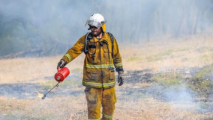
Heroes of the Field – Heysen Trail & CFS Volunteer on Front Page of the Advertiser
 One of our chief maintenance and construction volunteers is featured on the front page of today’s Advertiser. As well as volunteering on the Heysen Trail, John Potter is a volunteer with his local Cudlee Creek CFS, and is among an army of volunteers doing 12-hour shifts to protect life and property in the Adelaide Hills bushfire.
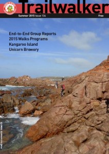
Summer 2015
Issue 135
December 2014
 Highlights include:
- End-to-End Group Reports
- 2015 Walks Programs
- Kangaroo Island
- Unicorn Brewery
Summer Twilight Walks + 2015 Walk Season Program Released

Summer Twilight Walks program released
Wednesday evening walks, 1-2 hours, around Adelaide.
Warm summer evenings are perfect for short walks. Open to members and new people from just $6 per walk.
Trailstarter and Trailwalker 2015 Walk Season program
Trailstarter walks are good for those new bushwalking or who want a shorter walk.
Trailwalker walks are for those wanting more demanding walks.
End-to-End 2015 Walk Season program
A new End-to-End group 10 starting from Cape Jervis in May 2015.
Walk the complete length of the Heysen Trail over approx sixty walking days, spread over six years. One day or one weekend a month.
Find out more about End-to-End walks.
FREE SA National Parks Vehicle Entry
Take the kids to walk and explore nature

Thanks to the guys at Nature Play and National Parks and Wildlife Service SA free vehicle entry passes are being offered to provide opportunities for children to explore nature.
Hike, ride, swim, climb, camp, play or take photographs at any of South Australia’s great Parks listed below with this free vehicle entry pass.
South Australian Parks are special places that provide a safe home for thousands of plants and animals that are found nowhere else in the world. Hike, ride, swim, climb, camp, play or take photographs at any of South Australia’s great Parks listed below with this free vehicle entry pass!
- Belair National Park
- Morialta Conservation Park
- Para Wirra Recreation Park
- Deep Creek Conservation Park
- Ngarkat Conservation Park
- Mount Remarkable National Park
- Flinders Ranges National Park
- Gawler Ranges National Park
- Coffin Bay National Park
- Lincoln National Park
- Innes National Park
- Bool Lagoon Game Reserve and Hacks Lagoon Conservation Park
Nature Play SA Inc is a not-for-profit association established to increase the time South Australian children spend in unstructured play outdoors and in nature.
Need some inspiration for where to walk and explore? Check out the SA National Parks Guide.
Photos courtesy of Play & Go.
Art Exhibition: Echoes of the Heysen Trail – starting this weekend

Exhibition Opening
2.30pm this Saturday 1 November 2014
Robin Hood Hotel, 315 Portrush Rd, Norwood
Free entry
Exhibition 1 Nov – 30 Nov 2014
A range of paintings on the Heysen Trail available for purchase, varying sizes.
Artists
Marree De Souza
Marika Lis
30% of proceeds to the Friends of the Heysen Trail.
Fire Danger Season Brought Forward 2014/15
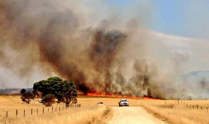
The dates for the 2014/2015 Fire Danger Season have been brought forward. The Heysen Trail is closed during these high risk times.
| Fire Ban District | Start Date | End Date |
|---|---|---|
| Mount Lofty Ranges | 1 December 17 November 2014 | 30 April 2015 |
| Adelaide Metropolitan | 1 December 2014 | 30 April 2015 |
| Mid North | 15 November 1 November 2014 | 30 April 2015 |
| Flinders | 1 November 15 October 2014 | 15 April 2015 |
Walkers are reminded to be extra vigilant of fire weather conditions in coming months. Check the Fire Danger Rating before setting out on a hike, monitor changing weather conditions, and always have a back-up plan. Download the CFS smartphone app.
Find which Fire Ban District your planned hike is in on our Interactive Map, by turning on the Fire Ban Districts checkbox layer.
Some short sections of the Heysen Trail remain open year round, principally those sections not on private land. These sections include public roads, Conservation Parks and Reserves (closed on days of Total Fire Ban), Forests (closed on days of Total Fire Ban) and vacant land.
Pathway along Adelaide’s beaches – have your say
The Government of SA and six local councils have been working on a scheme to create a Coast Park – a 70km walking and cycling path along the metropolitan Adelaide coastline, from North Haven through to Sellicks Beach.
Planning and consultation for one of the final sections, from Grange, through Tennyson, to Semaphore Park, is underway. A working group has produced four solutions, and local residents have raised their concerns. It’s time to have your say on the plan.
The Park will include, as far as possible, a continuous two-way pathway or trail for walkers and cyclists along the coastal foreshore.
It has been progressively developed since 1992.
We at the Friends of the Heysen Trail consider that Option 1 provides the best solution and is in line with our Policy Document on Shared Use of Walking Trails: a narrower 1.5m – 2m wide path along the dune edge. As path allows for walkers and slow cyclists we consider a 2m wide path is required. Part of this option includes an upgrade of the parallel Seaview Road for faster cyclists. Whilst the ideal in the overall plan calls for a 3m wide path, we think this option provides the balance between encouraging people to walk, cycle and experience the natural environment, whilst balancing dune environment management.
More information about this Coast Park Consultation can be found on the Charles Sturt website at yoursaycharlessturt.com.au/coast-park-consultation
Have your say via the online consultation survey.


Proposed 400km Walking Trail along River Murray
Seeking Feedback via Online Survey
 A new walking and riding trail along the River Murray is being considered by three regional councils.
A feasibility study is underway and input is being sought.
The trail could begin in Salt Creek on the Coroong, following the Coorong to the Murray Mouth, then following the River Murray to Morgan via Tailem Bend, Murray Bridge and Mannum. The trail will provide links to a number of iconic and historic river towns, major tourism attractions and other existing trail networks along its route.
This feedback survey allows people to view the preliminary trail alignment prior to the land survey commencing. The feedback survey closes 3 November 2014.
You can review the high level alignment maps:
- Coorong: Salt Creek to Wellington
- Murray Bridge – Wellington to Murrawong (north of Murray Bridge)
- Mid Murray – Mypolonga to Morgan
Art Exhibition: Echoes of the Heysen Trail

Exhibition Opening
2.30pm Saturday 1 November 2014
Robin Hood Hotel, 315 Portrush Rd, Norwood
Free entry
Exhibition 1 Nov – 30 Nov 2014
A range of paintings on the Heysen Trail available for purchase, varying sizes.
Artists
Marree De Souza
Marika Lis
30% of proceeds to the Friends of the Heysen Trail.
New Heysen Trail Maps for Sale
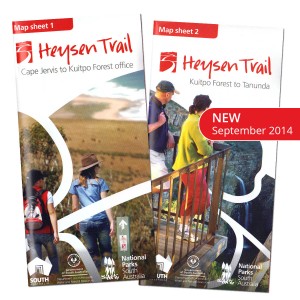 A new series of Heysen Trail maps have been released.
Over the next 12-18 months the Southern and Northern Guidebooks are being gradually replaced with fold-out map sheets.
The first two map sheets are available for purchase now via our online store, for $15 with postage from $1.45.
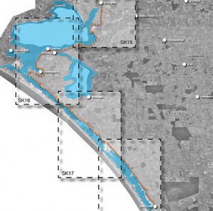
The maps are double sided and printed on water resistant paper. The maps include elevation profiles with kilometre markers and crossing point names. The new map style allows walkers to gain a “big picture” understanding of where they are on the trail, with a continuous trail line and a constant 3-5km of mapping around the trail.
Remember, you can sign up to receive re-route notifications for your guidebook or map sheet editions. All guidebooks and map sheets published since 2008 are available for notification.
There will be 8 maps in this series:
- Map 1: Cape Jervis to Kuitpo Forest – available now
- Map 2: Kuitpo Forest to Tanunda – available now
- Map 3: Tanunda to Burra – coming soon
- Map 4: Burra to Spalding – coming soon
- Map 5: Spalding to Wirrabara Forest – coming soon
- Map 6: Wirrabara Forest to Dutchmans Stern Conservation Park – coming soon
- Map 7: Dutchmans Stern Conservation Park to Mernmerna Creek – coming soon
- Map 8: Mernmerna Creek to Parachilna Gorge – coming soon