View all news articles below, or select a news category to the right.
Animal control program on the Fleurieu Peninsula, 1-14 May 2023

Map highlighting the ‘no shooting/buffer’ zone
Warning to walkers on the Wild South Coast Way on the Heysen Trail.
There will be an extensive animal control cull of feral deer on the Fleurieu Peninsula by PIRSA and other organisations, between 1 and 14 May 2023.
Walkers may be affected if in the region of Boat Harbour Beach, Tunkalilla Beach and the trail to Ballaparudda Creek campground.
The cull will use helicopters carrying thermal technology to detect deer, allowing them to be culled even in dense scrub. Flights will be on week days and weekends, mainly around dawn and dusk, when thermal cameras can detect targets most easily.
The Wild South Coast Way will remain open to walkers during the operation
No shoot and low flying buffers will be put in place around the Wild South Coast Way (Heysen Trail) and Bullaparudda campground, as well as public roads and infrastructure.
The buffer zone relating to the Wild South Coast Way is displayed in orange on the map above.
There is no risk to people or livestock, but if you are in affected areas you may hear low flying helicopters and the sound of gun shots in the distance.
You can find out more information about the operation on the Parks Closure and Alerts page.
FoHT new Council & Annual Report 2022

Member News: FOHT new Council & Annual Report 2022
 The Friends AGM on 5 April 2023 at Torrens Rowing Club was well attended with an upbeat vibe and lots of chatting among members. Thank you all for your membership, engagement and volunteering to keep the Friends and Heysen Trail alive.
Please welcome the incoming Council Members listed below who will continue that commitment.
2023 FOHT Office Bearers & Council Positions
Reminder that the revised FOHT Constitution adopted in 2022 included provision to assist renewal that all member are elected for 2 year terms, a limit of 3 x 2 years continuous in an Office Bearer position and maximum 12 years continuous for any Council member.
- President – Neil Hendry
- Vice President – Melanie Sjoberg
- Secretary – Vicki Stewart continuing in current 2 year term
- Treasurer – Basia Samcewicz continuing in current 2 year term
Council Members
- Continuing in current 2 year term – Barbara Deed; John Babister; Margaret Fletcher.
- Newly elected: Paul Bond; Judy McAdam; Ross McDougall; Kathy Wright; Mark Fletcher.
FOHT achievements and financial statements were presented and approved at the AGM. The FOHT Annual Report for 2022 outlining those presentations is attached for your information.
April 2023
Issue 165
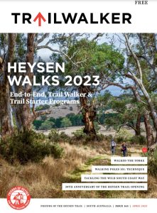 Highlights include:
- 30th Anniversary of the Heysen Trail Opening
- Tackling the Wild South Coast Way
- Walking Poles 101: Technique
- Walked the Yorke
Mapsheet 1D and 2A: Re-route at Chookarloo Campground, Kuitpo Forest, January 2023
View pdf map showing re-route
This is a minor but permanent re-route of the Trail near Chookarloo Campground at Kuitpo Forest.
The new route directs walkers away from the Kuitpo Tree Climb and associated car park. Northbound, it deviates from the Trail at the Avenues Picnic Ground (Mapsheet 2A & Southern Guidebook, Map 2.9 at Grid Ref. 916 015), runs parallel with Black Nursery Road for 200 metres before crossing the road. The new trail then enters the forest at GR 918 015. After a short meander through a dense eucalypt forest, it rejoins the Trail just to the north of the Tree Climb area.
The two hike-in campsites at Chookarloo have been closed, but the other 21 campsites in this campground are available for hikers.
Walkers should be aware of increased road traffic when crossing Black Nursery Road and should avoid entering the Tree Climb facility and walking under the high ropes course. There is now a cafe at the the facility and walkers are welcome to take a break and tarry a while at the cafe. Please walk around the high ropes apparatus when accessing the cafe.
Download gpx file for loading onto your GPS unit.
This re-reoute applies to: Section 10: Kyeema to Dashwood Gully
View all re-routes for the Mapsheet 1: Cape Jervis to Kuitpo Forest (Sept 2014)
View all re-routes for the Mapsheet 1: Cape Jervis to Kuitpo Forest inc the Wild South Coast Way (Edition 2, 2022)
View all re-routes for the Mapsheet 2: Kuitpo Forest to Tanunda (Sept 2014)
Mapsheet 4B: Realignment of the trail east of Mt Bryan, September 2022
View pdf map showing re-route
The Mt Bryan re-route is designed to improve the alignment of the trail with the road reserve.
After leaving the Mt Bryan East Rd, the realignment follows the northern side of the fence. After reaching a stile the trail generally tracks north west, zig zagging to the summit.
Download gpx file for loading onto your GPS unit.
This re-reoute applies to: Section 30: Dares Hill Summit Rd to Hallett
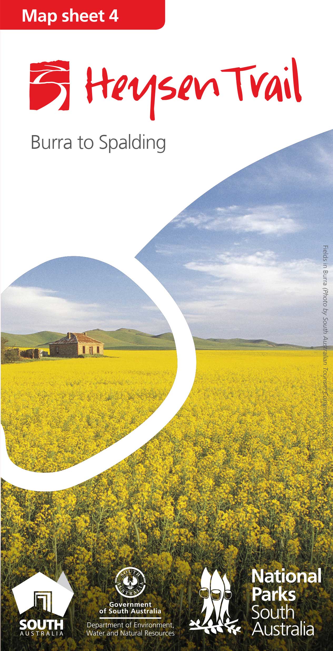
View all re-routes for the Mapsheet 4: Burra to Spalding (May 2015)
Mapsheet 1C: Re-route at Robinson Hill/Jaggers Block, September 2022
View pdf map showing re-route
This minor re-route relates to the original September 2014 version of Map sheet 1 (Cape Jervis to Kuitpo).
When walking south-north, the re-route starts at the intersection of Prouse, Hancock and Keens Road following a fence line west behind a telephone tower to enter the Robinson Hill walk-in site.
Just prior to the tank and platform it turns north west, out of the campsite, down into and through a disused quarry, to cross Hancock Road and enters the Jaggers Forest, over a step-ladder stile.
It then follows the fence line of the forest, initially west, then north, then west again with a final northerly turn to exit the forest onto Roads Lane, over a stile.
The re-route avoids temporary reroutes through the the forest which may arise due to future logging operations.
This re-route was marked in early September 2022, which was just in time to be included in the new Edition 2 of Map sheet 1.
Download gpx file for loading onto your GPS unit.
This re-reoute applies to: Section 6: Tugwell Road to Inman Valley
View all re-routes for the Mapsheet 1: Cape Jervis to Kuitpo Forest (Sept 2014)
Mapsheet 1D: Re-route at Kyeema – exit off Woodgate Hill Rd, December 2022
View pdf map showing re-route
The Heysen Trail has been permanently re-routed through Kyeema Conservation Park, parallel to Woodgate Hill Road but completely within the Park boundary.
Northbound, it enters the Park through the gate at the junction of Woodgate Hill and Blackfellows Creek Roads (Mapsheet 1D and Southern Guidebook Map 2.8, Grid Ref 909 942). The new route runs along the southern boundary of the Park until it re-joins the main Trail at Grid Ref. 899 943, near the Kyeema car park.
This re-route greatly improves walker safety by eliminating the undulating walk along Woodgate Hill Rd. It also provides a much more enjoyable walk through the park.
Walkers should exercise caution when crossing Woodgate Hill Road near the junction with Blackfellows Creek Road.
We appreciate the assistance of the Parks SA Rangers who helped with the route selection and trail marking.
Download gpx file for loading onto your GPS unit.
This re-reoute applies to: Section 9: Mt Compass to Kyeema
View all re-routes for the Mapsheet 1: Cape Jervis to Kuitpo Forest (Sept 2014)
View all re-routes for the Mapsheet 1: Cape Jervis to Kuitpo Forest inc the Wild South Coast Way (Edition 2, 2022)
The Heysen Trail is currently closed due to the Fire Danger Season
Most of the Heysen Trail is currently closed due to the Fire Danger Season, however sections through parks, reserves and road reserves remain open. The Wild South Coast Way on the Heysen Trail between Cape Jervis and Victor Harbor remains open, but is closed on days of Catastrophic fire danger. The rest of the Heysen Trail will reopen at the end of the Fire Danger Season, between 15 and 30 April 2023.
The Fire Ban Season dates for 2022/2023 are:
- between Cape Jervis and Tanunda in the Barossa Valley: The Fire Danger Season in the Mt Lofty Ranges will commence on 1 December 2022 and end on 30 April 2023. The Wild South Coast Way on the Heysen Trail between Cape Jervis and Victor Harbor remains open, but is closed on days of Catastrophic fire danger.
- between Tanunda in the Barossa Valley and Wirrabara Forest: The Fire Danger Season in the Mid North will commence on 15 November 2022 and end on April 30th 2023.
- between Wirrabara Forest and Parachilna in the Flinders Ranges: The Fire Danger Season in the Flinders ends on April 15th 2023.
December 2022
Issue 164
 Highlights include:
- Lavender Highlights
- End-To-End Year In Summary
- When The Only Way In Is To Walk
- Southbound Stomp Or Northward Wander
Fire Danger Season closes some sections of the Heysen Trail north of Tanunda

Fire Danger Season has closed sections of the trail in the Mid North fire danger district
In the 2022/23 Fire Danger Season news item issued earlier, we advised walkers that restrictions would commence in the Flinders fire danger district on Nov 1 and in the Mid North district on Nov 15.
This means that some sections of the Heysen Trail north of Tanunda are now closed.
Over the fire danger season, the Heysen Trail is closed in the sections that traverse private property. However, apart from broadcast fire ban days, you can still access some sections of the trail. Those sections include national parks, conservation parks, forest reserves and public roads.
We recommend that you check more detailed information about those sections on our Fire Danger Season page.
Fire Danger Season closes some Flinders sections of the Heysen Trail

Fire Danger Season has closed sections of the trail in the Flinders fire danger district
In the 2022/23 Fire Danger Season news item issued earlier this week, we advised walkers that fire restrictions have commenced in the Flinders fire danger district.
This includes sections of the Heysen Trail north of Wirrabara.
Over the fire danger season, the Heysen Trail is closed in the sections that traverse private property. However, apart from broadcast fire ban days, you can still access some sections of the trail. Those sections include national parks, conservation parks, forest reserves and public roads.
We recommend that you check more detailed information about those sections on our Fire Danger Season page.
Animal control programs are also planned soon for reserves in the Flinders district
In addition to these closures, we have been advised of a number of feral animal control programs commencing this weekend that may also affect walkers in this district.
The Mount Brown & Dutchman Stern Conservation Parks
During the Fire Danger Season, walkers are still able to walk the Heysen Trail through conservation parks, provided it is not a broadcast fire ban day.
However, both the Dutchman Stern & Mount Brown Conservation Parks will be closed for public safety while a pest control program is carried out from 6am on Saturday November 5th to 2pm on Friday November 11th 2022.
Mount Brown Conservation Park is just south of Quorn. You can find it on Heysen Trail Mapsheets 6C and Northern Guidebook Maps 3.7 & 3.8. There is further information about this park closure on the Parks Closure & Alerts page.
Dutchman Stern Conservation Park is just north of Quorn. You can find it on Heysen Trail Mapsheets 6D & 7A and Northern Guidebook Maps 4.1 & 4.2. There is further information about this park closure on the Parks Closure & Alerts page
Buckaringa Sanctuary
Buckaringa Sanctuary will be closed from the evening of Friday November 4th to the morning of Wednesday November 9th 2022.
Australian Wildlife Conservancy, the managers of Buckaringa, will also be conducting feral animal control works.
Buckaringa Sanctuary can be located on Heysen Trail Mapsheets 6D & 7A and Northern Guidebook Maps 4.6 & 4.7.
As Buckaringa is on private property, the Heysen Trail through the sanctuary is closed at this time of the year as a matter of course. We are providing this notice as an additional warning to walkers.
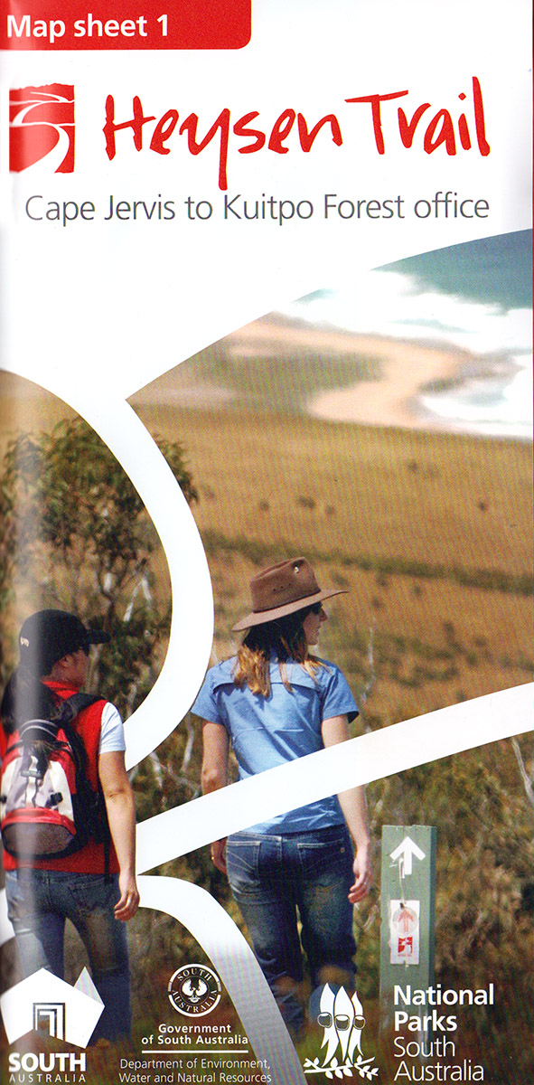
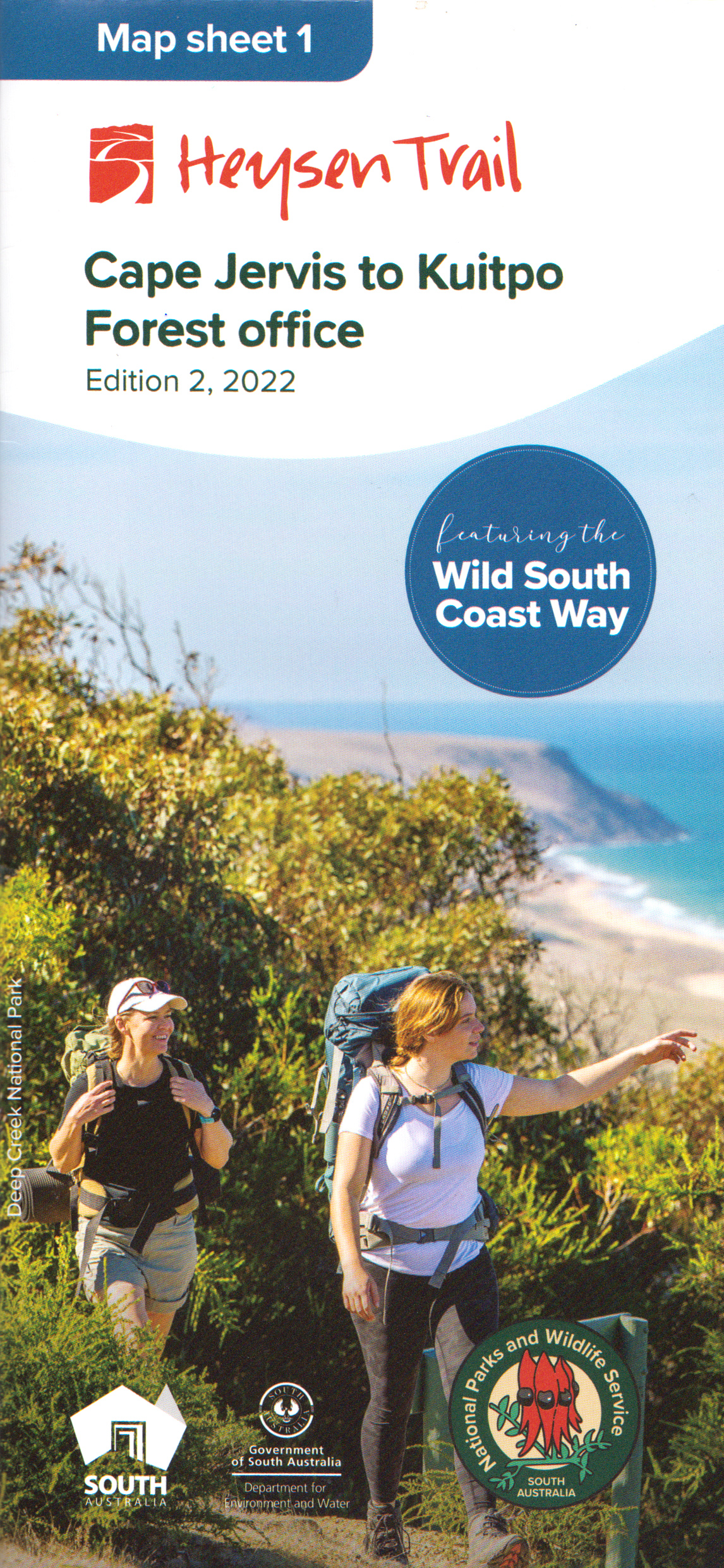
New Heysen Trail Map 1, including the Wild South Coast Way.

Release of the new Heysen Trail Map 1, incorporating the Wild South Coast Way
The Friends have taken delivery of the revised version of the Heysen Trail map sheet 1. The newly released Edition 2 map covers the Cape Jervis to Kuitpo section of the trail. It incorporates the Wild South Coast Way on the Heysen Trail – the 74 km long series of spectacular walks between Cape Jervis & Victor Harbor.
You can purchase the new map sheet now via our online store, for $15 with postage from $3.70.
The map shows several spur and loop trails associated with the Wild South Coast Way, the new ‘walk-in’ campsites and other facilities erected on the trail. It also has information about when you can walk the Wild South Coast Way – it is open year round except on days of Catastrophic fire danger.
Remember, you can sign up to receive re-route notifications for your map sheet editions. All map sheets published since 2014 are available for notification.
The Friends map and book clearance sale continues
Meanwhile the Friends map and book clearance sale continues. We are running low on stock of most of our ‘to be discontinued lines’.
We’ve sold our last copy of Warren Bonython’s classic, ‘Walking the Flinders Ranges’. However, we have been advised that the Royal Geographical Society have a few remaining copies. If you missed out on reading the story that led to the creation of the Heysen Trail, you can purchase the book from the RGSSA .
Animal control program on the Fleurieu Peninsula, 19-30 September 2022

Map of the Wild South Coast Way, the Heysen Trail along the southern coastline of the Fleurieu Peninsula
Warning to walkers on the Wild South Coast Way on the Heysen Trail.
There will be an extensive aerial cull of feral deer on the Fleurieu Peninsula by PIRSA and other organisations, with the support of local landholders, between 19 and 30 of September 2022.
Walkers may be affected if in the region of Boat Harbour Beach, Tunkalilla Beach and the trail to Ballaparudda Creek campground.
The cull will use helicopters carrying thermal technology to detect deer, allowing them to be culled even in dense scrub. Flights will be on week days and weekends, mainly around dawn and dusk, when thermal cameras can detect targets most easily.
The Wild South Coast Way will remain open to walkers during the operation
No shoot and low flying buffers will be put in place around the Wild South Coast Way (Heysen Trail) and Bullaparudda campground, as well as public roads and infrastructure.
There is no risk to people or livestock, but if you are in affected areas you may hear low flying helicopters and the sound of gun shots in the distance.
You can find out more information about the operation on the Parks Closure and Alerts page.
Mapsheet 2A: Kuitpo – Jupiter Creek temporary re-route, June 2022
This is a temporary re-route
View pdf map showing re-route
This reroute is in the Jupiter Creek Plantation on Mapsheet 2A and Southern Guidebook Map 3.1.
It follows the eastern edge of the plantation along Pocock Road from the intersection with Bassham Road (Grid Reference 955 107) until the car park at GR 953 117. It then follows the northern edge of the forest until it reconnects with the Trail at GR 947 120.
Walkers should take care not to enter the logging area shown on the map and to beware of logging trucks using the haul roads to Pocock Road.
Logging operations are due to recommence in July/August 2023, so this reroute will remain in place until further notice.
This re-reoute applies to: Section 10: Kyeema to Dashwood Gully
View all re-routes for the Mapsheet 2: Kuitpo Forest to Tanunda (Sept 2014)
View all re-routes for the Re-Routes
August 2022
Issue 163
 Highlights include:
- Why Rush A Good Thing?
- Renovation Of Rossiters Hut
- Think Pink!
- Christmas Creek, Lamington NP
Bio Security alert – Be aware of the potential dangers of Foot & Mouth Disease
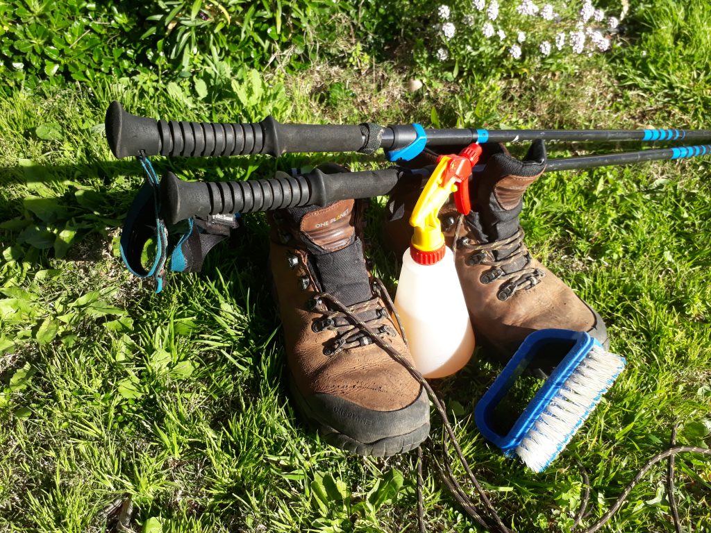
With the increasing risk of Foot and Mouth Disease (F&MD) being introduced to Australia, it is essential that walkers take precautions to combat the potential spread of FM&D and other soil borne diseases.
As the Heysen Trail (and many other walking trails) traverse private properties, it is important that we respect and protect the agricultural activities that are conducted by landholders.
What we can do to stop the spread
Therefore walkers are asked to clean your footwear, clothing and equipment, including walking poles, so they are free from mud, animal manure and mucus.
- Use a stiff brush to clean boots & poles to remove dirt and seeds,
- Wash the equipment in water to remove any remaining contaminants,
- If possible, immerse your boots in a foot bath
- If a foot bath is not available, use a spray bottle with any of the following cleaning agents:
- soap,
- detergent,
- bleach,
- vinegar,
- citric acid,
- percarbonate.
Find out more about Foot and Mouth Disease (F&MD).
Heysen Trail closure through the Buckaringa Sanctuary, Friday 26th to Monday 29th August 2022.

The Buckaringa Sanctuary will be temporarily closed for 3 days in late August 2022. As the Heysen Trail passes through the sanctuary, we advise walkers to consider the closure if planning to walk in the area.
The closure will commence on the evening of Friday 26th August and continue until the morning of Monday 29th August 2022.

The Buckaringa Wildlife Sanctuary is home to many Yellow-footed Rock-wallabies and is located between Quorn and Hawker. You can find it on map 6, chapter 4, of the Heysen Trail Northern Guidebook and on Sheet Map 7b – Dutchmans Stern Conservation Park to Mernmerna Creek.
The Heysen Trail enters the southern boundary of the sanctuary at grid reference 195 440. The northern section on the trail exits the sanctuary at 257 490.
The closure affects the trail in the following walk sections:
51 Warren Gorge to Buckaringa Gorge
52 Buckaringa Gorge to Callabrinda Creek
The closure is because the Australian Wildlife Conservancy (AWC) will be undertaking feral animal control in the sanctuary.
AWC will place closure signs at all entry points to the sanctuary to warn walkers of the danger.
Heysen Trail closure through the Buckaringa Sanctuary, Friday 1st July to Wednesday 6th July 2022.
The Buckaringa Sanctuary will be temporarily closed for 5 days in early July 2022. As the Heysen Trail passes through the sanctuary, we advise walkers to consider the closure if planning to walk in the area.
The closure was originally planned for early June. Due to a number of factors the new dates for the closure are :
- Commencing at 5pm on the evening of Friday 1st July through to 8am on Wednesday 6th July 2022.
The sanctuary is home to many Yellow-footed Rock-wallabies and is located between Quorn and Hawker. You can find it on map 6, chapter 4, of the Heysen Trail Northern Guidebook and on Sheet Map 7b – Dutchmans Stern Conservation Park to Mernmerna Creek.
The closure affects the trail in the following walk sections:
51 Warren Gorge to Buckaringa Gorge
52 Buckaringa Gorge to Callabrinda Creek
The closure is because the Australian Wildlife Conservancy (AWC) will be undertaking feral animal control in the sanctuary.
AWC will place closure signs at all entry points to the sanctuary to warn walkers of the danger.
Heysen Trail GPX files update for GPS: 13 re-routes and corrections
A collection of re-routes and corrections of the trail path in the downloadable GPX file and Interactive Map.
These re-routes have also had a minor +3km impact on the Heysen Trail Distances.
The following re-routes, updates and corrections have been added::
- Mapsheet 2B – minor correction of display of trail route around Morialta Barns
- Mapsheet 2D – reroute of trail along Tower Rd/Ross Fire Track to take the trail off Wirra Wirra Rd
- Mapsheet 3A – minor correction of display of trail route to show it following Roennfeldt Rd near Sturt Highway
- Mapsheet 3B – minor, display Marrabel ‘Walk-in’ site on download files
- Mapsheet 4A – show reroute of trail through the southern part of Caroona Creek Conservation Park, and more accurate alignment in the northern part of the Conservation Park
- Mapsheet 5A – minor, display Bundaleer Sports ground campsite on download files
- Mapsheet 5B – show reroute of trail through main street of Crystal Brook
- Mapsheet 5B – show reroute of trail north of Bowman Park
- Mapsheet 6A – show reroute of trail in Wirrabara forest approaching Block 9 Road
- Mapsheet 6A – minor, display White Park Tank on download files. This tank will be installed in June 2022.
- Mapsheet 6B – minor realignment of route along the Pine Track
- Mapsheet 6C – minor correction of display of trail route approaching Horrocks Pass, and more accurate alignment along the pass.
- Mapsheet 6D – include alternate Heysen Trail route of the The Dutchmans Stern Hike.
Mapsheet 4A: Caroona Creek Newikie Creek Reroute, May 2022
View pdf map showing re-route
The Heysen Trail has been re-routed through the southern part of Caroona Creek Conservation Park as it follows Newikie Creek.
Download gpx file for loading onto your GPS unit.
This re-reoute applies to: Section 28: Wandallah to Newikie Creek
View all re-routes for the Mapsheet 4: Burra to Spalding (May 2015)