View all news articles below, or select a news category to the right.
Reminder of a change to the Heysen Trail in the former Bundaleer Forest.
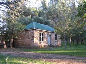
We remind walkers that, as previously announced, there have been a series of changes to the Heysen Trail in the vicinity of Curnows Hut and the former Bundaleer Forest.
In the ‘Heysen Trail reopens on Saturday May 1st 2021‘ news item, we referred to a number of re-routes along the trail.
One of those, Item 3 Bundaleer, advised a change of the route in April 2021 to follow the Bundaleer Greenway. That re-route considerably lengthened the trail.
On 30 June 2021 we updated the news item to say that the Department of Environment and Water had reversed that re-route.
As a result the original trail between Curnows Hut and New Campbell Hill has been reinstated.
This is a significant change to the trail between Curnows Hut and Raeville. That walk, shown as Section 35 of the Heysen Trail Walk Selector, returns to 20 kms.
Any reference to the change of the trail to follow the Bundaleer Greenway was removed from our website Re-route page in June.
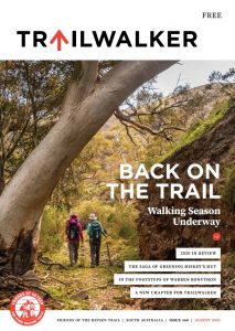
August edition of the Trailwalker
The upcoming August edition of the Trailwalker magazine, contains an article ‘Heysen Trail Route News’.
The article on page 7 includes an item headed ‘Bundaleer Forest’. The item describes the April 2021 change to follow the Greenway.
That article was written prior to the 30 June reinstatement of the original route.
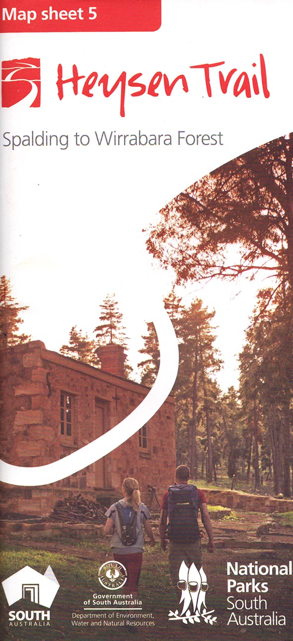
In order to eliminate any confusion, we confirm that the Heysen Trail again follows the route as shown on the Heysen Trail Mapsheet 5A & the Northern Guidebook Map 1.4.
That is also the route shown on the Heysen Trail GPX file 16/2/2021 v4.0 and the corresponding version of the Heysen Trail Interactive Map.
August 2021
Issue 160
 Highlights include:
- '2020 In Review'
- 'The Saga of Greening Hiskey's Hut'
- In the Footsteps of Warren Bonython'
- 'A New Chapter for TrailWalker'
Vale Cliff Walsh

Cliff – Change Agent
Cliff will not be well known to most Friends Members, however he played a pivotal role in the organisation’s resurgence in the early 2000s.
He realised the financial survival of the Friends depended on left over grant money that accrued interest, in the days when investments did that. And that was not very much. At that time, the Friends’ council dealt with the entire management process and Cliff thought that streamlining the various processes, using the committee structure, would benefit the organisation. Consequently, subcommittees of the Friends, i.e., Walking, Membership and Marketing, Financial and Trail Maintenance could focus on their tasks, improving efficiency. This, plus a dynamic council, could concentrate on increasing membership, revitalising the walking programme and generating yearly surpluses that could be churned back into the Trail though the Maintenance Committee. As a result, this lead to a massive increase in membership, doubling in 2 years, and to some extent, the End 2 End programme.
Apart from his association with the Friends, he was the economics professor at the University of South Australia, economics advisor to Prime Minister Malcolm Fraser, introducing him to Grange, amongst his various achievements. Our condolences to his family and friends.
Tributes
“Sharp, focused, and unstoppable. Great Council member, and always there when needed. Didn’t stop even when very ill. Formidable. Vale Cliff. Well remembered.”
Simon Cameron
“Great intellect – set the Friends on a path to create the large, successful organisation we have today. Vale Cliff.”
Robert Alcock
Constitution Review – Member Information Sessions
Friends of Heysen – Constitution Review – Member Information Session
FOHT Council has decided to review our 35 year old Constitution to modernise and refresh it to meet our current needs. Council is undertaking consultation with committees and members to help build a framework for the next 35 years.
Why?
The Constitution outlines the rules for how the Friends manages the finances, policies and priorities for our activities: walks program, trail development, office and promotion. Council members think it is a good opportunity to revitalise how we manage the Friends and encourage newer members to become more involved.
Interested members are invited to an information session that will outline key proposals, answer questions and obtain feedback from members.
Members will need to register via the Friends Walk/Event on-line system as numbers will be capped and usual COVID requirements apply. A draft document will be available.
Council will consider any feedback and issues raised before seeking legal advice on the provisions and any formal process.
The current Constitution requires that proposed changes be presented at a special Meeting of Members or Annual General Meeting.
Mapsheet 5B: Re-route near Bowman Park – Huddleston, May 2021, updated August 2024
View pdf map.
Due to damage to fences the Trail no longer follows the Crystal Brook through private property from Bowman Park all the way to Wilkins Highway (Hughes Gap).
At Bowman Park the Trail continues south along Bowman Park Road and turns left onto Huddleson Road until it meets Heads Road. The Trail turns west along Heads Road and then crosses private property to return to the original Trail, along the delightful creek line of the Crystal Brook.
Download gpx file.
This re-reoute applies to: Section 38: Bowman Park to Mt Zion
View all re-routes for the Mapsheet 5, Spalding to Wirrabara Forest (August 2015)
Keep fruit fly free on your walks !!
Attention Heysen Trail Walkers.
Walkers need to be aware that due to the fruit fly problem in metropolitan Adelaide, there are severe penalties for moving potentially affected fruit from one region to another unaffected region.
Please check which region (green, orange or red) you live in, and act accordingly, after viewing the regulations on the SA Govt. fruit fly web site
Only take raw fruit in your lunch boxes if you bought it in a green zone.
For your information the advice from the Department is that:
- We should check the prescribed list of excluded fruit and veges (includes such items as bananas, citrus, blue berries and apples) and not bring them if we are taking them from a red or orange zone. There are processes that can be instigated to render the banned fruits safe, including preparing them cooked, dried, grated, pureed and packaged/processed. Cut, sliced or mashed F&V are still at risk for fruit fly and should be excluded from transporting with you.
- We can purchase our requirements in the green zones.
- To be doubly safe retain your itemised receipt from the point of purchase so that there is no doubt about the source of your food.
Heysen Trail closure near the Buckaringa Sanctuary, Thursday 3rd June to Tuesday 8th June 2021.

The Buckaringa Sanctuary will be temporarily closed early in June. As the Heysen Trail passes close to the sanctuary, we advise walkers to consider the closure if planning to walk in the area.
The planned closure is:
- Thursday evening 3rd June to Tuesday morning 8th June 2021.

The sanctuary is home to many Yellow-footed Rock-wallabies and is located between Quorn and Hawker. You can find it on map 6, chapter 4, of the Heysen Trail Northern Guidebook and on Sheet Map 7b – Dutchmans Stern Conservation Park to Mernmerna Creek.
The closure is because the Australian Wildlife Conservancy (AWC) will be undertaking feral animal control in the sanctuary.
AWC will place closure signs at all entry points to the sanctuary to warn walkers of the danger.
Mapsheet 6A: Re-route of Heysen Trail approaching Block Nine Road through Wirrabara Forest
View pdf map.
The trail on its approach to Block Nine Road has been rerouted away from the boundary fence on a private property.
Download gpx file.
This re-reoute applies to: Section 40: The Bluff Lookout to White Park Road
View all re-routes for the Mapsheet 6, Wirrabara Forest to Dutchmans Stern Conservation Park (August 2015)
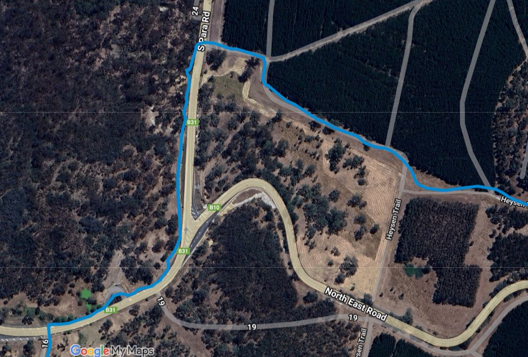
Reroute of the Heysen Trail near Chain of Ponds where it crosses North East Road, Early 2021
View pdf map.
This re-route was marked in early 2021 to allow for a roadwork upgrade of the junction of North East Road and South Para Road.
It was expected to be a temporary change until the roadworks were completed in June 2021.
The route shown in purple is the Heysen Trail in Chain of Ponds crossing North East Road.
UPDATE December 2021. Due to land access issues related to SA Water property, the trail has not returned to the original route. Further options are being investigated.
CAUTION: The re-routed trail now crosses North East Rd about 50 metres from the crest of a hill which makes for a dangerous road crossing. This is dangerous as the speed limit on the North East Rd is 100 km/h.
Please be extra cautious when crossing the road.
Download gpx file.
View all re-routes for the 2014 Southern Guidebook, 6th Edition
The Friends need help with Bookkeeping
The Friends need help with Bookkeeping
The Friends are seeking a volunteer to join the bookkeeping team.
Job Description
– Manage the finances of the Association
– Maintain financial records – invoices, receipts, sales
sheets, and petty cash
– Pay accounts and manage the weekly banking
– Perform the weekly balance
– Liaise with Treasurer and Office staff
Skills Required:
– Have an understanding of general office procedures –
Use of various computer systems, including MYOB Account Right, Microsoft Excel and Word.
— Financial record keeping
Location and Times:
– The Friends office, Suite 203, Epworth Building,
33 Pirie Street, Adelaide
– Fridays – 10am to 2.30pm
For further information, contact the Office.
John and Margaret will happily answer your questions.
Autumn 2021
Issue 159
 Highlights include:
- South Coast Walk 2020
- Reality of solo hiking a ,long distance trail
- Hiltaba Reserve: Warren Bonython Walk
- Walk the Yorke in the year of COVID
Heysen Trail Closure – Southern Flinders Ranges Parks (February 2021)

Walkers are advised that access to the Heysen Trail in the Southern Flinders Ranges will be restricted from 6 am Saturday, 20th February 2021 until 2pm Friday, 26th February 2021.
Telowie Gorge Conservation Park, The Napperby Block of Mount Remarkable National Park, Spaniards Gully Conservation Park and Wirrabara Range Conservation Park will be closed for the purpose of undertaking a pest control program.
The parks cover a long section of the trail on Heysen Trail Map sheets 5B and 6A and Maps 2.5 to 2.7 of the Heysen Trail Northern Guidebook.
Many sections of the Heysen Trail are closed over the Fire Danger Season. The Country Fire Service has already announced the commencement of the Fire Danger Season for the the complete length of the Heysen Trail.
However walkers can still use some sections of the trail, including sections that are not on private land including Conservation Parks and Reserves, Forests, public roads and vacant land – provided it is not a day of a declared total fire ban..
But the feral animal control program means walkers need to take note of this closure and avoid that section of the trail over the period from the 20th to 26th February.
For more information about the control program or park closure, please contact the Natural Resources Centre on (08) 8841 3400.
You can also check this and other park closures on the Parks SA Alerts page.
Mapsheet 6A and 6B: Minor Re-Route through Melrose
View pdf map.
A 700 metre section of the Heysen Trail has been rerouted as it enters Melrose from the south.
This re-reoute applies to: Section 42: Murraytown to Melrose
View all re-routes for the Mapsheet 6, Wirrabara Forest to Dutchmans Stern Conservation Park (August 2015)
Re-Route near Wilpena Information Centre, September 2020
View pdf map.
The trail has been adjusted when passing the Wilpena Information Centre. The new 800m route avoids the 1.5km route around the resort and caravan park.
Download gpx file.
View all re-routes for the 2014 Northern Guidebook, 3rd Edition
Mapsheet 8B: Re-Route near Wilpena Information Centre
View pdf map.
The Trail has been rerouted to avoid the Wilpena resort and caravan park when passing the Wilpena Information Centre, shortening the walk by approximately 0.5 km.
Download gpx file.
This re-reoute applies to these 2 sections:
View all re-routes for the Mapsheet 8, Mernmerna Creek to Parachilna Gorge (August 2015)
High Water Crossing Alternate Route entering Morialta Conservation Park, February 2021
View pdf map.
When entering Morialta Conservation Park from Norton Summit:
- when the creek water level us low, there is a 140m long low water crossing, and
- when the creek water levels are high there is a 1.6km long high water crossing alternate route along Colonial Drive and Colonial Track
Download gpx file.
View all re-routes for the 2014 Southern Guidebook, 6th Edition
Mapsheet 2B: High Water Crossing Alternate Route entering Morialta Conservation Park
View pdf map.
When entering Morialta Conservation Park from Norton Summit:
- when the creek water level is low, there is a 140 metre low water crossing
- when the creek water levels are high there is a 1.6 km high water crossing alternate route along Colonial Drive and Colonial Track
Download gpx file.
This re-reoute applies to: Section 14: Montacute Heights to Cudlee Creek
View all re-routes for the Mapsheet 2: Kuitpo Forest to Tanunda (Sept 2014)
Re-route up The Sugarloaf, north of Inman Valley, November 2020
View pdf map.
A 600m re-route up The Sugarloaf, north of Inman Valley. An improved realignment was marked in November 2020
Download gpx file.
View all re-routes for the 2014 Southern Guidebook, 6th Edition
Mapsheet 1C: Re-route up The Sugarloaf, north of Inman Valley
View pdf map.
A 600 metre reroute up Sugarloaf Hill, north of Inman Valley.
Download gpx file.
This re-reoute applies to: Section 7: Inman Valley to Myponga
View all re-routes for the Mapsheet 1: Cape Jervis to Kuitpo Forest (Sept 2014)
Summer 2020/21
Issue 158
November 2020
 Highlights include:
- Celebrating 35 years of the Friends
- 2020/21 Walk Programmes
- Trail Development Update
- Future Trail Projects in Parks & Forests
- Our latest Honorary Members